Wednesday 30 December 2020

Get Active with Your New Year’s Resolution

Get Active with Your New Year’s Resolution
By Benjamin Barnett

Do you want to make a change in 2021 that reaps rewards? An easy way to do that is to pick an active travel option for your trips around town. Sticking to a New Year’s resolution can be hard to do, but choosing an active way to get around is one small thing that can make a big difference.

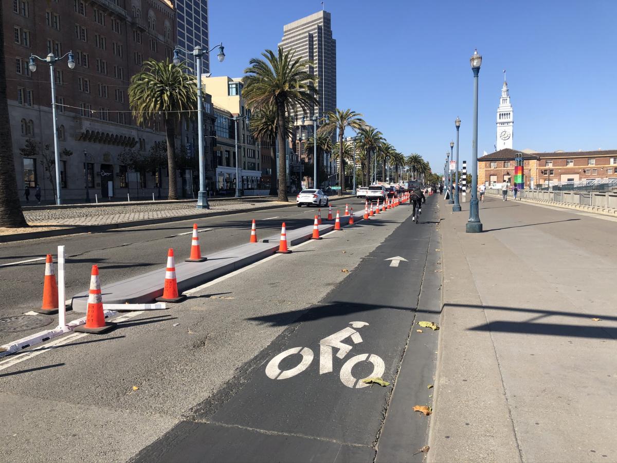
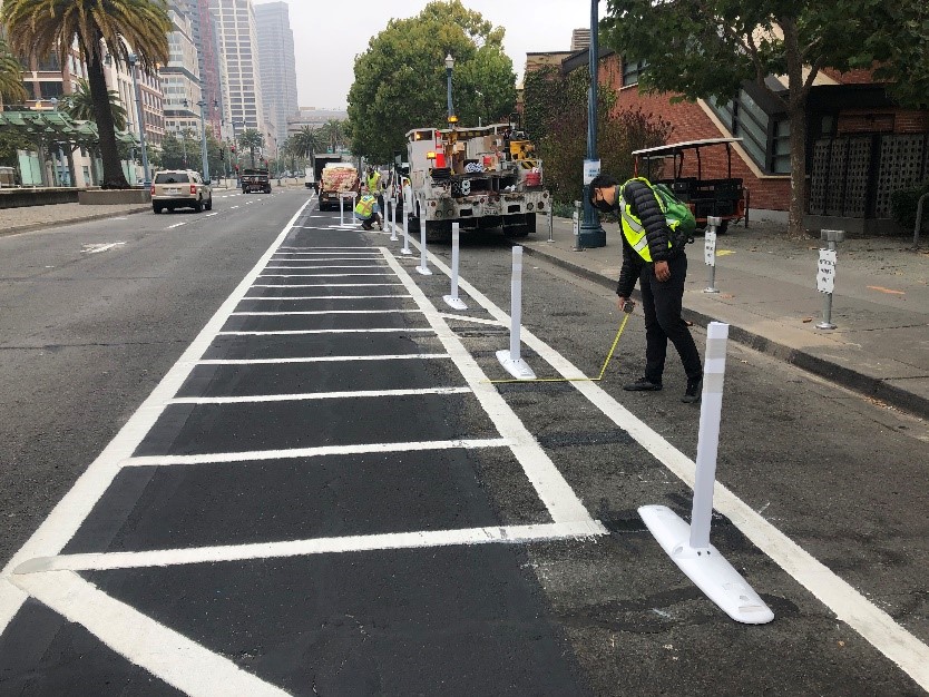
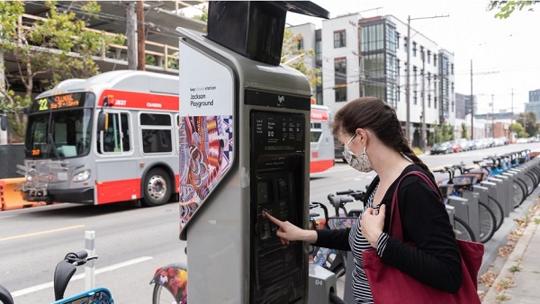
“Active mobility” is the industry term that describes how people move around the city using any non-motorized means of physical activity. The best-known examples of active mobility are walking and bicycling, though other modes include running, skateboarding, scooters and roller skates. Whatever way you choose to be active when you are going to the grocery store, the doctor or to other essential places, you’ll be rewarded for your efforts.

Woman uses bikeshare station while Muni 22 bus drives past

Staying Healthy

One benefit of choosing active mobility is stress reduction. Making your trips by foot, bicycle or skateboard gets your heart rate up and brings your stress levels down. The COVID-19 pandemic has brought a great deal of additional stress into our lives. We’re not only juggling multiple roles at home and the associated time constraints that places on us, we’re also worried about ourselves and our families becoming ill, while also dealing with economic and emotional issues.

Active modes of transportation can also help protect you from serious diseases such as stroke, heart attack, some cancers, depression, diabetes, obesity and arthritis. Riding a bike is healthy, fun and a low-impact form of exercise for all ages. Walking is easy to fit into your daily routine by strolling to shops, parks, school or work. It also reduces negative health problems that can arise from inactive and sedentary lifestyles. The US Centers for Disease Control recommend increasing frequency of active transportation as a great way to stay healthy and improve physical fitness.

Better for the Environment

Another benefit of active mobility is reducing greenhouse gas emissions to slow global warming. Every year, a typical American car emits 4.6 metric tons of carbon dioxide. Rising automobile use is increasing these greenhouse gas emissions and escalating the rate at which the Earth’s atmosphere is reaching a climate tipping point. Active mobility lowers daily greenhouse gas emissions, helping us back away from that tipping point.

You’ll also be reducing air and noise pollution by making your trips out and about more physically active. Air pollution negatively affects human health and the environment causing acid rain, excessive algae growth in bodies of water, haze, wildlife deaths, thinning of Earth’s ozone layer, crop damage and global climate change. Noise pollution disrupts ecosystems and wildlife, as well as the lives of people in urban and suburban areas. Active mobility reduces air and noise pollution by replacing car trips that produce greenhouse gases and noise, benefiting the environment and urban ecosystems.

Make a Better Choice

And of course, you benefit your neighbor when you choose  an active mode of transportation to get around. You free up space on Muni for those who have no other options. You also avoid traffic delays and can enjoy seeing your city from a different perspective. With this easy resolution, you’ll be able to emerge from these unprecedented times with a change that you can be proud of.


Published December 30, 2020 at 09:40AM
https://ift.tt/3aPbgvg

Wednesday 23 December 2020

New Equity Toolkit Helps SFMTA Improve Access

New Equity Toolkit Helps SFMTA Improve Access
By Mariana Maguire

The SFMTA’s Equity Toolkit helps us improve Muni service for San Francisco’s most transit-dependent residents and essential workers. Using data layered with mapping we are able to improve access to jobs and key destinations by identifying and fixing gaps in service. Our Equity Toolkit helps us serve San Franciscans better.

The toolkit focuses on San Francisco’s nine neighborhoods identified by the Muni Service Equity Strategy, including the Inner Mission, Outer Mission/Excelsior, Visitacion Valley, Bayview/Hunters Point, Oceanview-Ingleside, Chinatown, Tenderloin, Western Addition and Treasure Island. It’s part of SFMTA’s Transportation Recovery Plan for rebuilding our transportation system for a strong, lasting recovery that is more just and equitable for historically marginalized communities.

For many of our essential workers, COVID-19 is not only a health crisis, it is an economic crisis too. Economic and public health data show that most of our essential workers live in historically underserved equity strategy neighborhoods. If they are dependent on public transportation and can’t get to work reliably, not only does the city suffer, those workers could lose their jobs. That’s why improving job access for our essential workers is so important.

The Equity Toolkit uses transit service data from the six regional transit agencies – SFMTA, BART, SamTrans, AC Transit, Golden Gate Transit and Caltrain. The data includes routes, schedules and frequencies. This show us how far a customer can get within 30, 45 and 60 minutes from key neighborhood locations within neighborhoods identified by the Muni Service Equity Strategy. We can compare job access for transit riders before and during the pandemic, and gauge how our service changes affect access. We can also now detect gaps that we couldn’t before and make better decisions for future Muni service.

Image from SFMTA’s Equity Toolkit showing information for the Bayview neighborhood since shelter in place began

Image from SFMTA’s Equity Toolkit showing information for the Bayview neighborhood post-Shelter-in-Place.

So far, the Toolkit shows that access to jobs and services via public transportation is down in nearly every neighborhood in the city since we started the Muni Core Service Plan in March. That plan prioritized service for high-ridership Muni routes, transportation-dependent populations and connections to essential jobs and services. As a result, people living in neighborhoods identified by the Muni Service Equity Strategy currently have more Muni service than people in other neighborhoods, who generally have more alternatives to public transit.

For example, in the Bayview, where there is a high concentration of essential workers, the existing Core Service Plan has made essential jobs within a 30-minute commute 12% more accessible than before the COVID-19 pandemic. Jobs within a 45-minute commute are 55% more accessible.  The Equity Toolkit shows that we still have work to do to ensure adequate Muni service for those who need it most right now. We will continue to use what we learn to improve our Core Service Plan and increase access to essential jobs and services for San Francisco’s most vulnerable communities.

In the coming weeks we will have more blog articles that dive deeper into the neighborhood-specific findings from the Equity Toolkit.


Published December 23, 2020 at 10:52AM
https://ift.tt/3hqhTFL

Monday 21 December 2020

New Muni Route to Serve Bayview and Hunters Point Neighborhoods

New Muni Route to Serve Bayview and Hunters Point Neighborhoods
By Enrique Aguilar

Starting in early 2021, Muni’s new 15 Bayview Hunters Point Express line will improve Downtown access, reduce commute times and add transit capacity for residents of the Bayview and Hunters Point neighborhoods. This community-designed route connects the hilly communities east of Third Street to Downtown and was chosen by residents who voted in a fall 2020 survey. The process and the route demonstrates our commitment to working with communities to provide equitable Muni service. 

Launching the new route coincides with the gradual return of Muni Metro rail service. Returning to rail frees up enough buses to run new service, like the 15 Bayview Hunters Point Express and new 27 Bryant route, and improve frequency on other key routes. Service on the 15 will run every 10 minutes from approximately 5:00 a.m. to 10:00 p.m. weekdays and 8:00 a.m. to 10:00 p.m. on weekends. 

Map of new 15 Bayview Hunters Point Express route, the purple line from Bayview to Downtown shows the new route making stops east of 3rd Street before heading inbound via 3rd Street and on 4th Street in the outbound direction.

Map of new 15 Bayview Hunters Point Express route

The Muni Service Equity Strategy highlights the importance of improving transit performance in neighborhoods with high percentages of low-income households and people of color. The Bayview is San Francisco’s most diverse neighborhood, comprised of 27% African Americans, 37% Asian and Pacific Islanders, 24% Latinx, 12% seniors, 24% youth and over 30% of households having less than $30,000 in annual income. 

The COVID-19 pandemic has hit Southeast neighborhoods the hardest. Prioritizing transportation for those with the fewest options and in an area with a high concentration of essential workers is a critical principle in our Transportation Recovery Plan. Residents often endure long travel times to get to jobs, health care, education and other essential trips whose destination is not within the neighborhood. Addressing long and unreliable travel times is the most consistent request we receive from customers when identifying needed improvements. The 15 Bayview Hunters Point Express directly responds to this feedback by following the community’s lead in identifying the best way to link the Bayview neighborhood to downtown San Francisco.   


Muni bus on 3rd Street in Bayview 

Muni bus on 3rd Street in Bayview 

Community Collaboration 

The SFMTA has been working in collaboration with residents of the Bayview and Hunters Point community to improve transportation. Last year the SFMTA adopted the Bayview Community Based Transportation Plan, which identifies transportation priorities that reflect community values and support a growing and resilient Bayview.  

In coordination with District 10 Supervisor Shamann Walton’s Office, the SFMTA project team formed a working group comprised of community leaders. In response to COVID-19 physical distancing constraints, the group met virtually and had regular meetings starting in August 2020. The group structure allowed for deep discussions that were critical in identifying key priorities and destinations and provided other important feedback to shape three route alternatives. Those three alternatives were put to a community vote with the preferred option being one that residents felt provided service closer to their homes, made trips shorter and served a part of the community where service is most needed. 

We thank Supervisor Shamann Walton’s office, the working group members and all those whose voted on a preferred route – your voice helped us identify and build this exciting new Muni line to serve the community.  


Published December 21, 2020 at 03:09PM
https://ift.tt/3nH6nrB

Friday 18 December 2020

By the numbers: Protecting Operator and Customer Health and Safety

By the numbers: Protecting Operator and Customer Health and Safety
By Emily Stefiuk

The SFMTA has responded to COVID-19 by working to minimize the risk of transmission and protect the health and safety of our employees and the public. Health and safety is SFMTA’s Transportation Recovery Plan’s number one priority.  

To assess how we are doing, the SFMTA has been monitoring data through our Transportation Recovery Plan Dashboards. The Objective 1 dashboard compiles metrics associated with health and safety, including sanitizing vehicles and facilities, promoting physical distancing, and encouraging mask compliance. Here’s what we’re seeing:  

  • As of December 6, operator reported mask-related incidents are down 92% from the peak in April.  

  • Mask compliance on Muni is at an all-time high at 96% of observed passengers wearing masks.  

  • We’ve upped our mask distribution – our Transit Information Program (TIP) staff distributed over 14,000 masks to customers the week of November 16.  

  • To date, no COVID-19 positive cases have been traced to riding Muni.  

These findings are even more important as the city and the region have been experiencing a surge in COVID-19 cases after the Thanksgiving holiday. While there is an alarming surge in cases, it's important to recognize that our science-based best practices paired with the public's embrace of critical interventions like wearing a face masks or face coverings allows us to keep our system running for those who need us during this unprecedent time. Additionally, we are maintaining a safe and healthy system so that when increased activity is permitted once again, Muni will be ready for you. 

These numbers reflect efforts that have been underway since the beginning of the pandemic to protect operator and customer health and safety. Since March, SFMTA has implemented mitigation measures that limit the possibility of exposure to, and transmission of, COVID-19. To encourage customers to practice good public health behavior throughout their journey, we launched our Ambassador Program in April and expanded it as the TIP program in September. TIP staff provide information to customers on best practices and alternatives to Muni like our recently-launched Essential Trip Card discount taxi program. TIP staff also provide the public with information about COVID-19 Muni Core Service, help manage crowding and distribute masks to customers that may have forgotten theirs.  

A Muni bus with a "Mask Required" head sign.

Other measures Muni has implemented include audio announcements and head signs on buses to remind customers that masks are required when riding Muni. We have also continued the sanitization practices we implemented at the onset of the pandemic. Vehicles return to our operating divisions at the end of each run, so each operator starts their shift with a sanitized vehicle.  

The metrics show that these measures and added precautions to ensure the health and safety of our employees and the public are paying off. As the pandemic continues, the SFMTA is committed to using data to inform our COVID response, service delivery, and budget decisions.  

Customer Reminders 

Remember, we still need your help. Help reduce the risk of COVID-19 transmission by: 

  • Staying home, except for essential trips.  

  • Shopping locally and supporting your neighborhood businesses. 

  • Wearing a face mask or face covering over your mouth and nose and maintaining physical distance such as leaving a seat open between you and anyone who is not in your household. 

  • Use alternate transportation whenever possible – walk, bike or take a taxi – to save a seat on Muni for those who don’t have other options. 

If you do need to travel on Muni: 

  • Please respect your Muni operator. They are working hard for you. 

  • Face coverings are required on Muni. To avoid getting passed up, cover your nose and mouth with face cover or mask while you are waiting for Muni and on Muni. 

  • Board by the back door unless you require assistance. 

  • Give yourself extra time just in case. Your fare is good for two hours across multiple routes. 


Published December 18, 2020 at 05:00PM
https://ift.tt/2WAatFX

Wednesday 16 December 2020

Tenderloin Streets Transform During COVID-19

Tenderloin Streets Transform During COVID-19
By Kimberly Leung

COVID-19 has disproportionately impacted people who live and work in the Tenderloin. As a result, the SFMTA has been working closely with District 6 Supervisor Matt Haney’s office, other city departments, the Tenderloin Traffic Safety Task Force and community members to address the public health issues and unique challenges in the neighborhood through innovative interventions.   

The Tenderloin is home to many of our most vulnerable communities including historically marginalized groups such as people with disabilities, residents of SROs and supportive housing and limited-English proficient communities. With every single street in the Tenderloin on the city’s High Injury Network -- the 13 percent of San Francisco streets that account for 75 percent of severe traffic injury collision and fatalities -- this critical neighborhood is the focus of our latest efforts to make the city safer for everyone. 

As part of the city’s COVID-19 response, the SFMTA prioritized changes to Tenderloin streets that aim to achieve immediate and long-term results. Our main priorities, based on community advocacy and feedback, are:  

  1. Expand physical distancing space to alleviate public health concerns around overcrowding  
  2. Support local community group activities and small businesses  

Map showing the Tenderloin, existing parking lane closures shown in yellow - O'Farrell from Mason to Leavenworth, existing block closure shown in purple - Ellis from Jones to Golden Gate, physical distancing lanes in blue - Jones from O'Farrell to Golden Gate, play streets on Turk from Leavenworth to Jones, shared spaces in light blue - on Larkin from O'Farrell to Eddy, quick-build shown with brown dotted line on Golden Gate from Polk to Taylor and Leavenworth from Post to McAllister

SFMTA COVID-19 projects in the Tenderloin: 

  • Parking Lane Prohibitions and Block Closures – Temporary vehicle restrictions were implemented on major blocks in the neighborhood to support essential services like safe sleeping sites, physical distancing and meal services. This includes daily street closures on the 100 block of Golden Gate at St. Anthony’s and the 300 block of Ellis (except Saturday) in collaboration with GLIDE to provide the community with free meals programs. These closures have allowed the blocks to transform into vibrant, community spaces where residents and workers can receive COVID-19 testing, visit pop-up food pantries, take showers, get meals, and simply have outdoor space. 
  • Outdoor Dining (Temporarily paused for our current Health Order) – The city’s Shared Spaces program is a vital lifeline for businesses by creating flexible uses of sidewalks, streets and outdoor spaces for restaurant and retail activities. In the Tenderloin, the program facilitated temporary closures on Larkin Street between Eddy and O’Farrell streets and previously parts of Golden Gate Avenue for Tenderloin restaurants and retail.  
  • Play Streets – Through partnerships with the Boys & Girls Club, Tenderloin Community Benefit District and other community-based organizations, a weekly closure of Taylor Street between Leavenworth and Jones streets provides temporary car-free open space for children, seniors and Tenderloin neighbors to enjoy every Saturday. Play Streets have been successful in creating a space for children to play, for COVID-19 testing and resources and for neighbors to take a break outside.  
  • Jones Street Physical Distancing Lanes – Between Golden Gate Avenue and O’Farrell Street, a lane was established to provide temporary walking and rolling space on a critical north-south connection in the neighborhood. The eastern parking lane and one vehicle lane on Jones Street were repurposed to provide this pedestrian walking space -- doubling the width of the sidewalk. 
  • Turk Street Physical Distancing Zones – The sidewalks on Turk Street, a key east-west corridor in the neighborhood, have been expanded at intersections with high pedestrian volumes, including Jones, Leavenworth and Hyde streets so that people could physically distance themselves while waiting to cross the intersection. 

Upcoming Projects:  

  • Golden Gate and Leavenworth Vision Zero Quick-Builds - The project goal of the Quick-Builds is to improve overall comfort and safety for those walking and bicycling on Golden Gate Avenue between Market and Polk streets and on Leavenworth Street between McAllister and Post streets. Please join us for the Virtual Open House for the Golden Gate and Leavenworth Quick-Build projects from December 15th through January 8th. The Virtual Open House will be hosted in seven languages reflecting the diversity of the community.  
  • Tenderloin Neighborhood Traffic Safety Improvements - Building on past comprehensive neighborhood-wide efforts in the Tenderloin, including daylighting and signal retiming, we are proposing to reduce the neighborhood speed limit and implement “no turn on red” regulations. Studies show that lowering speeds greatly improves a pedestrian’s chance of survival in the event of a collision. Currently, most Tenderloin streets are 25 miles per hour, and now, the SFMTA is proposing to lower the neighborhood speed limit to 20 miles per hour. If approved, the Tenderloin will be the first neighborhood in San Francisco to have widespread speed reductions. 

Thank You Tenderloin Community! 

We want to express sincere appreciation and acknowledge the Tenderloin community groups who have been tenacious in advocating for traffic safety and travel options in their neighborhood: Tenderloin Traffic Safety Task Force, Tenderloin People’s Congress, Tenderloin Community Benefit District, Central City SRO Collaborative, Tenderloin Neighborhood Development Corporation and many others. We are committed to being responsive and partnering with the community as we work through this crisis together.   


Published December 16, 2020 at 03:56PM
https://ift.tt/2Kyk51e

Tuesday 15 December 2020

27 Bryant Returns to Serve Communities in Mission, SOMA and Tenderloin

27 Bryant Returns to Serve Communities in Mission, SOMA and Tenderloin
By Enrique Aguilar

Beginning on Saturday, January 23, the 27 Bryant will return to service with a route realignment that will improve service reliability by using temporary emergency transit lanes.  

The 27 Bryant makes critical connections for three of San Francisco’s Muni Service Equity Strategy neighborhoods that have been hit especially hard by the pandemic. The Tenderloin is one of most diverse and dense neighborhoods in San Francisco with many seniors, families, lower income households and persons with disabilities relying on transit. The 27 Bryant will soon travel directly to FoodsCo and Costco in SoMa to provide a connection to other food options. It will also stop just a couple of blocks away from the Mission Food Hub on Alabama Street in the Mission, an organization that provides free groceries to Latinx families.  

 27 Bryant and two people crossing with a stroller on Bryant Street at 20th St in the Mission  

27 Bryant on Bryant Street at 20th St in the Mission  

With the anticipated return of rail in August, SFMTA had initially planned to prioritize the return of the 27 Bryant to service in fall 2020. The unexpected Muni Metro motorization, however, meant that the buses that would have gone to the 27 were put on rail lines instead. The upcoming phased return of rail service in early 2021 allows us to free up buses for the 27 Bryant so customers can again take this line to go grocery shopping, attend medical appointments, and access social services.  

Thank you to the community groups, especially in the Tenderloin, for continued advocacy for this essential lifeline throughout the last few months. To engage with community groups representing the neighborhoods served by the 27, staff provided updates at biweeky meetings and hosted a virtual open house in September, inviting key community stakeholders for feedback on proposed changes. 

During this emergency period, the 27 Bryant will be on a temporary modified route through SoMa that will travel southbound on Jones connecting to 8th Street between Market and Harrison streets and northbound on 7th Street between Market and Folsom Streets continuing on Leavenworth. The 27 route will not serve Ellis, Eddy, and 5th Streets.  

Map of temporary 27 Bryant modified route, the solid blue line indicates active route and dashed blue line indicates discontinued route. Muni and BART icons placed near Powell Station to display option to connect.

Map of temporary 27 Bryant modified route, the solid blue line indicates active route and dashed blue line indicates discontinued route. Muni and BART icons placed near Powell Station to display option to connect.

The temporary emergency transit lanes that are currently on 7th and 8th Streets restrict private automobiles so Muni service can keep moving. Prior to the pandemic, traffic congestion on 5th Street caused unreliable travel times that can cause long wait times during peak hours. By rerouting the 27 to use the transit lanes, it can help improve the reliability of the route by providing more consistent travel time in that segment and reduce the bunching and gapping that we often see on the 5th Street corridor. This is especially important during the pandemic when avoiding crowded buses is a priority for the SFMTA and riders alike.  

Over the next few months, feedback from the Tenderloin, SoMa, and Mission communities will help inform the proposal developed for the permanent route of the 27 Bryant. As for the 31 Balboa, we do not yet have a timeline for the return of this line. Please review the route map for more details including terminal changes and let us know if you’d like to receive updates or have questions or comments by contacting staff: 

Jean Long, Transit Planner, Jean.Long@SFMTA.com 

Enrique Aguilar, Public Information Officer, Enrique.Aguilar@SFMTA.com 


Published December 15, 2020 at 04:34PM
https://ift.tt/2Wg5muy

Monday 14 December 2020

A City Responds: 2020 Annual Report

A City Responds: 2020 Annual Report
By Bradley Dunn

While there are many changes to our end of the year rituals and much uncertainty about the future, one tradition that continues is the San Francisco City Charter dictating that we release the Fiscal Year 2019-2020 Annual Report.   

Like much of our work, the SFMTA’s Annual Report has made the transition online during this pandemic. 

By utilizing these online tools, we share interactive maps and dashboards to help show our Agency’s work like Slow Streets, Shared Spaces or our Key Performance Metrics.  

You can find the Annual Report and the hard work of our dedicated staff below.


Published December 14, 2020 at 04:03PM
https://ift.tt/34eCx65

Thursday 10 December 2020

Milestones on the Waterfront

Milestones on the Waterfront
By Benjamin Barnett

Over the summer, the SFMTA and Port of San Francisco broke ground on the Embarcadero Quick-Build Projects, bringing protected bikeways to the Embarcadero between Bay and North Point streets and Harrison and Mission streets, freeing space for pedestrians along its iconic Promenade. Just last month, Public Works and SFMTA crews substantially completed the centerpiece of this effort, The Embarcadero’s first segment of two-way protected bikeway - by installing 47 concrete islands, striping and signage changes, and a new bike signal at Howard Street. Now open in front of the Ferry Terminal between Mission and Folsom streets, this bikeway directly connects with the Folsom/Howard corridor and will be fully completed in early 2021 with the installation of metal railings. Our staff will also conduct a user survey and project evaluation in spring 2021 in connection with the Embarcadero Enhancement Project. 

Check out the progress that has been made so far!

Person riding their bike past the Ferry Building on the green bike path
Protected bikeway with enhanced loading along Pier 35

concrete island and Ferry Building in the background
Concrete barrier under construction by Public Works for protected bikeway between Mission and Folsom streets

SFMTA paint crews adding some motorcycle spaces
Protected bike lane and motorcycle parking under construction between Harrison and Folsom streets

Our Work Has Just Begun

The Embarcadero corridor between Townsend and Lombard streets is part of San Francisco’s Vision Zero High Injury Network (HIN), the 13 percent of streets accounting for 75 percent of severe and fatal traffic injuries. Sadly, 189 reported severe injury collisions and two fatalities have taken place along this corridor in the last five years.

To achieve our safety goals, the SFMTA will continue its partnership with the Port of San Francisco and community stakeholders to deliver the greater Embarcadero Enhancement Project (EEP). The EEP seeks to:

  • Build a safer Embarcadero for all users
  • Improve connections between the Embarcadero and nearby neighborhoods
  • Elevate the Embarcadero’s role as a valued destination and workplace for locals, visitors, businesses, maritime, and industrial uses
  • Invest in critical infrastructure to support the renewal and recovery of our City while protecting public health

Stay Informed as We Create a Safer Embarcadero

The Embarcadero is a special place for many in San Francisco and beyond. We look forward to engaging with the community in the months ahead as this important project takes shape. Please visit our project website at SFMTA.com/Embarcadero to stay up to date on the latest information or contact the project team by emailing Embarcadero@SFMTA.com.


Published December 10, 2020 at 11:06AM
https://ift.tt/3qMfWaz

Wednesday 9 December 2020

Understanding Upcoming Muni Service Changes

Understanding Upcoming Muni Service Changes
By Mariana Maguire

In December and January 2021 the SFMTA will phase back in surface rail on the J Church and T Third. This will free up buses so we can bring back more routes like the 27 Bryant, extend bus service on other routes and continue to manage crowding on routes like the 38 Geary and 14 Mission. We also have more buses available for lines like the 5 Fulton and 33 Ashbury.

You may be wondering, “how is Muni able to add service?” Or, “why some routes but not others?” Three key factors guide our service decisions:

  • Service priorities
  • Available vehicles
  • Ongoing constraints to Muni service

Service Priorities

Our service planners look at the Muni system as a whole. Our goal is to provide as much consistent, reliable service as possible even though our resources are limited due to an ongoing budget deficit. These service changes in response to the evolving public health emergency will add new connections to different parts of the city and increase service on the highest-ridership routes. This means planning carefully so we can:

  • Meet ridership demands on routes that are in service and avoid crowding
  • Prioritize service for people who have access to fewer transportation options, including those who live and work in neighborhoods prioritized in our equity service strategy
  • Use our limited number of vehicles to provide Muni service throughout the city
  • Connect essential workers to essential locations such as neighborhood business corridors and medical facilities

Most of our essential workers live in the pandemic’s hardest-hit neighborhoods and don’t have as many transportation options to get to their essential jobs. It’s vital as our city fights coronavirus that essential workers can get where they need to go.

How We Are Able to Add Service

We only have a certain number of vehicles that we can put into service. To add bus service in January we are using two strategies:

  1. More buses will be available as we gradually bring back rail. We’ll start with surface rail service until we finish this round of subway maintenance work. Bringing back the J Church and then the T Third will free up multiple buses that we will put on other routes to reduce crowding and add new critical connections.
  2. By making our sanitizing process more efficient, we can return buses to service more quickly during the course of a day.

Surface service on the J Church and T Third lines will provide connections to Market Street where customers can easily transfer to the K Ingleside bus, L Taraval bus or N Judah bus for downtown service. Without the use of the subway, our other surface rail would have to terminate where there are fewer connections to downtown and the rest of our system. Between February and March 2021, we will aim to bring back the N Judah Metro by rail between La Playa and 6th and King streets, pending subway work and COVID developments. We expect the K Ingleside, L Taraval and M Ocean View to remain as bus routes through the spring as subway repairs continue, particularly in the Eureka Curve near Castro Station.

Ongoing Constraints on Service

Ultimately, we don’t have enough buses to bring back all pre-COVID routes  at this time due to several constraints:

  1. Sanitizing: Our COVID sanitizing procedure means we don’t keep the same vehicle in operation all day. Pre-COVID, three operators would drive the same bus, switching out in the field. Now, when it’s time for operators to switch, the vehicle returns to the yard for sanitizing and the next operator takes out a sanitized vehicle. The time we spend returning vehicles to the yard and sanitizing means we need at least 50% more vehicles to serve any route daily.
  2. Physical distancing: The number of customers we can carry on our vehicles is much lower than before COVID-19, so it takes more vehicles to move the same number of customers, especially on high-ridership routes. For example, on the 14R Mission – one of our highest demand routes – we were running 18 vehicles at a time pre-COVID. Now we’re running 35 vehicles at a time with less onboard capacity.
  3. Not all vehicles can serve all routes: We can’t put a light rail vehicle on a route without tracks, or an electric trolley bus on a route without overhead wires. We can’t put larger buses and articulated buses on certain routes because they can’t navigate some of San Francisco’s iconic slopes and curves. This limits our options.
  4. Subway repairs/construction: We learned the difficult lesson in August that our subway needed some significant repairs. We can’t run Metro rail service until we’ve fixed the most pressing subway issues, and ongoing maintenance needs are likely to come in the future. Also, with the L Taraval Improvement Project continuing construction, we will wait to bring back the LK Ingleside-Taraval light rail line. For now, L Taraval Bus and K Ingleside will continue to go directly to downtown.

We will keep monitoring and adjusting routes so that we can expand Muni service to levels that we can sustain in light of these constraints.

If you can stay home or use alternative forms of travel, we still need you to do so. This helps make space on Muni for essential workers and people who rely on public transportation.

Please remember to pay your “fare share” as well. A fare is required to ride and the SFMTA relies on fare revenue to provide service. For customers who can’t afford Muni, we have programs that can help.


Published December 09, 2020 at 10:47AM
https://ift.tt/3m3zq72

Tuesday 8 December 2020

Upcoming Muni Service Expansions Phase-in Rail Service, Add Bus Service

Upcoming Muni Service Expansions Phase-in Rail Service, Add Bus Service
By Mariana Maguire

Graphic of the December 19 core service map

Graphic: Updated core service map, effective December 19, showing the temporary J Church surface rail route.

On Saturday, December 19, the SFMTA will gradually start to bring back Muni Metro service by rail and increase bus service, including resuming several routes based on community feedback.

Muni Metro begins resuming rail service on December 19 with the J Church between Balboa Park Station and Church and Duboce streets. On January 23, the T Third resumes rail service between Sunnydale and Embarcadero Station once safety and operational improvements are finished at Embarcadero Station.

These two rail changes will put more operators back on Muni and free up to 20 buses, allowing us to extend routes, increase frequencies, resume service like the 27 Bryant, and bring two new lines into service: the 55 Dogpatch and the 15 Bayview-Hunters Point Express. The full 33 Ashbury-18th Street will also return to service to provide another cross-town connection.

In February and March 2021, we will aim to bring back the N Judah Metro by rail between La Playa and 6th and King streets, and a shuttle train between Embarcadero and West Portal. We expect the K Ingleside, L Taraval and M Ocean View to remain as bus routes through the spring as subway repairs continue, particularly in the Eureka Curve near Castro Station.

These service changes focus on providing access to essential destinations and services to support San Francisco’s essential workers and economic recovery, especially for communities that depend on transit the most. The 15 Bayview-Hunters Point, 27 Bryant, and 55 Dogpatch are examples of service for these populations and are the result of community engagement and feedback. We continue to work on adding more service on our high-ridership lines and using available vehicles and operators to help relieve crowding.

Service hours will remain approximately 5:00 a.m. to 10:00 p.m. daily unless otherwise noted. Owl network service hours will remain approximately 10:00 p.m. to 5:00 a.m. daily. Subway maintenance will be conducted evenings starting at 8:00 p.m. daily. Bus substitutions will run on Metro lines that enter the subway starting at 8:00 p.m., shifting to Owl service at 10:00 p.m.

Below is the complete list of service changes. Please note that some details are subject to change. The information will be updated accordingly. For the most up to date information with free language assistance and accessibility please call 311.

December 19 Muni Service Changes

J Church Metro Rail


January 23 Muni Service Changes

T Third Metro Rail

  • Service between Sunnydale and Embarcadero Station.
  • Service will be mostly surface-only on 3rd Street. Vehicles will enter Embarcadero Station, service the station, then turn back. This allows us to provide connections to downtown and Market Street.
  • Starting at 8:00 p.m. daily for evening subway maintenance, bus substitutions will provide Muni Metro service and Owl service at 10:00 p.m..
  • On weekends, buses will serve the T Third from 5:00 a.m. to 8:00 a.m. between Sunnydale and Steuart Street. Embarcadero Station opens at 8:00 a.m.

1 California (short): Additional service between California and Presidio streets and Clay and Drumm streets, where ridership is highest.

5 Fulton (short): Additional service between Fulton and 8th Avenue and the Salesforce Transit Center, where ridership is highest.

7 Haight-Noriega:

  • Due to limited numbers of 60-foot motor coaches, shorter 40-foot coaches will serve the 7 Haight-Noriega on weekends. 60-foot coaches will continue to provide weekday service.
  • 60-foot coaches will serve the N Judah Bus daily, which overlaps with the 7 Haight-Noriega on Haight Street.

8AX Bayshore “A” Express (weekdays only): Additional service on the 8AX Bayshore between Kearny Street and Pacific Avenue and Bayshore Boulevard and Visitacion Avenue, where ridership is highest. Instead of peak hour service only, the 8AX Bayshore will be in service all day and in both directions.

12 Pacific: Adjusted headways to provide consistent service during the midday hours when ridership is high.

14 Mission: Additional service and frequency to address crowding.

14R Mission Rapid: Some 14R buses will go to Mission & Lowell streets to relieve terminal congestion due to high frequency at Daly City BART Station. 

14 Mission Owl: Longer 60-foot coaches and frequency increase to address crowding.

15 Bayview-Hunters Point Express (BHPX): Community members directly shaped the design and planning of this new line to provide a faster trip between Bayview-Hunters Point and downtown. The route between Palou and 3rd streets to Market and 3rd streets via Hunters Point reflects the community’s travel patterns and priorities. See more information about this new line.

22 Fillmore:

  • Additional service to address crowding.
  • As part of the completion of the first phase of the 16th Street Improvement Project, the new modified route will travel east on 16th Street and north on 3rd Street to the new terminal on Mission Bay Boulevard North.
  • Once the 22 Fillmore moves to serve Mission Bay, the new 55 Dogpatch will begin service to continue to provide bus connectivity for the Dogpatch and Potrero Hill neighborhoods. See more about the 55 Dogpatch below.

27 Bryant:

  • The full route will go back into service in response to community feedback and engagement.  
  • To improve reliability by using temporary emergency transit lanes, the route will be modified to travel southbound on 8th Street between Market and Harrison streets and northbound on 7th Street between Market and Folsom streets. The temporary emergency transit lanes are restricted for Muni service only, so they can keep buses moving even if there is traffic congestion, which helps manage crowding.
  • The reroute will maintain access to BART and Muni Metro and will provide a connection to new destinations like FoodsCo on Folsom at 14th Street.
  • Over the next few months, SFMTA staff will ask for feedback from community members and evaluate the performance of the 27 Bryant on this modified route.

30 Stockton (short):

  • A short line between Caltrain and Van Ness Avenue at North Point Street will add service in segments of the route that consistently experience crowding.
  • The 30 Stockton will travel south on 4th Street, west on Harrison Street, south on 5th Street, then east on Townsend Street to its terminal.

30 Stockton (long):

  • The extension to Crissy Field and the Presidio connects residents and visitors of San Francisco to an outdoor recreational area via public transit.
  • The relocation of the daytime terminal to Crissy Field (at the Sports Basement parking lot) provides enough space for longer 60-foot coaches. These larger coaches have helped alleviate crowding on routes with high ridership.

33 Ashbury:

  • The full route will return to service in response to customer feedback about cross-town connections that the route provides to a number of medical facilities.
  • During street closure event hours Friday through Sunday on 18th Street between Collingwood and Hartford streets, the 33 Ashbury will use a special event reroute. Check the route page for special event route details.

37 Corbett: The regular route will come back between Parkridge Drive and Burnett Avenue, and Masonic Avenue and Haight Street.

38 Geary: Increased frequency on weekdays and weekends to address crowding. 

43 Masonic: The route will be extended slightly to connect to the 1 California at California Street and Masonic Avenue while maintaining the same number of bus resources.

55 Dogpatch: A new route will be added between 16th and Mission streets and 20th and 3rd streets to replace the eastern segment of the 22 Fillmore modified route to Mission Bay. This route was developed with community members from the Dogpatch and Potrero Hill neighborhoods. See more information about this new line.


Published December 08, 2020 at 10:20AM
https://ift.tt/3m1NZYJ

Wednesday 2 December 2020

Community Meetings About Rebuilding Potrero Yard

Community Meetings About Rebuilding Potrero Yard
By Adrienne Heim

Potrero Yard Modernization Project - Upcoming Community Conversations

A conceptual design sketch of Potrero Yard showing a multi-story bus yard with housing above from the prospective of 17th and Bryant streets.

Conceptual design sketch of Potrero Yard at Mariposa and Hampshire streets.

This has been an unprecedented year for so many families, small businesses and the SFMTA. We are working to move San Franciscans around the city safely and quickly during the pandemic. At the same time, the SFMTA faces tough choices with immense revenue losses caused by the pandemic.

The Potrero Yard Modernization Project is essential to providing Muni service for some of our busiest bus routes like the 14 Mission, 22 Fillmore, and 30 Stockton, among others. This 105-year-old trolley bus facility does not meet modern seismic safety and maintenance standards and urgently needs to be rebuilt to continue to be able to support Muni service. The Potrero Yard Modernization Project will make the yard seismically stable and better able to support Muni operations, maintenance and cleaning and would ensure that staff is able to safely and effectively conduct their jobs. The project will be hosting two virtual community conversations about the long-overdue renovations needed for this bus yard. On December 5 and 12 from 11 a.m. to noon, we will have two virtual community conversations to provide a brief overview of the project and go into an in-depth discussion about recent project milestones.  

We hope you can join us!

• English-language Meeting: Saturday, December 5 from 11 a.m. to 12 p.m.

• Spanish-language Meeting: Saturday, December 12 from 11 a.m. to 12 p.m.

For meeting details visit SFMTA.com/PotreroYard. If you’re unable to attend our upcoming meetings, take a virtual tour of Potrero Yard by visiting SFMTA.com/PotreroYardTour.

The Project Concept

The proposed project improvements offer solutions to ensure we can maintain our fleet of buses as efficiently as possible, accommodate new buses that will be delivered in the next six years, enhance resilience to climate change and natural disasters like earthquakes and ensure that our staff is able to perform their work in a safe and efficient way.

Potrero maintenance staff replacing a bus tire.

Potrero maintenance staff replacing a bus tire.

To support transit needs, the project proposes to build a three-level bus facility designed for ground-floor activities on Bryant and possibly 17th streets. The project also provides an opportunity to address local housing needs, through mixed-income housing proposed on top of the yard, something that has never been done before on an active bus yard in the United States. The total facility would be up to 150-feet in height.

The new building would also include:

  • Up to 575 residential rental units with a 50% minimum target for affordable housing
  • Infrastructure for all battery-electric buses
  • Centralized, modern space for Muni operator training
  • Centralized location for Street Operations, Muni’s “first responders”
  • Built to an elevated structural and seismic standard
  • LEED Gold Certification

Project Milestones

Since November 2019, we have been working with the Planning Department on the environmental review process, referred to as CEQA, that will analyze potential environmental impacts and identify strategies for mitigating those impacts.

At the same time, we’ve begun the developer selection process to procure a joint development partner to design, build and finance the project, as well as to maintain the common portions of the building. This August, we distributed the Request for Qualifications (RFQ) and we’re now working on the Request for Proposals (RFP) draft which requires the top three qualifying development teams from the RFQ to produce a project that includes community values and priorities laid out in the RFP document. We plan to release the RFP in early January 2021. 

Learn more about the project and subscribe to project updates by visiting www.sfmta.com/PotreroYard

Take our Request for Proposals (RFP) Survey at SFMTA.com/PotreroYardSurvey to inform the RFP with your priorities for neighborhood uses and housing at the site. 

For more information, please email PotreroYard@sfmta.com or call us at 415.646.2223.


Published December 02, 2020 at 05:04PM
https://ift.tt/2VxZoEQ

Tuesday 1 December 2020

Chances of Service Cuts and Layoffs Rise Due to Budget Impacts

Chances of Service Cuts and Layoffs Rise Due to Budget Impacts
By Bradley Dunn

At today’s SFMTA Board meeting, the Director of Transportation discussed how the pandemic has caused catastrophic revenue losses, and the SFMTA does not expect revenues to return fully for years to come. While the SFMTA is in a stronger financial position than our peer transit agencies, and we’ve worked to realize more than $100 million in savings during the pandemic, we are projecting the need for substantial service cuts and layoffs to make up for projected revenue losses of $607 million.

These cuts will be painful and difficult both for the people of San Francisco and our employees. We continue to work with our elected leaders and have reached out to President-elect Biden’s transition team as well to repeat the calls from across the industry for the urgent need to secure federal support for our nation’s transit systems.

Federal CARES Act funding helped to replace hundreds of millions of dollars of lost revenue but was not enough. We are currently projecting that the pandemic will cause a loss of $607 million of revenue through June 2023, even after spending our CARES Act funds.  If the SFMTA had not received these funds, more drastic measures would have been necessary earlier on in the pandemic. In addition, service reductions and layoffs would have occurred already.  By the end of the month, we will have spent all of our CARES funding keeping our workers employed and Core Service running to support essential workers across the city. 

To make up for our lost revenue, we must cut spending even further. Our forecasts indicate the need for layoffs of between 989 to 1,226 full-time positions, or up to 22% of the workforce to close our Fiscal Year (FY) 2022 projected deficit.  Every employee that we are forced to layoff hurts our ability to provide services. We depend on each of our employees to provide the transit, street safety and other services on which the public relies. 

We do not know exactly how these cuts will be spread throughout the agency, but we do know that these cuts will hurt all San Franciscans. Cuts could include:

  • Combined with our previous service reductions earlier this year, we might only be able to operate about 35% of the pre-pandemic service
  • When schools reopen, we may lack the funding to pay for crossing guards and other school safety programs
  • Discontinuing the Essential Trip Card program, a discount program helps seniors and people with disabilities pay essential trips in a taxi when many people lost access to their local bus service

Each of these cuts would make transportation in San Francisco harder, less equitable and more harmful to the environment. But we have no choice.

We wish that we could tell you exactly what the future will hold, but there is just too much we don’t know.  We don’t know how long the pandemic will last. We don’t know how quickly our customers will return. We don’t know what the economy will look like in the future, or if there will be any additional federal help. In addition to the revenue loss we currently project, there is even further potential risk to our revenues. It is possible that over the current 2-year budget period, there could be additional financial risks to our budget. If our revenues come in below projections, the situation may be even worse.   

Given these revenue losses, we are working hard to save money. We have cut overtime spending by 48% compared to last fiscal year. We instituted a hiring freeze for all but the most mission-critical positions. Combined with other fiscal controls, the SFMTA has found $118 million in cost reductions this fiscal year. The majority of those reductions have been in non-labor costs. Finding additional reductions without reducing our labor costs will be increasingly difficult as we cannot put off purchasing critical supplies --like parts --while still providing services.

We cannot survive without new funding and we will be looking for different ways to secure additional local revenue.  We are considering a wide variety of options to supplement our revenues including a general obligation bond, a community facilities district and reauthorization of the Prop K sales tax. There are tough times ahead and we need the support from the people of San Francisco so that we can provide the high-quality transit and other services that they deserve and depend on.


Published December 01, 2020 at 06:46PM
https://ift.tt/3oeBZEP

Tuesday 24 November 2020

Shared Spaces Lights Up Skybridge on Stevenson

Shared Spaces Lights Up Skybridge on Stevenson
By Nehama Rogozen

The Shared Spaces program has imagined new ways to utilize public spaces around the city. Skybridge on Stevenson, a unique partnership between SFMTA, OEWD, the San Francisco Parks Alliance, the Mid Market Community Benefit District, and Zendesk in an alley in SoMa illustrated how coming together, we can support communities.

Dance performance in an alley
Dancers were just one part of the programing for the Skybridge Shared Space

While completing its ten week run, the Shared Spaces program  event served as a launchpad to reimagine community building in the diverse neighborhood where SOMA Pilipinas, the Transgender District, Theatre District and Mid-Market mix. Dense neighborhoods like SOMA often lack access to open spaces and community gathering locations, making this project even more important.

Every Thursday evening, Stevenson Street was shut down between 6th and 7th streets for performances by area musicians, dancers and artists. Food from area businesses like Montesacro Pinseria Romana SF and The Grilledcheezguy were available free of charge to attendees, many of whom are residents of nearby SROs. Even with the required masks, physical distancing and other safety measures, the event provided an evening of normalcy during these challenging times.

The Skybridge project showed how we are working to be nimbler and provided needed services during the pandemic. The Parks Alliance had already planning a lighting installation and pop-up events to activate the Stevenson alleyway. However, the Shared Spaces program expedited permits and gain support that otherwise might have taken years so that the community could enjoy the space more quickly.

The Skybridge on Stevenson team made it a priority to understand what the community was looking for, both before and after COVID-19 hit. Behind the lighting installation was a desire for increased safety as well as foot traffic to local businesses. Theater and music groups were looking for an outdoor space to practice and perform. Local residents sought opportunities to connect with each other safely.

“As someone who comes into these communities, you are the least knowledgeable,” says Mark Bonsignore of the SF Parks Alliance. “Really listen to what needs to be done. There’s always a way. You can’t always build a park so we look at underutilized areas of the city and utilize them so they can be for the public benefit.”

With several SFMTA projects like Mission Street SoMa, Better Market Street, the 6th Street Pedestrian Safety Project, and Safer Taylor Street either underway or starting soon, we are exploring opportunities to utilize public space and/or side streets for community-building during construction. For example, the 6th Street Pedestrian Safety Project will ensure that Skybridge on Stevenson can continue during construction. We look forward to plans aiming to restart the event this spring.  

Thank you to all the partner organizations and people that made this project a huge success.


Published November 24, 2020 at 05:02PM
https://ift.tt/2V5nMgR

Friday 20 November 2020

Twin Peaks Tunnel Work to Start November 30

Twin Peaks Tunnel Work to Start November 30
By

Twin Peaks Tunnel Eureka Curve
View from inside the Twin Peaks Tunnel that was first opened 102 years ago in 1918 

The Eureka Curve is a section of the Twin Peaks tunnel that connects downtown San Francisco to West Portal and beyond. In 2019, we completed a major project in the Twin Peaks tunnel with seismic upgrades, major track and other infrastructure overhauls. Now, additional work in this crucial section of trackway needs to be done, and we will start that on Monday, November 30. This work is essential to improving the quality of the system and reducing the potential for disruptions to service in the years to come. 

Starting the Monday after Thanksgiving, construction crews will begin maintenance work inside the Twin Peaks Tunnel going into the tunnel via the entrance on Market Street between Diamond and Collingwood Street. Planned work includes replacement of the overhead catenary system (OCS) splice connectors, overhead lines, track fasteners, rails, track ballast, switch machine, trackway adjustment throughout the tunnel, rail grinding, installation of new subway lights, and several trackway and OCS tests. These are the key elements that keep our trains running. 

Work is planned for approximately three months, through February 2021. Crews will take a break for the holidays from December 24th through New Year's Day. Construction is scheduled for Monday to Saturday, from 7:30 a.m. to 8 p.m. with hours are subject to change based on construction needs. No night work will occur in the public right of way and will be limited to inside the tunnel. 

As we perform this work, some parking will be temporarily restricted, and traffic lanes will be modified in the construction zone near Castro Station: 

  • One lane street closure in each direction on Market Street between Diamond and Castro Street during active construction hours 
  • Parking will be temporarily restricted on Market Street between Diamond and Castro Street  
  • No access to Market Street from Collingwood Street. Local access to Collingwood Street from 18th Street will be provided 
  • Material and equipment staging on both sides of Market Street between Diamond and Collingwood Street.  
  • Heavy equipment will enter through West Portal Station tunnel most mornings for about an hour. We do not anticipate any parking impacts or traffic lane changes near West Portal Station.  
  • This work is part of our Subway Renewal program that targets critical subway systems and infrastructure for strategic overhauls to improve system reliability and resilience. This work will improve the maintainability of the trackway. It will also provide a more solid foundation for service into the future.  

Ballast Replacement Details 

Ballast is the rocky bed beneath the tracks that stabilizes the trackway. Over time, the ballast wears and can become dusty as the larger rocks are broken down, these are called fines. Over time the number of fines increases, and the trackway can become muddy and difficult to maintain. During the 2019 Twin Peaks project, we reused rather than replaced the ballast in an attempt to save time and money. Unfortunately, the required procedural steps to ensure that the reused ballast would maintain its integrity through a thorough wash/filtering process was not followed. Looking back, we acknowledge these choices were an oversight.

Subway track and ballast
Example of ballast – the rocks that help stabilize the tracks  

Today the ballast has continued to degrade and will, over the long term, reduce the expected life of the new trackway if left unaddressed. In order to take advantage of the current closure of the subway and minimize future disruptions to service, we are moving ahead with the ballast replacement now.  

This issue also underscores two of the key areas we are targeting with our Subway Renewal program: improved project delivery and workforce culture. The decision-making process that led to the reuse of the ballast in 2019 should have been interrogated more intensively. We are committed to promoting a more open workplace that supports our staff raising challenging questions during the course of projects to make sure the choices we make are in the best interest of the system and of the public.  

We thank San Franciscans and Muni customers for your continued patience and understanding as we navigate through our Subway Renewal program and work towards the return of rail service. We will keep you informed about our continued efforts at SFMTA.com/RailRecovery


Published November 20, 2020 at 03:29PM
https://ift.tt/3kPHA2y

Thursday 19 November 2020

Twin Peaks for All: Survey Results

Twin Peaks for All: Survey Results
By Benjamin Barnett

Last month, the SFMTA and San Francisco Recreation and Parks Department released a survey seeking public feedback regarding five proposed roadway options for Twin Peaks Boulevard. San Franciscans responded to the survey, ranked support for each alternative and shared opinions about how the different options met their needs. 

The Twin Peaks for All survey was open for almost three weeks and received more than 1,700 responses. This number reflects the high level of interest for this San Francisco park and its future access.  

Survey Background

Map with a blue line indicating both the north and south gates open at all time for vehicles as were conditions pre-pandemic. A green line indicates the east side of the figure eight is reserved for pedestrians and biking. The west side of the figure eight is reserved for two-way traffic.
Conditions on Twin Peaks Boulevard between Portola Drive and Barnett Avenue before COVID street closures.  

The Twin Peaks Boulevard gates were closed early in the pandemic to reduce crowding at the lookout point parking lot. The gates were closed on the north, at Burnett Avenue, and the south, at Portola Drive. Since then, Twin Peaks Park use by hikers, joggers and people on bicycles has increased significantly, with an average of more than 800-weekday visitors and more than 1,100-weekend visitors.  

While the new park access configuration received support, there are also significant community concerns. Our goal with the new design proposals and survey is to find a solution that balances all the various needs of the community including people with disabilities, neighbors and everyone that enjoys this iconic park. 

Survey Options:

  1. Burnett Avenue - Burnett Avenue gate is open 24 hours, with parking and a vehicle turnaround available on Christmas Tree Point Road.  
  2. Portola Drive - Continue keeping the Portola Avenue gate open, extending the hours from noon to midnight daily.  
  3. One-Way Southbound - One-way, southbound vehicle traffic, from the north gate at Burnett Avenue to the south gate at Portola Drive. Reserve the northbound vehicle travel lane for people walking and bicycling.   
  4. One-Way Northbound - One-way, northbound vehicle traffic, from the south gate at Portola Drive to the north gate at Burnett Avenue. Reserve the southbound vehicle travel lane for people walking and bicycling.  
  5. Pre-COVID - Open both the north and south gates, as were conditions pre-pandemic. The east side of the figure eight is reserved for people walking and biking and the west side of the figure eight is reserved for two-way traffic.   

Overview of Results:

Map showing a blue line representing vehicle access from the Burnett gate up to the entrance of Christmas Tree Point parking lot 24 hours day. A green line indicates pedestrians and bikes only from the Portola Gate to the entrance to Christmas Tree Point. A green line indicates the east side of the figure eight is reserved for pedestrians and biking.
Map representing the Burnett Avenue Option, the most preferred option according to the survey. 

  • The Burnett Avenue Option was most preferred with 52 percent of people ranking it highest in comparison to the other four options 
  • The Pre-COVID Option was the most divisive of the five options, it ranked as the second most preferred with 30 percent but also most respondents ranked it as less preferred with 64 percent of the vote.
  • Mode of transportation to Twin Peaks was associated with responses, with visitors traveling by non-motor vehicular modes favoring the Burnett Avenue Option and visitors traveling by motor vehicular modes favoring the Pre-COVID Option 
  • Many respondents commented that they prefer some form of car-free space on Twin Peaks 
  • Survey respondents are concerned about sharing the road to the top of Twin Peaks with tour buses and motor vehicle traffic 
  • Crime, vandalism and litter are concerns associated with all options 

What We Learned from You

Many people who filled out the survey are regular visitors to the area; almost 50 percent of the respondents typically visit Twin Peaks one or more times per week with another 27 percent of people who visit once per month. People who took the survey tend to reside near the park. The highest percentages of respondents came from zip codes immediately adjacent to the park and of the more than 1,700 responses, 50 respondents were from outside of San Francisco. In total, 52 percent ranked the Burnett Avenue option as their preferred choice. The next closest preference was the Pre-COVID option, with 30 percent.  

Bar graph showing Option 1 with 39% blue, 13% orange, 11% grey, 8% yellow, 29% peach, Option 2 with 15% blue, 15% orange, 18% grey,178% yellow, 34% peach, Option 3 with 10% blue, 15% orange, 20% grey, 18% yellow, 37% peach, Option 4 with 10% blue, 13% orange, 19% grey, 20% yellow, 38% peach, Option 5 with 24% blue, 6% orange, 7% grey, 7% yellow, 57% peach

Other data demonstrating Option 1 was the most preferred include:  

  • Trip frequency did not have an impact on preference, from the respondents stating that they rarely/never visit Twin Peaks to those visiting 1-4 times a week, Option 1 was preferred.  
  • Most respondents 64 years of age or younger preferred Option 1.Those 65 years of age or older preferred Option 5.  
  • Option 1 was the top preference across races/ethnicities.

More to Come

Access to Twin Peaks is important to San Franciscans and this was reflected by the large number of responses and the range of responses to the Twin Peaks for All survey. Responses reflected that both personal and property safety is important as is access to the beautifully scenic resource. For a much more detailed analysis of our survey data please visit our Survey Report.

SFMTA staff will continue to review the options, working with project stakeholders to develop a project that is feasible and meets the needs of the public based on the survey results. Staff will develop a final proposal to share with the community and present to the SFMTA Board of Directors for potential approval in the coming months.   Twin Peaks is a beautiful and unique destination for San Francisco residents and visitors alike and everyone should have the opportunity to enjoy it. For more information or to sign up for an email update, visit our project page.  


Published November 19, 2020 at 03:18PM
https://ift.tt/2IImjLb

Thursday 12 November 2020

Central Subway: Slowed by COVID-19 But Still Making Progress

Central Subway: Slowed by COVID-19 But Still Making Progress
By Phillip Pierce

The Central Subway is a transformational transportation project that will extend the T Third underground to Chinatown through some of the busiest and densest parts of our city. While this mega-project is nearing completion, we are unfortunately delayed a few months due to COVID-19 and other complexities. 

Before the pandemic, we anticipated that construction would be finished by the end of next month, with customers riding trains at the start of revenue service a year later. Our current projections put the completion of construction this spring and the start of service in the following spring of 2022. 

Picture of a corridor in the future Moscone Station

View of the sleek concourse at the Yerba Buena/Moscone Station. 

The main reasons for this delay: 

  • Moving to remote work and instituting necessary safety measures and procedures during COVID-19 

  • Quarantining multiple contractor crews when, despite safety measures, some of the team tested positive for COVID-19 

  • Difficulties and delays in getting materials from suppliers during COVID-19 

  • Ongoing design changes throughout the project due to the differing site conditions discovered deep underground 

These delays will likely have impacts on the overall project budget, and we are working closely with our construction contractors to get the project completed as safely and prudently as possible. 

Highlights and Making Progress  

Granite etchings of construction photographs by artist Catherine Wagner installed at Yerba Buena/Moscone Station

Granite etchings of photographs by artist Catherine Wagner installed at Yerba Buena/Moscone Station 

Most importantly for our neighbors, the most disruptive construction is far behind us. The streets and sidewalks along Stockton Street in Union Square and Chinatown are reopened and most work is now deep underground. The last remaining closed street – one block of Washington Street in Chinatown - will be reopened around the end of the year.  

The vast majority of the project is now completed. The tunnels and tracks are done with crews now working on the final finishes, installing art and systems like automatic train control cabling, traction power and communications.  

We even added a ceremonial “Golden Spike” on 4th Street joining the new Central Subway railwith the existing T Third rail line. A golden spike was first used to celebrate when the rails from the east and west come together on the First Transcontinental Railroad – a tradition that many projects follow to this day. 

The project is a finalist for two International Tunneling Association Awards. The Chinatown–Rose Pak Station is a  "Project of the Year” contender. The Union Square/Market Street Station’s innovative design for the battered drilled shafts support system are also nominated.  

Crews have installed some of the public art  – including a kinetic sculpture at 4th and Brannon station, granite etchings inside Yerba Buena/Moscone (photo above) and a light installation at Union Square/Market Street.

Some of the final decorative panels being installed at the platform level in Chinatown–Rose Pak Station

Some of the final decorative panels being installed at the platform level in Chinatown–Rose Pak Station 

Central Subway Facts 

Once in operation, the Central Subway will greatly reduce travel times and increase capacity along the congested Stockton Street and 4th Street corridor while enhancing connections to BART, Muni Metro, Chase Center, Oracle Park and Caltrain.  

The Central Subway route starts across from Caltrain at King Street, runs along 4th Street on surface, transitions into underground tunnels with a portal under the I-80 freeway, the tunnel crosses under the BART and Muni Metro tunnels beneath Market Street, and continues under Stockton Street to Washington Street. With an above ground stop in SoMa at 4th and Brannan, and subway stations at Yerba Buena/Moscone Center, Union Square/Market, and Chinatown – Rose Pak, the Central Subway will vastly improve transit access for the residents in areas of the city, such as Chinatown, that have limited transportation options. 

By extending the T Third line, the Central Subway will not only make new connections, but will also increase overall service in Visitacion Valley, the Bayview, and Dogpatch neighborhoods.

Lots of natural light and exposed concrete from the skylights for the entrance underground at Yerba Buena/Moscone Station.

Lots of natural light and exposed concrete from the skylights for the entrance underground at Yerba Buena/Moscone Station. 

Floors, ceiling panels, finishes and color-changing LED light art installation by Erwin Redl 

Floors, ceiling panels, finishes and color-changing LED light art installation by Erwin Redl 

The platform at the future Union Square station

Platform level with finished floors and transit information signs up at Union Square/Market Street 


Published November 12, 2020 at 03:01PM
https://ift.tt/32G7Mq2