Friday 30 October 2020

New Twin Peaks Proposals: Survey Open Until November 3

New Twin Peaks Proposals: Survey Open Until November 3
By

Map with a blue line indicating both the north and south gates open at all time for vehicles as were conditions pre-pandemic. A green line indicates the east side of the figure eight is reserved for pedestrians and biking. The west side of the figure eight is reserved for two-way traffic.

The Twin Peaks Boulevard gates were closed early in the pandemic to reduce crowding at Christmas Tree Point lookout parking lot. Since then, Twin Peaks Park use has increased significantly among people walking, rolling, hiking, jogging and bicycling, with an average of over 800 visiting each weekday and over 1,100 on weekend days.

While the new park configuration received support, it also resulted in community concerns regarding accessibility for people with disabilities and negative neighborhood impacts. In an attempt to address concerns, local roadway access is now available via the Portola Drive south gate daily between 6:00 p.m. and midnight. 

The SFMTA is working with the community and other city departments including Recreation and Parks, the Police Department and Public Works, on new ideas to ensure access that balances the needs on Twin Peaks.

Project Goals:

  • Restoring access to the viewpoint, especially for people with disabilities 
  • Providing a space for people walking and rolling that allows for physical distancing 
  • Reducing negative impacts by park users on neighbors 
  • Retaining the extraordinary increase in new park users by maintaining safe, continuous routes for those traveling on foot, bicycle and assistive mobility devices

SFMTA is seeking feedback on five alternative designs for Twin Peaks. Please explore the designs and provide input below with our survey. The survey will close November 3. Community feedback will be analyzed and final proposals shared with the community. 

Twin Peaks Survey

Twin Peaks Survey (Chinese)

Twin Peaks Survey (Spanish)

Twin Peaks Survey (Tagalog)

For more information on Twin Peaks please visit our Twin Peaks For All project page.


Published October 30, 2020 at 09:48AM
https://ift.tt/3jFebax

Wednesday 28 October 2020

Moving Better Market Street Forward

Moving Better Market Street Forward
By

This blog is co-authored by SFMTA Director of Transportation Jeffrey Tumlin and San Francisco Public Works Acting Director Alaric Degrafinried.

Less than a year after car-free Market Street closed the area to private vehicles to improve safety and transit performance and set the stage for construction of Better Market Street, city agencies involved in the project must adjust plans for the first phase of project construction from 5th to 8th streets.

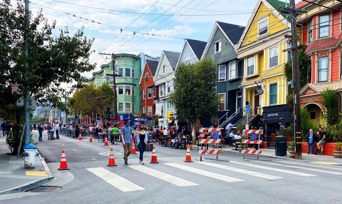
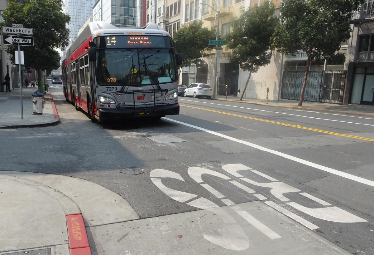
Our plans for the project need to change not only because of the impact on the local economy and our department budgets due to COVID-19, but also because of the greater-than-anticipated success of car-free Market Street. When private vehicles were removed from Market Street, transit became up to 12% faster and the number of people biking increased by 25% – over 800 people per hour at peak. The original designs for a new sidewalk-level bikeway would not have enough capacity to keep up with the updated demand of people biking on Market Street.

The COVID-19 pandemic also required us to revise our plans because it is not only a health crisis but is also devastating the economy, including local businesses and the capital funds of all city agencies involved in this project. As local businesses work to recover, we need to minimize construction disruptions – especially on the sidewalks in front of their stores.

Given the economic challenges and changing demands we now face in San Francisco, our departments came together and made the tough decision to adjust the design for Better Market Street in order to move the project forward. As a city, we remain committed to working with our community partners and delivering the Better Market Street project to make this vital corridor safer, more resilient and more inviting for all.


Funding and Time Constraints

The full project from Octavia Boulevard to Steuart Street was estimated to cost over $600M when the project was approved. By the time the COVID-19 pandemic hit, the city had secured only approximately $200M to plan, design and construct the full project. The funding gap was going to be a challenge even before the current financial crisis decimated our department budgets. By postponing major changes to the sidewalks and limiting certain infrastructure upgrades, we expect to save over$60M for Phase 1 between 5th and 8th streets alone.

Construction must start in early 2021 due to the requirements of a federal BUILD Grant providing key funding for building the project. These grant funds are needed now more than ever so we must proceed as quickly and thoughtfully as possible to get started.


Goals and Plan for Phase 1 Construction: 5th to 8th Streets

The project goals remain to improve safety, transportation, accessibility, infrastructure and revitalize Market as the city’s preeminent civic space and ceremonial street. The first phase of construction between 5th and 8th streets is focused on four key components:

  • Create a bike facility that will safely accommodate more people on bicycles
  • Build new accessible boarding islands to improve the customer experience, transit functionality and capacity, and new wider curb ramps to upgrade sidewalk accessibility
  • Upgrade and replace aging infrastructure like the rails, overhead lines, traffic signals, sewer and water lines, and repave the street
  • Replace unhealthy trees and new street furnishings but postpone replacing the brick sidewalks or changing the sidewalk to minimize disruptions directly in front of local businesses


Changes for People Biking

The original sidewalk-level bikeway design is too expensive and won’t have enough capacity. It was designed to accommodate 2015 levels of people biking – half the people biking in 2020 pre-COVID, let alone the increases we expect to see in the future. As in our original plans, we remain committed to reducing conflicts between Muni and people on bikes.

Our new plan is to move all Muni buses to the center lane, reserving the curb lane for bikes to share with paratransit, taxis and commercial vehicles (note: Uber/Lyft are considered private vehicles and are not allowed on Market Street). By removing curbside transit stops we will also eliminate conflicts between buses and people on bikes.

The curb lane will have updated bike priority markings on the pavement, speed tables to discourage speeding and a raised buffer between lanes to discourage vehicles from changing lanes. Loading restrictions in the morning and evening peak commute hours continue to limit delivery vehicles and conflicts during the busiest times on Market Street.

Better Market Street bike lane graphic

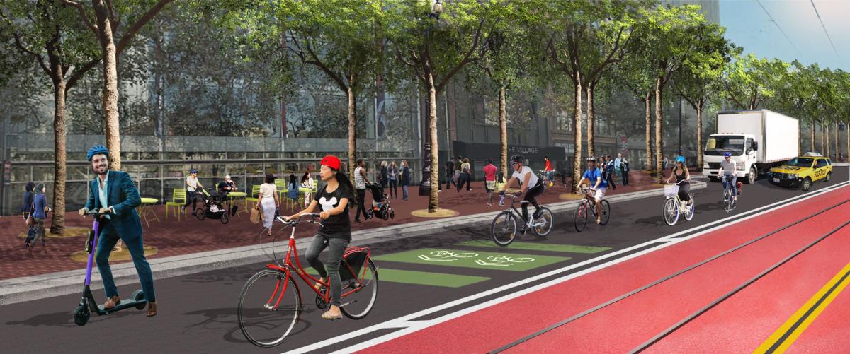
Graphic: The first phase of Better Market Street includes a bike-priority curb lane and center Muni-only lane. San Francisco Public Works


Accessibility and Transit

All Muni routes on Market Street between 5th and 8th streets will shift to the center in a Muni-only lane – taxis and other buses are not allowed. To reduce crowding for customers waiting, we plan to build new boarding islands that are twice as big as the current islands. The new islands at UN Plaza and at 6th Street will have new shelters with seating, be fully accessible, and include wheelchair ramps for F-line service.

New wider sidewalk curb ramps at intersections and across from boarding islands will also make the sidewalk more accessible.

Better Market Street new Civic Center area graphic

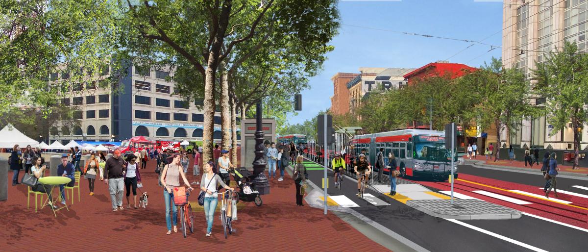
Graphic: Accessible center boarding island at UN Plaza. San Francisco Public Works  


State of Good Repair

Better Market Street will replace the worn-down rails, BART grates in the street, and traffic signals, and fully repave the road. The project team plans to replace some water and sewer pipes that have reached end of life and reline others to extend their life. Lastly, some transit infrastructure is worn out and in need of replacing, including the traction power systems that provide electricity to vehicles, overhead lines and switches.

Plans for Better Market Street also still include construction of the F-Loop, which will improve Muni service with new rail along McAllister Street and Charles J. Brenham Place allowing the F Market & Wharves streetcars to return to the waterfront for faster service without limiting access to the Castro.


Postponing Major Sidewalk Work

By not widening the sidewalk, replacing light and overhead cable system poles and other utilities, or the red brick, we can significantly reduce immediate costs as well as disruptions to businesses along the street. We plan to revisit this segment between 5th and 8th streets further down the line when conditions improve and work with building developers to make sidewalk upgrades part of their work.


Public Meetings

We recognize that these are big changes. We are actively meeting with project stakeholders and city partners. We will hold a virtual open house from November 2 – 13 that will be available online for the public to visit. We will also hold virtual public meetings on November 4th at noon and November 9th at 4:30pm to share project details and hear feedback. For details please visit the Better Market Street project website.


Published October 28, 2020 at 03:59PM
https://ift.tt/35I8m7l

Monday 26 October 2020

City Project to Improve the 28 19th Avenue Bus Line

City Project to Improve the 28 19th Avenue Bus Line
By Enrique Aguilar

As part of the 19th Avenue Combined City Project, the SFMTA will implement transit priority and safety improvements for people walking along the route of the 28 19th Avenue. The improvements will make it safer to walk, remove stops to make transit service more reliable, and enhance customers’ experiences—on and off the bus.  

As part of the project, seven Muni stops were removed between Irving Street and Ocean Avenue on the 28 19th Avenue bus line to improve transit reliability. Removing closely spaced stops will help to reduce delays for the 28 19th Avenue line while preserving bus stops within a block of each removal to minimize impacts to people with limited mobility. Please visit our website for more details about these stop changes, which took effect on October 17.  

The project includes transit bulbs that allow Muni vehicles to stop for passengers without having to pull out of traffic. It will also widen the sidewalk at corners by installing pedestrian bulbs along 19th Avenue and modify traffic and pedestrian signals to give people who walk more time to cross the street.  

The SFMTA Board approved the project, including these stop changes, after community engagement and feedback in 2015.  

Diagram summarizes proposed improvements, which include transit bulbs at 13 intersections, pedestrian bulbs at 19 intersections, stop relocation at eight intersections including udah, Lawton, Noriega, Rivera, Taraval, Vincente, Eucalyptus, Winston. It will make bus stops far-sided to take advantage of Transit Signal Priority, local stop only at two intersections, and bus zone extension at one intersection.

Diagram of 28th the 19th Avenue Rapid Project improvements (note: stop removal on 19th at Irving is still under review) 

The transit improvements are just one part of the combined project that will also include water main and sewer replacement and rehabilitation and Auxiliary Water Supply Service for emergency fire fighting. This project will be followed by Caltrans repaving of 19th Avenue from Holloway Avenue to Lincoln Way. 

San Francisco Public Works will lead construction, beginning in Fall 2020 and be completed in 2023. Project work will be completed in four segments to minimize construction impacts during its 27-month duration. The first construction segment from Lincoln Way to Noriega Street on 19th Avenue is anticipated to begin in November.  

In preparation for stop changes this month, project staff has mailed over 10,000 postcards to residents near the project area, posted multilingual signs at every intersection, and briefed district supervisors for District Three, Four and Seven. Transit Information Program (TIP) staff along 19th Avenue were present during the first six days of these stop changes taking effect to help customers find alternative stops, provide project information and answer questions.  

TIP staff helping 28 19th Avenue customers find alternative stops 

TIP staff helping 28 19th Avenue customers find alternative stops 

Find additional information about the transit reliability and pedestrian safety components of the project at SFMTA.com/28Rapid. For the overall project information, please visit sfpublicworks.org/19th-Avenue.


Published October 26, 2020 at 02:47PM
https://ift.tt/3ow9lQI

Thursday 22 October 2020

Shared Spaces Permits Extending to Next Summer

Shared Spaces Permits Extending to Next Summer
By Phillip Pierce

More than 1,800 individual operators and counting are making the Shared Spaces Program a successful part of San Francisco’s economic recovery. Permits originally set to expire at the end of December may now be extended through June 30 and new applications are welcome. Mayor Breed has called for this extension as well as for exploring ways to make the program permanent.

Shared Spaces allow merchants to use sidewalks, full or partial streets, and other nearby outdoor spaces like parks, parking lots and plazas for restaurant pick-up and other neighborhood retail activities allowed under San Francisco’s Public Health Orders. The program is a multiagency collaboration born out of the city’s Economic Recovery Task Force. 

The White Cap shared space with people eating in the Outer Sunset.

White Cap’s Shared Space in the Outer Sunset.

How to Renew Existing Permits:

The process for renewing permits to June 30, 2021  depends on the type of Shared Space. Merchants may use the following guide to understand how to renew a permit:

  • Sidewalk Permits – Automatically renewed before December 31, 2020.  No action is needed from the permittee unless:
    • The permittee wants to modify the existing permit. To do so, the permittee must submit a new application for a Sidewalk Permit on the Shared Spaces website.  
    • The permittee wants to discontinue or withdraw the existing permit. To do so, email SharedSpacesPermit@sfdpw.org with "Withdraw
      permit" in the subject line.
  • Curbside Lane Permits – On Monday, October 26 curbside lane permit holders are scheduled to receive a personalized email from the SFMTA to renew, extend or change the existing permit. The email contains a personalized link to a permit renewal form. This webform must be completed by November 15, to be guaranteed a permit renewal by December 31.
    • If the curbside lane zone being permitted extends in front of a neighboring property, written consent for the permittee to occupy that area through June 30, 2021 from the affected neighboring property owner(s) must be provided.
    • If the curbside lane zone has a fixed structure or deck, a signed form and photos must be provided as described in the Shared Spaces Design Guidelines.
  • Street Closure Permits – To extend the Street Closure permit beyond December 31, the permittee must submit a new application for Street Closure Permit on the Shared Spaces website.
  • Private Property Permits – Valid through the end of the State of Public Emergency. No action is needed from the permittee.
  • Port Property Permits – To renew, email SharedSpaces@sfport.com requesting renewal.
  • Recreation and Parks Department Property Permits – Permittees will be contacted by the Recreation and Parks Department in the coming weeks about extending Outdoor Dining and Outdoor Fitness Permits. The availability of facilities for outdoor fitness classes may change due to the change in seasons or the reopening of facilities previously closed by the health order.
  • Just Add Music (JAM) Permits – If the JAM permit is associated with a Shared Space, the Shared Space permit must be renewed in order for the JAM permit to remain valid. JAM permits not associated with Shared Spaces do not need to be renewed at this time.

Small Business Impact Survey

During these difficult times, the city is working to help small businesses. If you are a business owner or operator, please take the short survey below to help evaluate the Shared Spaces Program. Please fill out a separate survey for each business that you operate.

Survey: ENGLISH  /  ESPANOL  /  中文  /  PILIPINO  /  TING VIT


The 18th Street Shared Space with people eating and walking with traffic cones to prevent cars.

The Castro area on 18th Street is open for people each Sunday. Check out our website for a full list of Shared Space street closures.

More Information

To learn more about the program, track applications or apply, please visit our website or email SharedSpaces@sfgov.org


Published October 22, 2020 at 05:28PM
https://ift.tt/34lJClS

Monday 19 October 2020

SFMTA Staff Recognized for Putting Riders First

SFMTA Staff Recognized for Putting Riders First
By Bradley Dunn

SFMTA staff were honored for their work to keep the city moving during the San Francisco Transit Riders’ Rider First Awards last Friday. The nonprofit organization that aims to better transit in San Francisco gave awards to several members of the SFMTA’s hard-working staff who put Muni customers first. 

“It's as important as ever that we come together to show our appreciation for all those people working hard to make Muni better every day for riders, despite all the challenges,” the San Francisco Transit Riders said of the awards. 

The San Francisco Transit Riders present awards to Perry Poole, Johnny Siu, Celso Abueg at West Portal Station.

The San Francisco Transit Riders present awards to Perry Poole, Johnny Siu, Celso Abueg at West Portal Station.

The Transit Riders presented awards to: 

  • Myra Phillips and the Car Cleaner team for developing and instituting new cleaning protocols and systems in a quick and effective response to the pandemic, 

  • Dickson Yee and the Personal Protective Equipment team for tireless work making sure our Muni operators and staff have personal protective equipment, 

  • Cable car operators Perry Poole, Johnny Siu, Celso Abueg and Sam Eversly for stepping up in a new role as ambassadors and using their customer service skills out to the streets to help direct people during all the service changes, 

  • Public Information Officer Enrique Aguilar for visual communications that helped the public understand service changes and the importance of transit lanes, 

  • Jason Lee for  ushering the biggest improvement in customer information in two decades through design and the SFMTA Board serving as the Program Manager for the Next Generation Customer Information System, 

  • Felix Castillo for being a voice for his fellow Muni Operators during the pandemic, 

  • Shaun Reeves, a Muni Operator, who helped transport homeless San Franciscans under investigation for COVID-19 infection in the early days of the shelter-in-place. 

You can watch the SF Transit Riders’ Rider First Awards ceremony here. “This year has shown once again that Muni is the critical transportation link for our essential workforce. People who are riding Muni throughout this crisis are the critical workers doing the essential tasks we depend on during these difficult times,” the organization said. “They're also the people who depend on Muni to access services We have always known #TransitIsEssential.” 

The SFMTA congratulates the staff who won awards for their dedication to our customers.  


Published October 19, 2020 at 05:16PM
https://ift.tt/35fwU7j

Tuesday 13 October 2020

Reducing Crowding and Providing Service to Open Spaces

Reducing Crowding and Providing Service to Open Spaces
By Enrique Aguilar

The 30 Stockton bus route extension to Crissy Field in the Presidio began service on September 19. In partnership with the Presidio Trust, Muni implemented this new lifeline connection to bring workers, families, residents and visitors from Chinatown, Tenderloin and SoMa neighborhoods to the Golden Gate National Recreation Area via public transportation.

30 Stockton bus in service with Golden Gate Bridge in the background
The 30 Stockton on Marina Boulevard en route to downtown San Francisco

Shifting from 40-foot to 60-foot buses on the 30 Stockton helps reduce crowded conditions through neighborhoods like Chinatown, a neighborhood that generates some of the highest rates of trips in San Francisco. Moving the terminal to its new location in Crissy Field provides increased space for these longer buses.

Direct access to parks via public transportation is vital for neighborhoods with the least access to open space in San Francisco. Visitors to the Presidio enjoy nature within the city, including miles of walking and biking trails, beaches, scenic overlooks with views of the Golden Gate Bridge, the bay and the city, as well as picnic and play areas. The 30 Stockton extension not only benefits park-goers, but serves as a lifeline for essential workers who work or live in the Presidio or nearby neighborhoods.

30 Stockton bus stopping Sports Basement
The 30 Stockton making its new last stop near the Sports Basement store

Details on the 30 Stockton extension:

  • The 30 Stockton route extends into the Presidio between 6:00 a.m. and 8:00 p.m. daily. All other times, the 30 Stockton terminal is on Divisadero at Chestnut.
  • We have added three stops in each direction within the Presidio:
    • On Mason Street near Marina Boulevard by Crissy Field East Beach.
    • On Mason at Halleck Street near the Tunnel Tops park and Presidio Main Post.
    • By the Sports Basement store at Crissy Field.
  • Daily frequency: Every 12 minutes on weekdays, every 20 minutes on weekends.


Published October 13, 2020 at 04:03PM
https://ift.tt/3dp0Xx0

Thursday 8 October 2020

First Temporary Emergency Transit Lanes Complete on Mission Street

First Temporary Emergency Transit Lanes Complete on Mission Street
By Erin McMillan

14 Mission bus driving on Mission Street in transit lane

14 Mission downtown on the transit lane. 

Installation of the all-day, temporary emergency transit lanes on Mission Street is complete. With installation completed in just a few months, the new all-day temporary emergency transit lanes from 11th to 3rd streets downtown serve segments of the 14 Mission and 14R Mission Rapid and will help keep buses out of traffic to reduce crowding and travel times. Both routes have been a lifeline for essential trips during the pandemic and have experienced crowding despite increased service. Almost ten percent of trips on the 14 Mission and 14R Mission Rapid are at or exceeding our COVID-era capacity standards, which take into account the need for physical distancing. By reducing delay from congestion, Muni can provide more frequent service and greater capacity with the same number of buses.

In addition to installing the temporary all-day transit lanes, the transit lanes were widened to improve traffic safety. Previously, the lanes on Mission Street were too narrow to accommodate traffic and buses, which has contributed to unsafe street conditions and 225 collisions involving transit in the past five years.

These are the first of the temporary emergency transit lanes  to be installed. SFMTA is planning to install additional temporary transit lanes along other key locations across the city. With the need for a swift response to increasing traffic congestion and the need for more space on buses to allow for physical distancing due to COVID-19, temporary emergency transit lanes are an emergency response that allows us to be nimble and install these temporary measures and evaluate the outcomes, making changes as necessary.

Now that installation is complete, we’ll begin the evaluation process evaluating metrics like travel time and ridership. You can provide feedback about what you feel is important to evaluate for these temporary emergency transit lanes. Take a short survey about how we should evaluate temporary lanes.

Soon, we’ll invite you to help evaluate the transit lanes. Sign up for project updates to receive a link to the survey via email or text in the coming weeks.

For additional project information, visit www.SFMTA.com/TempLanes14


Published October 08, 2020 at 02:43PM
https://ift.tt/36LpsDt

Monday 5 October 2020

Slow Streets are Full Steam Ahead

Slow Streets are Full Steam Ahead
By

Bikers on Noe Street

Last week, the San Francisco Board of Supervisors ruled against four California Environmental Quality Act (CEQA) appeals that have been delaying Slow Streets, temporary emergency transit-only lanes, bike lanes and emergency street closures. Within 12 hours of the Board’s decision, SFMTA crews were back out in full force to implement these critical initiatives that help keep San Francisco moving during the pandemic. 

The Board of Supervisors ruled unanimously that these temporary projects are deemed critical to the city’s emergency response efforts, preventing a further delay. 

Implementation of new Slow Streets was put on hold while we waited for the appeals hearings, giving crews the opportunity to focus on filling in the signage gaps and repairing existing Slow Streets to improve the network.

Now, crews are bringing you more Slow Streets to connect our city. These improvements are needed to move about in these unusual times. The Slow Streets are welcoming, accessible, and allow for physical distance for people who want to travel on foot, bicycle, wheelchair, scooter, skateboard, or other forms of micro-mobility in San Francisco. Slow Streets attract users of the full array of neighborhood demographics—including children, older adults, people with disabilities and people of color. 

After the hearing, new Slow Streets were installed on Clay and Noe streets and Pacific and Tompkins avenues, bringing the current total to 20 Slow Streets corridors and 38 miles of Slow Streets:   

  • 20th Avenue from Lincoln Boulevard to Ortega Street 
  • 20th Street from Valencia Street to Potrero Avenue 
  • 23rd Avenue from Lake to Cabrillo streets 
  • 41st Avenue from Lincoln Way to Vicente Street 
  • Clay Street from Arguello Boulevard to Steiner Street (New) 
  • Chenery Street from Burnside Avenue to Lippard Avenue 
  • Excelsior Avenue from London to Munich streets 
  • Golden Gate Avenue from Masonic Avenue to Broderick Street 
  • Kirkham Street from 7th Ave to Great Highway 
  • Lake Street from 28th to Second avenues 
  • Lombard between Mason and Powell streets 
  • Mariposa Street from Kansas to Texas streets 
  • Noe Street from 18th to Duboce streets (New) 
  • Ortega Street from 47th to 15th avenues 
  • Pacific Avenue from Steiner to Gough streets (New) 
  • Page Street from Stanyan to Gough streets 
  • Sanchez Street from 23rd to 30th streets 
  • Shotwell Street from Cesar Chavez to 14th Street 
  • Somerset Street from Silver Avenue to Woolsey Street 
  • Tompkins Avenue from Andover to Putnam streets (New) 

Plans are underway to continue expanding the Slow Streets network, with new Slow Streets scheduled for implementation this week on 20th Street between San Bruno and Pennsylvania avenues, Arkansas between 23rd and 17th streets, Duncan between Guerrero and Sanchez streets, and Minnesota between Mariposa and 22nd streets. The full network of approved Slow Streets is expected to be built out by the end of October. Implementation of the additional Slow Streets corridors is currently being planned with input from neighborhoods, community groups, and elected officials.

We’re also always taking suggestions for new Slow Streets. Want to suggest a street for Slow Streets Phase 4? Good candidates for Slow Streets are lower-traffic residential streets, without large hills, connecting neighbors to essential services in the absence of Muni service. Suggested corridors will be screened for feasibility and access conflicts, and we aim to create Slow Streets throughout the city. Please take our survey and help us plan out Phase Four.

Slow Streets are for essential trips,  not neighborhood gathering points. As required by the public health ordinance, everyone should bring their required  face covering and maintain proper physical distance from people outside their households.  To make sure Slow Streets are being used properly, staff are continuously monitoring this program for its effectiveness.  

For updates and additional information on the SFMTA’s Slow Street Program, visit the program webpage at SFMTA.com/SlowStreets. Please also visit our website for the latest agency updates about our COVID-19 response.  


Published October 05, 2020 at 05:27PM
https://ift.tt/3ddMcxj