Wednesday 27 January 2021

Slow Streets: A Path to Permanence

Slow Streets: A Path to Permanence
By Shannon Hake

In locations throughout San Francisco, the Slow Streets Program has shown that minimizing traffic on residential streets allows them to be more safely used as a space for people traveling by foot and by bicycle. Due to the program’s success, the SFMTA is now exploring the possibility of making some of the current temporary Slow Streets permanent, extending their use beyond the COVID-19 emergency.  

Image of three posts place in the travel lane with a sign indicating "Slow Street" in English, Chinese and Spanish

Slow Streets discourage non-local vehicle access through barricades and signage. Reducing the number of vehicles on Slow Streets provides more space for physically-distanced essential travel and exercise during the COVID-19 emergency. Because of their popularity, community members have indicated a strong interest in a longer-term future for these streets. As such, we are planning ahead so that some Slow Streets can be maintained beyond the public health emergency.

In the coming months we’ll be implementing our “Path to Permanence” on the first three Slow Streets corridors: Page Street, Shotwell Street, and Sanchez Street. These are corridors where our resident and user surveys have shown strong community support for Slow Streets.  The positive feedback from these surveys has shown that residents and users of these Slow Streets overwhelmingly support making them permanent. After completing the planning process with these three streets, we’ll explore other streets in the network using the same process:

  • Determine Support for Permanence: We survey the residents living along all of our Slow Streets to better understand the desire to make the designation permanent. These surveys are ongoing and will be completed on all Slow Streets corridors by May.
  • Listen to the Community: On streets with strong support, we engage with residents and stakeholders on potential permanent treatments. These could include operational changes like turn restrictions or other physical changes with more durable materials, beyond the temporary delineator treatment currently in place on some Slow Streets.
  • Design Permanent Treatments: Using the feedback from the community, our engineers and planners will complete the permanent Slow Streets design, which will consist of uniform elements. We’ll meet with the community again to share this design and address any outstanding concerns.
  • Approve Permanent Changes and Slow Streets Designation: Following a public hearing process and other internal review, we’ll present permanent corridor changes to the SFMTA Board of Directors for final approval.

What’s Next

The SFMTA has implemented 25 temporary Slow Streets since April 2020. Identifying which corridors have support for being made permanent will take time. We plan to survey residents along all temporary Slow Streets corridors by May 2021 to determine which corridors may advance to permanence.

The Slow Streets network continues to evolve, and will expand to include 13 additional temporary corridors if our proposal is approved at the SFMTA Board of Directors meeting on February 16. These new corridors will go through the process outlined above to determine whether they should be considered permanent.

For updates, additional information, and to provide input, visit our Slow Streets Program page


Published January 27, 2021 at 03:17PM
https://ift.tt/3t0mPX3

Tuesday 26 January 2021

Fiona Hinze Fills Final Seat on SFMTA Board of Directors

Fiona Hinze Fills Final Seat on SFMTA Board of Directors
By Lori Phelan

Fiona Hinze, transit accessibility advocate and resident of the Outer Richmond, has joined the SFMTA Board of Directors as the seventh member on the board, filling the final vacancy. Nominated by Mayor Breed in late October, Hinze brings a lifetime of experience advocating for transit access for people with disabilities such as herself. Hinze lives with cerebral palsy and uses an electric wheelchair for mobility.

Photo of Fiona Hinze

"It is important we have a member on the SFMTA Board who understands the needs of our disability community and the challenges people face getting around our City, whether that's riding Muni or navigating our streets and sidewalks," said Mayor Breed in a press release. "Fiona is a respected and trusted community member and knows how to listen to the needs of people living with disabilities and advocate for change. She will bring an important perspective to the SFMTA Board and I'm confident she'll prioritize equity and work to create a more accessible transit system for the people of San Francisco."

Hinze has been working as director of systems change for the Independent Living Resource Center San Francisco, a disability rights advocacy and support organization, since 2014. There she tracks key state and local advocacy issues and by attending community committee and task force meetings. She works to ensure consumers are aware of advocacy opportunities in the community, such as calls to action on various issues.

She's also co-chair of the Dignity Fund Coalition and has served on several boards and task forces including the Paratransit Coordinating Council, the Senior Disability Working Group of the Vision Zero Coalition, the Sunshine Ordinance Task Force and the Disability Organizing Network.

She just completed two terms on the California State Independent Living Council, to which she was appointed in 2014 by former governor Jerry Brown.

Hinze graduated from Stanford University in 2013 with a Bachelor of Arts degree with distinction in Psychology; Health and Development; also working as a research and teaching assistant. During that same time period, she worked as a legislative intern for Assemblywoman Fiona Ma.

With her approval from the San Francisco Board of Supervisors and being sworn in by Mayor Breed Jan. 14, Hinze's appointment fills the final vacancy on the SFMTA Board of Directors.

SFMTA Board of Directors

Twice monthly the agency's board of directors meet at City Hall to discuss and provide policy oversight for safe and efficient transportation in San Francisco in accordance with the city charter and the Transit First Policy.

This seven-member board, appointed by the Mayor and confirmed by the San Francisco Board of Supervisors, typically meets on the first and third Tuesday of each month at 1 p.m., unless otherwise noted. Meetings are open to everyone and are streamed live through SFGovTV. Additional information such as agendas, resolutions and legislation passed by the Board can be accessed through our public-facing website, SFMTA.com.


Published January 26, 2021 at 08:08AM
https://ift.tt/3onVc6G

Monday 25 January 2021

Meet Manny Yekutiel, New Addition to the SFMTA Board of Directors

Meet Manny Yekutiel, New Addition to the SFMTA Board of Directors
By Lori Phelan

On Tuesday, January 14, Mayor London Breed officially welcomed small-business owner Manny Yekutiel as one of two new members of the SFMTA Board of Directors. The appointment fills the sixth of the seven SFMTA board positions.

Yekutiel is currently the owner of Manny's, a restaurant, bar, coffee shop, political bookstore and civic social gathering space built at the corner of 16th and Valencia in the Mission district. He is also a member of the city's Small Business Commission and board member of the Valencia Corridor Merchants Association.

Photo of Manny Yakutiel

"I'm excited to nominate Manny Yekutiel to serve on the SFMTA Board of Directors," said Mayor Breed in a tweet. "He knows how to bring people together, and I am confident in his ability to bring a fresh perspective to the Board and represent the needs of SF small businesses and residents."

In Mayor Breed's press release he was quoted saying, "I am deeply humbled and honored to be considered to serve the City I love as a member of the board of the SFMTA."

"Mobility is freedom and it's my belief that a City like ours should aim to create access to that freedom to everyone, everywhere. Our transportation system can and should do that. The relationship between our transport system, streets, workers, and small businesses has never been more important. I've seen firsthand how decisions made by the SFMTA, in the case of temporarily closing streets to cars, has given small businesses a fighting chance to survive this crisis. If given the opportunity to serve, I promise to be a fierce advocate for all San Franciscans and will bring my perspective and my passion as a small-business owner to the Board."

According to his profile in Milken Scholars, Manny's was awarded Small Business of the Year by the California State Senate and has been featured in The New York TimesRolling Stone magazine, and the San Francisco Chronicle during its first year in business. The business has served more than 55,000 cups of coffee and tea, hosted over 500 civic events for the community, including over 150 local nonprofits and 17 of the 2020 democratic presidential candidates.

The restaurant is run by the nonprofit Farming Hope, which runs an apprentice program for formerly incarcerated and formerly homeless individuals and places them into full-time employment.

Before founding Manny's, Yekutiel was the proprietor of ESY Strategies, a political and philanthropic consulting organization.

Born in Los Angeles, he worked for President Barack Obama's 2012 reelection campaign and Hillary Clinton's presidential campaign during 2015. As a San Francisco resident since November 2012, he is part of the area's active Jewish community.

Yekutiel earned a Bachelor of Arts degree in political science from Williams College and was honored as one of the leaders under 30 years old in field of law and policy nationwide by Forbes magazine in 2015.

SFMTA Board of Directors

Twice monthly the agency's board of directors meet at City Hall to discuss and provide policy oversight for safe and efficient transportation in San Francisco in accordance with the city charter and the Transit First Policy.

This seven-member board, appointed by the Mayor and confirmed by the San Francisco Board of Supervisors, typically meets on the first and third Tuesday of each month at 1 p.m., unless otherwise noted. Meetings are open to everyone and are streamed live through SFGovTV. Additional information such as agendas, resolutions and legislation passed by the Board can be accessed through our public-facing website, SFMTA.com.


Published January 25, 2021 at 08:10AM
https://ift.tt/3iRAHyb

Friday 22 January 2021

Southeast San Francisco Residents Speak Up for More Mobility

Southeast San Francisco Residents Speak Up for More Mobility
By Adrienne Heim

The start of the 15 Bayview line on January 23 signals the SFMTA’s strengthening commitment to the diverse neighborhoods in southeast San Francisco, which have for too long seen disinvestment and a lack of sufficient transportation infrastructure. This commitment  extends to neighborhoods from Mission Bay to Visitacion Valley that have seen a surge in infill development such as the Chase Center, Visitacion Valley/Schlage Lock Plan and Candlestick Point and Hunters Point Shipyard. To begin to correct historical inequities and support this new growth, the SFMTA has been steadily engaged in bringing transportation improvements to residents, merchants, businesses and visitors to this important area.

Voice of the Community

From 2017 to 2019, the Southeast Muni Expansion project partnered with the Muni Service Equity Strategy, the Bayview Community Based Transportation Plan, and The San Francisco County Transportation Authority’s (SFCTA) District 10 Mobility Study project teams to conduct community outreach and collect feedback around community mobility needs and what Muni service performance improvements should be prioritized.

Southeast Muni Expansion Outreach

Because funding sources for transportation are limited, the Southeast Muni Expansion project team surveyed community members to review ten proposed options involving Muni bus routes, route extensions and reroutes, and more frequent service on existing bus routes that could be incorporated in the Candlestick Point-Hunters Point Development Transportation Plan The survey helped rank the community’s preferences, determining the order in which they can be planned and implemented.

Survey Results

The survey produced the following top three choices:

  • Option 4 – A new bus route between the Mission and Bayview neighborhoods
  • Option 7 – Improve the 29 Sunset bus route
  • Option 9 – A new express bus route between the Bayview and downtown

Option 1 was Geneva Harney BRT, Option 2 was Hunters Point Express, Option 3 was Candlestick Point Express, Option 4 was new Mission District connection, Option 5 was 19 Polk restructure, Option 6 was 22nd street Caltrain shuttle, Option 7 was 29 Sunset, Option 8 was 44/54 lines restructure, Option 9 was Hunters Point Express extension and Option 10 was 56 Rutland.

Results of the 2018/2019 survey

The  implementation of new bus service according to these priorities will also take into account any changes that may occur in the timeline for the Candlestick Point-Hunters Point development projects. In addition, we continue to review potential funding sources and a timeline for implementing additional service improvements.

Ongoing Service Improvements

In 2007 we inaugurated the T Third Light Rail service that links Sunnydale and Embarcadero Muni Metro Station, improving downtown transit access for the Bayview and Visitacion Valley neighborhoods. Additionally, the Mission Bay Loop between 3rd, 18th, Illinois and 19th streets now enables the T Third line to support both peak period demand and special events at Oracle Park and Chase Center. When completed, the Central Subway Project, will further improve the T Third by directly offering mostly underground service—that doesn’t have to contend with roadway traffic—from the 4th Street Caltrain Station to Chinatown.

In 2014, we launched our Muni Service Equity Strategy as a commitment to ensure transit is accessible, reliable, and affordable to all Muni customers. The strategy focuses on service in nine Equity Neighborhoods, including Bayview and Visitacion Valley in the southeast.

In 2019, we initiated the 29 Sunset Improvement Project to gather feedback on possible service improvements from diverse stakeholders, including students, who rely on the 29 Sunset. While those changes are currently on hold due to the COVID-19 pandemic, it remains a key route in the Muni Core Service Plan with frequent service to reduce crowding and support social distancing.  

To ensure that the transportation priorities and needs of neighbors in the southeast were being heard, we began conducting outreach for the Bayview Community Based Transportation Plan utilizing a Caltrans Sustainable Planning Grant. Community engagement resulted in directly administering a $600,000 Metropolitan Transportation Commission grant in areas that have the greatest needs and prompted several Bayview Quick-Build projects.

Learn More

Read a more detailed report on all the projects associated with this effort and receive project updates at SFMTA.com/SouthEastMuni.


Published January 22, 2021 at 11:02AM
https://ift.tt/3c4ak6Y

Thursday 21 January 2021

San Francisco Launches Safety - It’s Your Turn Campaign

San Francisco Launches Safety - It’s Your Turn Campaign
By Christine Osorio

In San Francisco, left turns are one of the top three crash factors in severe injuries and fatal collisions for people walking and biking. SFMTA is kicking off the new year with a city-wide education campaign designed to encourage safer driving behavior around left turns. The Safety - It’s Your Turn campaign will use multiple strategies, including grants to community organizations, to engage the public at different times and raise awareness about unsafe left turns.

Drivers especially will see the Safety - It’s Your Turn messaging on billboards and buses, hear about it on the radio, and read about it on social media and in newspapers. This community education program also accompanies the SFMTA’s Left-Turn Traffic Calming Project.  Under that project, launched in October 2020, the SFMTA installed safety infrastructure at 7 intersections on the High Injury Network.

nine posters with these messages: "safety it's your turn" in english, chinese and spanish, "take it slow" with an image of a turtle, "left turn guide bumps" with an image of a car turning left by guide bumps, an image of a cyclist wearing a helmet, "stay cool" because "cars behind you may honk and pull around", an image of a human walking a dog with the message "stay conscious of the sidewalks", and an image of a car turning left encroaching the wrong lane with the message "no"

Community Grant Awardees

After a competitive application process, the SFMTA has awarded six grants to community organizations around the city to amplify the Safety It’s Your Turn campaign.  Community organizations are closer to the communities they serve and are better positioned to develop culturally-responsive outreach programs and materials. In addition to sharing safe left-turn messaging, another objective of the grant is to reach communities historically underserved by transportation projects. For many of the organizations, this is their first-time developing Vision Zero messaging, and the SFMTA is pleased to be expanding its engagement with community stakeholders and leaders. The selected grantees include:

These community groups plan to share safe left-turn messaging directly to food-delivery drivers, hard-to-reach communities along the High Injury Network, teen drivers, and vulnerable road-users. Examples of the deliverables include map booklets for the visually impaired, teen driver safety kits, and art-inspired public service announcements.

Remember that 40% of traffic fatalities in San Francisco involve drivers making left turns. Drivers can make a safe left turn by yielding to pedestrians and bicyclists, taking it slow at less than 5 mph, and making their turn nice and wide.

Image with the caption "anatomy of a left turn" with a link to video

Watch: Anatomy of a Left Turn

Vision Zero

San Francisco adopted Vision Zero (www.visionzerosf.org)as a policy in 2014, committing to build better and safer streets, educate the public on traffic safety, enforce traffic laws, and adopt policy changes that save lives. The result of this collaborative, citywide effort is safer, more livable streets as San Francisco works towards the Vision Zero goal of zero traffic fatalities. San Francisco is engineering inherently safer streets, enforcing traffic laws more effectively, and targeting traffic-safety education to reach its Vision Zero goals.


Published January 21, 2021 at 08:30AM
https://ift.tt/3c1gvbY

Wednesday 20 January 2021

Muni Expands Service, Access for Equity Neighborhoods in January

Muni Expands Service, Access for Equity Neighborhoods in January
By Mariana Maguire

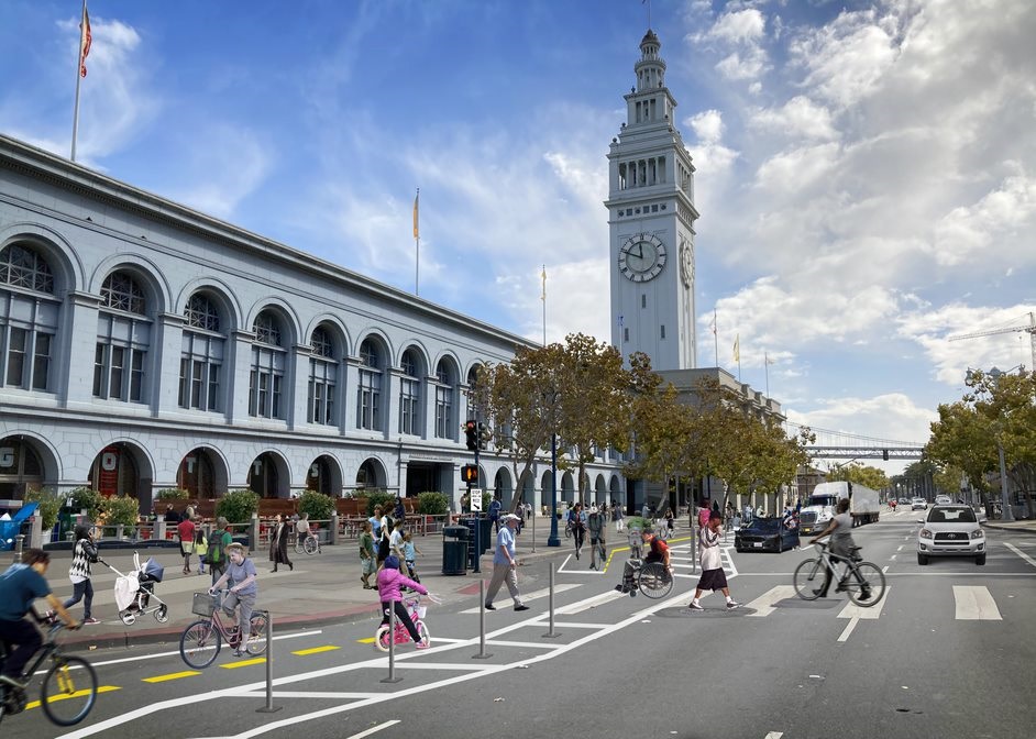
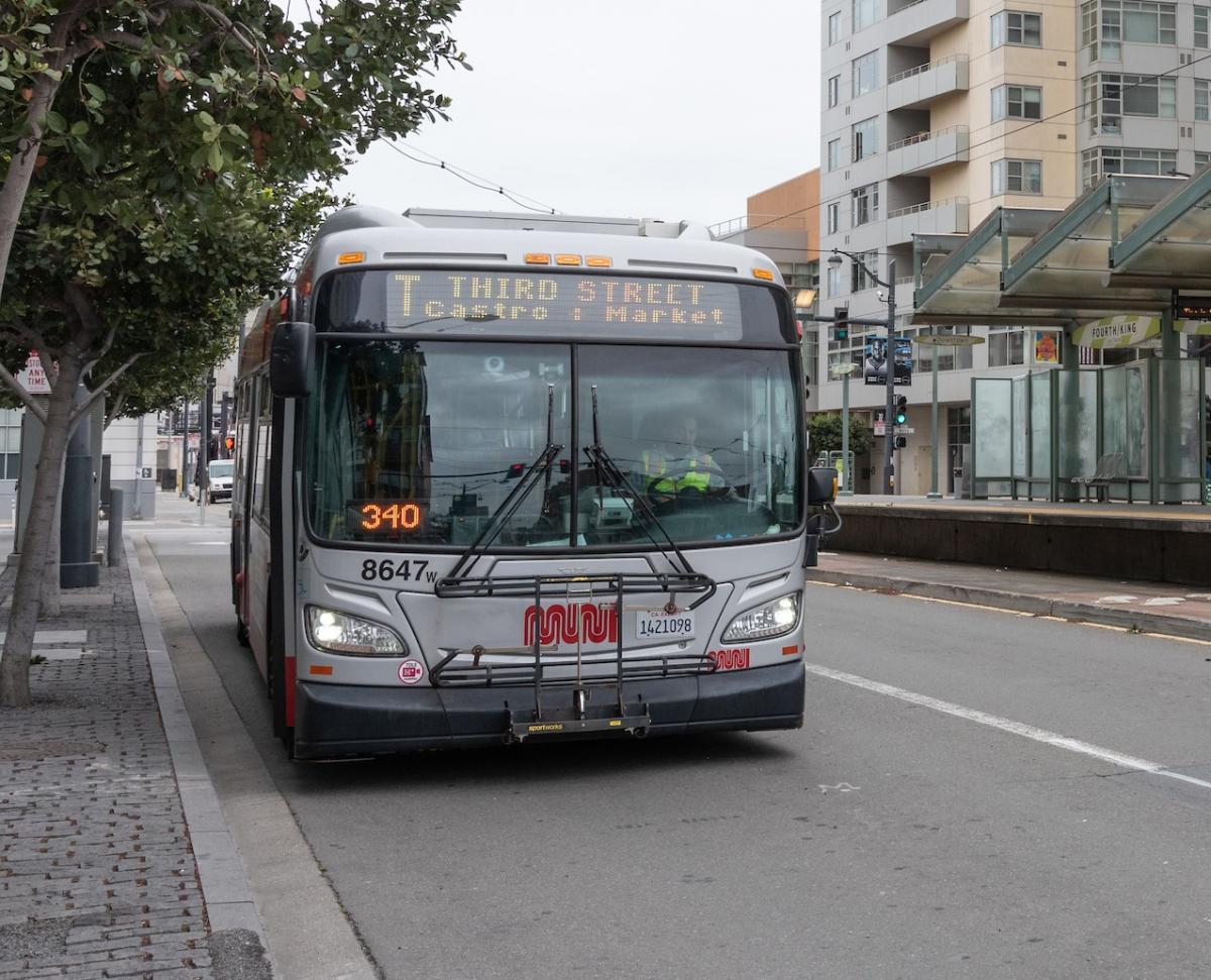
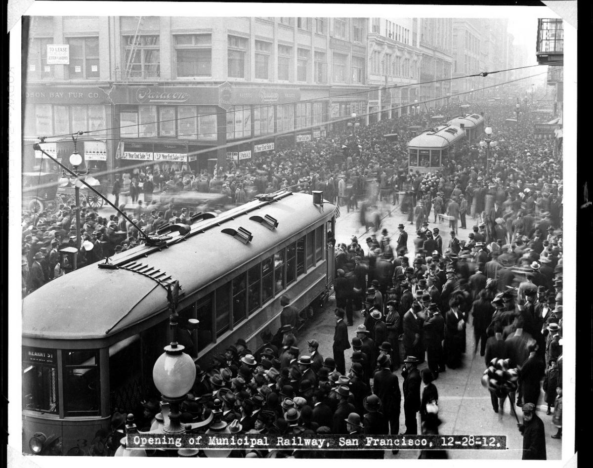
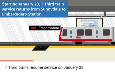
On Saturday, January 23, the SFMTA will restart T Third Muni Metro rail service and increase Muni bus service, including adding several routes based on community feedback.

Map of Muni Core Service as of January 23, 2021

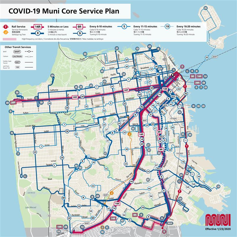
Graphic: New Core Service map, effective January 23, showing new and returning Muni lines.

Temporarily modified T Third rail service will resume between Sunnydale and Embarcadero Station. This frees up the buses currently providing the temporary T Third Street Bus service to increase bus service elsewhere. This change also brings more of our rail operators back to operating Muni Metro rail service.

Temporary changes to bus service include the return of the 27 Bryant and two new lines: the 55 Dogpatch and the 15 Bayview-Hunters Point Express. The full 33 Ashbury-18th Street line will also resume to provide another vital cross-town connection.

All of these changes are the direct result of community engagement and feedback. In particular, community members, SFMTA staff and District Supervisors worked together to develop the three new routes going into service January 23– the15 Bayview-Hunters Point Express, 27 Bryant, and 55 Dogpatch. These new routes will not only add service to those neighborhoods, but will also support San Francisco’s essential workers and economic recovery.

These Muni lines increase access to essential destinations and services for communities in the Tenderloin, Bayview-Hunters Point, Potrero, and Dogpatch that depend on transit the most and are part of the Muni Service Equity Strategy. By bringing these lines into service, we expect analysis through our new Equity Toolkit to show improvements in job access via public transportation for customers in these neighborhoods.

We aim to keep phasing Muni Metro rail back into service as subway repairs continue, particularly in the Eureka Curve near Castro Station. We also continue to work on adding more service on our high-ridership lines and using available vehicles and operators to help relieve crowding.

Below is the complete list of service changes. Please note that details are subject to change. For the most up to date information with free language assistance and accessibility, please call 311 or (415) 701-4311 or visit SFMTA.com/CoreService.

January 23 Muni Service Changes

All service changes below are temporary until further notice. Service hours: 5:00 a.m. to 10:00 p.m. daily, unless otherwise noted. Owl network service hours: 10:00 p.m. to 5:00 a.m. daily. Subway maintenance will be conducted evenings starting at 8:00 p.m. daily. For more information on frequency and hours of service, read more on the COVID-19 Muni Core Service Plan.

T Third Metro Rail: Service between Sunnydale and Embarcadero Station.

  • Service will resume on 3rd Street. Vehicles will enter Embarcadero Station, serve the stati
  • on, then turn back to Sunnydale. This allows us to provide connections to downtown and Market Street. For service along Market between Embarcadero and Castro, use Metro Buses or other Muni bus lines.
  • T Third customers traveling toward Sunnydale will enter Embarcadero Station from one of the Market Street portals at Drumm Street or Spear Street, go to the boarding level in the station and take the train toward Sunnydale.
  • T Third customers traveling into downtown San Francisco or other destination accessible via downtown will need to exit the train at Embarcadero Station and go to the street level to transfer to a Muni bus
  • Starting at 8:00 p.m. daily for evening subway maintenance, bus substitutions will provide Muni Metro service and Owl service at 10:00 p.m.
  • On weekends, buses will serve the T Third from 5:00 a.m. to 8:00 a.m. between Sunnydale and Steuart Street. Embarcadero Station opens at 8:00 a.m.

Animated video of T Third trains switching back at Embarcadero

Watch this animation of how to transfer at Embarcadero Station to and from the T Third.

N Judah Bus: Longer 60-foot coaches will help address crowding on weekends and continue to provide service on weekdays.

1 California (short): Additional service between California at Presidio streets and Clay at Drumm streets, where ridership is highest.

5 Fulton (short): Additional service between Fulton at 8th Avenue and the Salesforce Transit Center, where ridership is highest.

7 Haight-Noriega: Due to limited numbers of 60-foot motor coaches, shorter 40-foot coaches will serve the 7 Haight-Noriega on weekends. 60-foot coaches will continue to provide weekday service.

8AX Bayshore “A” Express (weekdays only): Additional service on the 8AX Bayshore between Kearny Street at Pacific Avenue and Bayshore Boulevard at Visitacion Avenue, where ridership is highest. Instead of peak hour service only, the 8AX Bayshore will be in service all day in both directions.

12 Pacific: Adjusted frequency to provide consistent service during the midday hours when ridership is high.

14 Mission: Additional service and frequency to address crowding.

14R Mission Rapid: Some 14R Mission Rapid buses will end at Mission at Lowell streets to relieve terminal congestion due to high frequency at Daly City BART Station. 

14 Mission Owl: Longer 60-foot coaches with increased frequency to address crowding.

15 Bayview-Hunters Point Express (BHPX): Community members directly shaped the design and planning of this new line to provide a faster trip between Bayview-Hunters Point and downtown. The route between Palou and 3rd streets to Market and 3rd streets via Hunters Point reflects the community’s travel patterns and priorities. See more information about this new line.

22 Fillmore: Modified route and additional service to address crowding.

  • As part of the completion of the first phase of the 16th Street Improvement Project, the new modified route will travel east on 16th Street and north on 3rd Street to the new terminal on Mission Bay Boulevard North.
  • Once the 22 Fillmore moves to serve Mission Bay, the new 55 Dogpatch will begin service to continue to provide bus connectivity for the Dogpatch and Potrero Hill neighborhoods. See more about the 55 Dogpatch below.

27 Bryant: The full route will go back into service with modifications in response to community feedback and engagement.

  • To improve reliability by using temporary emergency transit lanes, the route will be modified to travel southbound on 8th Street between Market and Harrison streets and northbound on 7th Street between Market and Folsom streets. The temporary emergency transit lanes are restricted for Muni service only so they can keep buses moving even if there is traffic congestion, which helps manage crowding.
  • The reroute will maintain access to BART and Muni Metro and will provide a connection to new destinations like FoodsCo on Folsom at 14th Street.
  • Over the next few months, SFMTA staff will ask for feedback from community members and evaluate the performance of the 27 Bryant on this temporary modified route.

30 Stockton (short): A short line between Caltrain and Van Ness Avenue at North Point Street will add service in segments of the line that consistently experiences crowding. The route will travel south on 4th Street, west on Harrison Street, south on 5th Street, then east on Townsend Street to its terminal.

33 Ashbury/18th Street: The full route will return to service as a trolley coach in response to customer feedback about cross-town connections that the route provides to a number of medical facilities.

37 Corbett: The regular route will come back between Parkridge Drive at Burnett Avenue, and Masonic Avenue at Haight Street.

38 Geary: Increased frequency on weekdays and weekends to address crowding. 

43 Masonic: The route will be extended slightly to connect to the 1 California on California Street at Masonic Avenue while maintaining the same number of bus resources.

55 Dogpatch: The former 55 16th Street will become the 55 Dogpatch, a modified route between 16th and Mission streets and 20th and 3rd streets to replace the eastern segment of the 22 Fillmore modified route to Mission Bay. This route was developed with community members from the Dogpatch and Potrero Hill neighborhoods. Visit SFMTA.com/55Dogpatch for more information.


Published January 20, 2021 at 07:15AM
https://ift.tt/2Kxc6lD

Tuesday 19 January 2021

The SFMTA and San Francisco Beautiful Kick Off Muni Art Project 2021

The SFMTA and San Francisco Beautiful Kick Off Muni Art Project 2021
By Jeanne Brophy

The SFMTA and San Francisco Beautiful  announce the kick-off of the 2021 Muni Art Project.  This year the program launch will be held virtually due to COVID-19 shelter-in-place orders.

Artwork by Agustina Caprioglio who found inspiration from COVID-19 and the frontline staff in hospitals,

Artwork by Agustina Caprioglio who found inspiration from COVID-19 and the frontline staff in hospitals, “They are our modern-day temples,” she states, “where people are born and die, where doctors and nurses work hard to take care of all”.

The 2021 theme, “San Francisco United” is the sixth year that the SFMTA, San Francisco Beautiful and The Poetry Society of America (sponsors of Poetry in Motion ®) have collaborated to bring art and poetry to Muni riders.  

“Now more than ever—it’s important to appreciate and be thankful for the positives around us,” said Jeffrey Tumlin, SFMTA Director of Transportation. “That’s why we’re looking forward to bringing Muni Art back and sparking some joy in the wake of such a difficult year.”

Begun in 2015, Muni Art is the only public art project that exclusively features San Francisco artists and poets. The artists’ original work and five poems selected by the Poetry Society of America, is presented on 100 Muni buses throughout San Francisco from January through April, 2021.

Art is the one language that unites everyone," said Darcy Brown, Executive Director of San Francisco Beautiful. "We all have lost so much, Muni Art 2021 is one project we didn't lose. We celebrate our local artists and poets and San Francisco.

The 2021 Muni artists are:

  • Kundan Baidwan
  • Agustina Caprioglio
  • John Keating
  • Deirdre Weinberg
  • Wes Wellner

The 2021 Muni poets and poems are:

  • Kim Addonizio
  • Derrick Austin
  • Jennifer Elise Foerster
  • Thom Gunn
  • Gary Soto

In addition to the poet panels, each artist also has three panels to freely use reflecting the theme for a total of eight original works that will line both interior display sides of the buses and conform to the specifications of Muni display space. In addition, each artist will be awarded $1,000.

For more details on the winners of the Muni Art Project, please visit www.sfbeautiful.org/MuniArt. Examples of each artist’ work can be found at SFMTA.com/MuniArt.


Published January 19, 2021 at 08:26AM
https://ift.tt/2NjHwwR

Twin Peaks: A New Vision for All

Twin Peaks: A New Vision for All
By Benjamin Barnett

SFMTA staff are recommending a proposal for Twin Peaks access aimed at balancing the diverse needs of the community, which they selected based on park usage data, feedback from neighbors and other stakeholders, as well as a public survey with over 1,700 responses.

Map of Twin Peaks Boulevard with closures, blue line showing opening of Twin Peaks Blvd

Map showing the proposed configuration of Twin Peaks Boulevard. See our website for a more detailed map or to read our report.

Recommendation: Open Portola Drive Gate at All Times, Close Burnett Avenue Gate

The proposal includes opening the gate at Portola Drive to traffic at all times and keeping the gate at Burnett Avenue closed. This option (also called Option 2) provides the best combination of safety and access, and addresses the negative impacts affecting neighbors.

This preferred option closes the northern Burnett Avenue gate to vehicles at all times, creating dedicated space for people walking, rolling and biking all the way to Christmas Tree Point Road.

The southern Portola Drive gate will be open to vehicles and tour buses at all times – improving access to the top of Twin Peaks for those with mobility challenges. The Portola Drive gate will also serve people walking, rolling and biking to and from Christmas Tree Point Road by way of the existing roadway shoulders and off-street paths. The recommended design does not require modifications to streets that currently restrict tour buses.

Five options were developed to achieve the project goals and reviewed by the SFMTA, in partnership with the San Francisco Recreation and Parks Department, the public, and other project stakeholders. Based on data and public feedback, SFMTA staff plans to bring the recommendation to the SFMTA Board of Directors for approval at a public meeting planned for this spring.

Photograph showing space dedicated to non-vehicle usage between Burnett Avenue and Christmas Tree Point

Photo: New space between Burnett Avenue and Christmas Tree Point parking lot that would be dedicated to people walking, rolling and biking. Vehicles would not be allowed at all times.

Project Background

Twin Peaks is a beautiful and unique natural resource for San Francisco residents and visitors alike. To provide additional recreational space for physical distancing during the COVID-19 pandemic the Burnett Avenue and Portola Drive gates on Twin Peaks Boulevard were closed in early 2020. Based on community feedback, we initiated the Twin Peaks for All project in October 2020 to explore how to best accommodate the high demand for this natural resource.

The project goals include restoring access to the viewpoint -- especially for people with disabilities, providing a space for people walking and rolling that allows for physical distancing, reducing negative impacts on neighbors and retaining the recent extraordinary increase in new park users. We collected data including parking counts, bicycle and pedestrian counts and historic collisions, reviewed turning radii for tour buses, talked to neighbors, released a public survey, analyzed the 1700 plus responses, reviewed street widths and coordinated with partner agencies.

We Heard from You

We heard concerns from neighbors of the Burnett Avenue gate that with the top of Twin Peaks closed to vehicles, substantially more drivers began parking near the northern gate, creating noise and litter. Vehicle break-ins were also reported in the area. Based on our analysis, opening the Portola Drive gate to vehicles at all times should decrease these negative impacts. The SFMTA also commits to monitoring and evaluating conditions once the proposal’s recommendations are put into place.

Additionally, to help drivers wishing to access the peak, SFMTA staff will:

  • Install additional wayfinding at the Burnett Avenue gate, directing drivers to access the top of Twin Peaks from the Portola Drive side.
  • Work with navigation providers (Waze, Google, Bing, etc.) to update their maps to direct drivers to the Portola Drive gate for accessing the Christmas Tree Point parking lot and the top of Twin Peaks.

Next Steps

SFMTA staff plans to bring this recommendation to the SFMTA Board of Directors for approval at a public meeting planned for this spring. We will conduct outreach to the community once that date is finalized so that individuals will have the opportunity to provide feedback and comments at the meeting.

Currently, people walking and bicycling at the temporarily closed Burnett Avenue gate must travel over the curb into the dirt and then back over the curb to access the roadway. If approved, the permanent closure of the gate would require a more accessible path for pedestrians. In cooperation with the San Francisco Recreation and Parks Department, SFMTA staff will improve the entrance, allowing people of all ages walking and rolling to travel through the area more easily on a level surface.

For more information on this project and its history, please visit our project page or email us at TwinPeaks4All@SFMTA.com.


Published January 19, 2021 at 09:14AM
https://ift.tt/3nWmS2f

Twin Peaks: A New Vision for All

Twin Peaks: A New Vision for All
By Phillip Pierce

SFMTA staff are recommending a proposal for Twin Peaks access aimed at balancing the diverse needs of the community, which they selected based on park usage data, feedback from neighbors and other stakeholders, as well as a public survey with over 1,700 responses.

Map of Twin Peaks Boulevard with closures, blue line showing opening of Twin Peaks Blvd

Map showing the proposed configuration of Twin Peaks Boulevard. See our website for a more detailed map or to read our report.

Recommendation: Open Portola Drive Gate at All Times, Close Burnett Avenue Gate

The proposal includes opening the gate at Portola Drive to traffic at all times and keeping the gate at Burnett Avenue closed. This option (also called Option 2) provides the best combination of safety and access, and addresses the negative impacts affecting neighbors.

This preferred option closes the northern Burnett Avenue gate to vehicles at all times, creating dedicated space for people walking, rolling and biking all the way to Christmas Tree Point Road.

The southern Portola Drive gate will be open to vehicles and tour buses at all times – improving access to the top of Twin Peaks for those with mobility challenges. The Portola Drive gate will also serve people walking, rolling and biking to and from Christmas Tree Point Road by way of the existing roadway shoulders and off-street paths. The recommended design does not require modifications to streets that currently restrict tour buses.

Five options were developed to achieve the project goals and reviewed by the SFMTA, in partnership with the San Francisco Recreation and Parks Department, the public, and other project stakeholders. Based on data and public feedback, SFMTA staff plans to bring the recommendation to the SFMTA Board of Directors for approval at a public meeting planned for this spring.

Photograph showing space dedicated to non-vehicle usage between Burnett Avenue and Christmas Tree Point

Photo: New space between Burnett Avenue and Christmas Tree Point parking lot that would be dedicated to people walking, rolling and biking. Vehicles would not be allowed at all times.

Project Background

Twin Peaks is a beautiful and unique natural resource for San Francisco residents and visitors alike. To provide additional recreational space for physical distancing during the COVID-19 pandemic the Burnett Avenue and Portola Drive gates on Twin Peaks Boulevard were closed in early 2020. Based on community feedback, we initiated the Twin Peaks for All project in October 2020 to explore how to best accommodate the high demand for this natural resource.

The project goals include restoring access to the viewpoint -- especially for people with disabilities, providing a space for people walking and rolling that allows for physical distancing, reducing negative impacts on neighbors and retaining the recent extraordinary increase in new park users. We collected data including parking counts, bicycle and pedestrian counts and historic collisions, reviewed turning radii for tour buses, talked to neighbors, released a public survey, analyzed the 1700 plus responses, reviewed street widths and coordinated with partner agencies.

We Heard from You

We heard concerns from neighbors of the Burnett Avenue gate that with the top of Twin Peaks closed to vehicles, substantially more drivers began parking near the northern gate, creating noise and litter. Vehicle break-ins were also reported in the area. Based on our analysis, opening the Portola Drive gate to vehicles at all times should decrease these negative impacts. The SFMTA also commits to monitoring and evaluating conditions once the proposal’s recommendations are put into place.

Additionally, to help drivers wishing to access the peak, SFMTA staff will:

  • Install additional wayfinding at the Burnett Avenue gate, directing drivers to access the top of Twin Peaks from the Portola Drive side.
  • Work with navigation providers (Waze, Google, Bing, etc.) to update their maps to direct drivers to the Portola Drive gate for accessing the Christmas Tree Point parking lot and the top of Twin Peaks.

Next Steps

SFMTA staff plans to bring this recommendation to the SFMTA Board of Directors for approval at a public meeting planned for this spring. We will conduct outreach to the community once that date is finalized so that individuals will have the opportunity to provide feedback and comments at the meeting.

Currently, people walking and bicycling at the temporarily closed Burnett Avenue gate must travel over the curb into the dirt and then back over the curb to access the roadway. If approved, the permanent closure of the gate would require a more accessible path for pedestrians. In cooperation with the San Francisco Recreation and Parks Department, SFMTA staff will improve the entrance, allowing people of all ages walking and rolling to travel through the area more easily on a level surface.

For more information on this project and its history, please visit our project page or email us at TwinPeaks4All@SFMTA.com.


Published January 19, 2021 at 09:14AM
https://ift.tt/3nWmS2f

Friday 15 January 2021

The Embarcadero Enhancement Project: Creating a Safe and Lively Waterfront

The Embarcadero Enhancement Project: Creating a Safe and Lively Waterfront
By Benjamin Barnett

As people walking, on bikes, scooters, and in motor vehicles all compete for space on the Embarcadero, travel along the waterfront can be challenging and create conflicts, especially at peak times. To address this, the SFMTA initiated The Embarcadero Quick-Build Project in 2020 as the first part of a larger plan to improve safety and livability on that corridor.

Safety and mobility improvements have so far been completed at Pier 35, the Ferry Terminal, and in the Rincon Restaurant Zone. These projects improve the safety and enjoyment of all modes of travel and mark a pivotal starting point in creating an improved waterfront for everyone to use.

Just the Start
The next step in connecting and extending these quick-build improvements is the implementation of an even more ambitious plan, The Embarcadero Enhancement Project (EEP). On Tuesday, January 12, the SFMTA presented the phasing plan of the EEP, including details of Phase 1, to the Port Commission. The plan prioritizes the next phases of infrastructure development that will occur along the corridor.

Rendering of proposed improvements on the Embarcadero at Ferry Building Plaza, showing two way bike lanes in front of the Ferry Terminal
Rendering of Phase 1 of safety improvements on the Embarcadero at Ferry Building Plaza

Safety and Mobility
The Embarcadero corridor between Townsend and Lombard streets is part of San Francisco’s Vision Zero High Injury Network (HIN), the 13 percent of streets accounting for 75 percent of severe and fatal traffic injuries. Sadly, 174 severe injury collisions and two fatalities have taken place along this corridor in the last five years. To achieve our Vision Zero safety goals of eliminating all traffic fatalities, the SFMTA will deliver the greater Embarcadero Enhancement Project through our on-going partnership with the Port of San Francisco and the input of community stakeholders. The Embarcadero Enhancement Project seeks to:

  • Build a safer Embarcadero for all users
  • Improve connections between the Embarcadero and nearby neighborhoods
  • Elevate the Embarcadero’s role as a valued destination and workplace for locals, visitors, businesses, maritime and industrial uses
  • Invest in critical infrastructure to support the renewal and recovery of our City while protecting public health

Upcoming Phases
The first phase will take place along the Central Segment between Mission Street and Broadway. The second phase will focus along the Southern Segment between Folsom and Townsend streets.

Phase 1 - Central Segment (Mission to Broadway)
The first phase (Central Segment) will be constructed in two parts, with less-intensive construction to occur in 2021, using “quick-build” techniques and city crews, followed by more substantial capital investment and construction.

This sequenced approach allows for timely implementation of key safety measures and expanded mobility options during the pandemic-related temporary shutdown of historic streetcar service. It also allows the project team time to observe and evaluate these changes prior to committing to more permanent and expensive streetscape features.

Phase 2 - Southern Segment (Mission to Townsend)
The second phase (Southern Segment) proposes to extend the quick-build and Central Segment improvements south toward the ballpark, Caltrain, and growing Mission Rock neighborhood. This phase requires more significant capital investment and changes to the existing promenade and center medians to accommodate a fully protected two-way bikeway. As such, Phase 2 has a longer and less certain timeframe. SFMTA staff are undertaking preliminary engineering and will be coordinating with the Port’s development plans for Piers 30-32 and 38-40.

Northern Segment (Broadway to North Point)
The Embarcadero Enhancement Project's preliminary engineering phase identified several design and funding challenges to implementing the project as envisioned along The Embarcadero north of Broadway.  This segment will not move forward as part of the EEP, but the SFMTA together with the Fisherman’s Wharf/Pier 39 circulation study will perform additional public outreach and analysis later this year to determine what safety improvements might be feasible in that area.

Stay Informed as We Create a Safer Embarcadero
The Embarcadero is a special place for many in San Francisco and beyond. We look forward to engaging with the community in the months ahead to help this important project take shape. Outreach for Phase 1 is currently underway through the spring of 2021. Please visit our project website at SFMTA.com/Embarcadero to stay up to date on the latest information and sign up for updates, or contact the project team directly by emailing Embarcadero@SFMTA.com.

Sign Shop Crew Installing Safe Hit Posts Along New Bicycle Facilities on Embarcadero
SFMTA Sign Shop crew installing safety posts along the Embarcadero bicycle lane in August 2020.


Published January 15, 2021 at 07:59AM
https://ift.tt/2XKO5KE

Thursday 14 January 2021

Renewing San Francisco’s Subway for the 21st Century

Renewing San Francisco’s Subway for the 21st Century
By Jerri Diep

The Muni Metro system operates underground from Embarcadero to West Portal in tunnels that were constructed between 50 to 100 years ago. Considering their age and history, SFMTA has undertaken a Subway Renewal Program to ensure that this vital segment of our transportation network is brought into a state-of-good repair.

The SFMTA kicked off the first part of the Subway Renewal Program during the current shutdown, which began as a result of the pandemic in March 2020. Work is underway to improve the reliability of the system and reduce disruptions for years to come. While we had hoped to complete all the near-term items we identified during our evaluation period by the end of 2020, designing and procuring some of the more complex elements is taking longer than expected. As a result, some of that initial work will continue even as service is restored.

Photo of rails in subway tunnel with construction vehicle

Track maintenance work being undertaken prior to the return of Muni light-rail to the subway

The Subway Renewal Program lays out a systematic approach to capital upgrades over the next ten years, targeting a backlog of repairs on the most critical systems. This work will improve our subway’s resilience and prepare it for the demands of the future. Additionally, the program provides a framework for future capital work by emphasizing continuous upgrades, as well as identifying replacement needs early and ensuring they are addressed promptly.  The critical subway infrastructure items we will replace over the next ten years include tangent (straight-line) track, crossover tracks and switches. We will also upgrade our electrical systems in the subway stations, enhance ventilation and replace and upgrade our automatic train control system. Long-awaited Wi-Fi connection inside the subway tunnel is already underway and is scheduled for completion prior to the subway reopening.

We will provide more information on future construction work as it becomes available. Stay tuned! 

Current Subway Work Details

The work of our engineering and maintenance teams on Subway Renewal includes:

  • Replacing defective splices on the overhead lines, installing new wire to reduce frequency of splices and redesigning support structures to optimize alignment, eliminating slow zones
  • Grinding rail to reduce wear on rolling stock, improve ride quality, and extend life of the rail
  • Spot-replacing track fasteners and rails in areas of higher wear and deterioration due to ground water
  • Replacing track switch machinery in the Muni Metro Turnaround area east of Embarcadero to ensure smooth operations at this critical junction
  • Replacing ballast in the Eureka Curve Tunnel to address rail stability and drainage issues
  • Upgrading Subway Lighting to allow for improved visibility during maintenance work and emergency response
  • Providing customer Wi-Fi access

Subway Work Timeline and Rail Service Return

The timing of rail service returning will align with the completion of safety and operational improvements inside the subway tunnel. The subway will operate initially with limited hours: underground service will stop and shift to bus shuttles at 8:30 p.m. for evening and late-night service due to anticipated low ridership and the need to complete the ongoing improvements of the renewal plan.

The T Third will be first the rail line to enter the subway at Embarcadero Station, once that location is operational, tentatively scheduled for January 23, 2021. The T Third line will operate on the surface between Sunnydale and the Embarcadero, where it will terminate, until full subway service can be returned.

In spring 2021, pending subway repairs and COVID-19 developments, we will extend the T Third rail service through the subway to West Portal and we restart the N Judah. We expect the K Ingleside, L Taraval and M Ocean View to remain as bus routes through the spring while we train more rail operators and complete the first phase of the L Taraval construction project.

We know many San Franciscans rely on our light rail service and we apologize for the inconvenience the continued closure of our rail system has caused. We are working hard to bring rail service back in better shape for a more comfortable and reliable ride. And, through our Subway Renewal Program, we’re planning for more reliable rides in the long-run. We thank you Muni customers for your patience while we work to bring the system up to the standard you deserve.

For updates on rail recovery efforts, please visit SFMTA.com/RailRecovery.


Published January 14, 2021 at 08:01AM
https://ift.tt/3oNOgAT

Wednesday 13 January 2021

We Need Your Feedback on Scooter Share

We Need Your Feedback on Scooter Share
By Philip Cranna

The SFMTA is seeking public input as we prepare for the next round of Powered Scooter Share Program permits. We are holding an online meeting at 4:00 p.m. on Thursday, January 14th and also have an online survey for feedback.

The current permits for Scooter Share expire in April 2021. We expect to issue the next round of permits to take effect as soon as the current permits expire. To improve the program, the SFMTA is considering updates and wants to hear from the community about:

  • Community engagement requirements: adding a mobility justice training requirement and additional outreach requirements
  • Distribution requirements: emphasizing the importance of ensuring that all neighborhoods in San Francisco are served by scooters
  • Adaptive scooter program requirements: transitioning from an adaptive pilot requirement to an improved accessibility requirement

The SFMTA is committed to fostering an urban environment where sustainable modes of travel are desirable, accessible, and preferred over operating a private vehicle.

Photo of scooter riders along Valencia Street

Scooter riders along Valencia Street

Background on 2019 Powered Scooter Share Permit Program

The SFMTA issued permits to four companies, Spin, Scoot, Lime and Jump to operate for a one- year term, beginning October 15, 2019. Due to the COVID-19 pandemic, the permits were extended by six months to April 2021.

Recent SFMTA authorization also enabled scooter companies to deploy more scooters and expand into new neighborhoods across San Francisco. This expansion aligns with the agency’s commitment to equity by increasing access to sustainable modes of transportation in underserved areas. Scooters offer an efficient travel choice that is environmentally friendly and fills transportation gaps for many. With reduced Muni service and returning traffic congestion, the city is focused on promoting sustainable ways to get around.

Companies Expanding

Spin was the first company to expand its fleet, by adding 500 scooters in September 2020. With the increase, Spin is authorized to deploy up to a total of 1,500 scooters and is required to meet a minimum distribution of scooters in three more neighborhoods: Inner/Central Richmond, Inner/Central Sunset and the Haight.

Lime acquired Jump in June 2020, and because both companies held a permit Lime is now authorized to operate up to 2,000 scooters. Their permit requires Lime to meet a minimum distribution of scooters in the Richmond and Sunset neighborhoods.

Increased Enforcement and Transparency

As the scooter companies’ fleets expanded, the SFMTA also increased our enforcement and monitoring of scooter share to address compliance and safety issues. For transparency in our effort to increase enforcement sweeps and respond to complaints, we’ve published a Scooter Share enforcement dashboard.

The SFMTA is currently standardizing the process of monthly reporting, which will be available on the Powered Scooter Share Permit Program site.

Get Involved:

Review the Powered Scooter Share Program website for more


Published January 13, 2021 at 09:12AM
https://ift.tt/38DI8FK

Monday 11 January 2021

4th Street Bridge Temporary Emergency Transit Lanes Approved

4th Street Bridge Temporary Emergency Transit Lanes Approved
By Erin McMillan

The SFMTA Board of Directors approved the temporary emergency transit lanes project for the 4th Street Bridge (4th Street between Berry and Channel Streets) on Tuesday, January 5, to support improved transit service on Muni’s T Third. Along with other proposed and planned key locations across the city, the SFMTA plans to install a temporary emergency transit lane on the 4th Street Bridge addressing a key bottleneck that delays the T Third line with work scheduled to begin as early as today, Monday, January 11.

t third bus at bus stop

Installing the dedicated transit lane will allow the T Third trains to move more quickly over the bridge without getting stuck in traffic as the SFMTA prepares for the return of T Third light rail service later this month. Pre-COVID, the combined KT line carried over 42,000 customers daily. Additionally, this will help Muni provide more frequent T Third service and increase physically-distanced capacity with the same number of vehicles. Currently, there are one northbound and two southbound lanes on the 4th Street Bridge. Muni tracks share the lanes with traffic, meaning the T Third often gets stuck in congestion, contributing to delays and bunching throughout the entire line.

The SFMTA Board of Directors approved temporary emergency transit lanes on the 4th Street Bridge in both the northbound and southbound directions. In response to community input, southbound left turns from 4th Street onto Berry Street will continue to be allowed, and there will be a phased approach to implementation of the northbound transit lane depending on site conditions.

At first, northbound left turns will be restricted from 4th Street onto Berry Street. The left turn pocket at that location will be converted to a transit lane, and northbound traffic will continue to be allowed on the 4th Street Bridge. If northbound traffic still causes delays to the T Third despite these initial changes, a northbound temporary transit lane will be installed between Berry and Channel Streets. With this change, turn restrictions would be implemented at 4th and Channel to prevent vehicles from entering the northbound transit lane, and northbound traffic would be prohibited on the 4th Street Bridge. A summary of this phased approach is provided below.

Phase 1: To be implemented as early as the week of January 11 with evaluation of the changes at least 3-4 weeks after T Third begins service:

  • Southbound transit lane will be installed in one of the two southbound lanes on the 4th Street Bridge
  • Northbound left turns will be prohibited from 4th Street onto Berry Street
  • The left turn pocket in the northbound direction at 4th onto Berry Street will be converted to a transit lane

Phase 2: If the evaluation of Phase 1 shows that auto traffic still causes transit delay on the 4th Street Bridge, despite the Phase 1 improvements, additional changes to be implemented:  

  • Northbound transit lane will be installed in the sole northbound lane on the 4th Street Bridge
  • Northbound traffic will not be permitted on the 4th Street Bridge, making the bridge one-way southbound for general traffic
    • Heading east on Channel, no left turn onto the 4th Street Bridge
    • Heading west on Channel, no right turn onto the 4th Street Bridge
    • Heading north on 4th Street at Channel, no through traffic onto the 4th Street Bridge (right or left turn required)

map of turn restrictions on 4th street bridge

Map shows Phase 2 of the project which will be implemented if an evaluation shows that northbound traffic continues to delay transit service.

Evaluation of the phased approach 

Once Phase 1 has been installed and the T Third resumes rail service, evaluation will include monitoring existing traffic cameras in the area to see if traffic blocks the northbound lane on the 4th Street Bridge more than 5% of the time. In addition to monitoring traffic, we will also monitor train travel times using location data from equipment that is onboard some of the trains to identify the times of day when trains experience the longest travel times on the 4th Street Bridge so that these causes of delay can be further investigated and addressed.

After the initial evaluation of this phased approach and the temporary project is fully in place, an additional evaluation of the full project will take place including a community survey and a technical evaluation of the effectiveness of the temporary transit lanes on the 4th Street Bridge.

Community requests for changes on nearby streets

Engineering staff are still working to determine the design feasibility of community members’ suggestions to allow left turns out of the One Mission Bay garage, conversion of Berry Street between 4th and 3rd to two-way or one-way in the opposite direction, and a dedicated right turn lane at Mission Bay Drive and Berry Street.

For additional information on this project, and to sign up for updates, check out the project webpage at SFMTA.com/TempLanesTThird.


Published January 11, 2021 at 01:47PM
https://ift.tt/3sarwNH

Friday 8 January 2021

How Public Input is Helping Shape a Better Market Street

How Public Input is Helping Shape a Better Market Street
By Mariana Maguire

In response to budget constraints and challenges resulting from the COVID-19 pandemic, the Better Market Street project team released updated design proposals for Market Street between 5th and 8th streets in September 2020. We then hosted multiple stakeholder and public meetings, posted a public survey and held a month-long virtual open house in order get feedback on the proposals.

We received and reviewed hundreds of public comments and found four recurring areas of concern:

  • curb lane sharing,
  • speed tables,
  • curbs between vehicle lanes and
  • car-free Market Street enforcement.

Based on these issues, we are proposing the following additional modifications:

  • Lowering the speed limit to 20 miles per hour between Franklin and Steuart streets
  • Adding speed tables next to boarding islands to slow vehicle traffic and discourage speeding where transit riders and pedestrians are more vulnerable
  • Removing previously proposed mountable curbs between vehicle lanes and explore other ideas for lane separators and
  • Exploring the use of traffic cameras to monitor illegal turns onto Market Street and issue citations in order to improve enforcement of the Market Street ban on private vehicles

We also will make several changes to improve safety for people walking and biking, while maintaining access for taxis and commercial vehicles along the majority of Market Street. These include:

  • Installing signage clearly indicating that taxis and paratransit may use loading zones at all times (already completed) and
  • Implementing four new required right turns for taxis and commercial vehicles, eastbound at 8th and 6th streets and westbound at Kearny/Geary and Turk streets.

This will further reduce conflicts between motorized vehicles and people walking and biking along one of San Francisco’s highest injury corridors.

Illustration of Market Street showing various turn restrictions

Illustration of existing and new proposed required right turns off Market Street and turn exemptions on Mission Street.

These changes build upon those approved in 2019 including: 

  • Implementing peak hour, peak direction commercial vehicle loading restrictions (6:00 - 9:30 a.m. south side, 3:00 - 7:30 p.m. north side) to reduce conflicts during rush hours
  • Requiring right turns for commercial vehicles at three locations (eastbound at 12th and Beale street, and westbound at Hayes and Larkin street).

Also, exempting taxis from left-turn restrictions along Mission Street (eastbound at 11th and 9th streets, westbound at 2nd, New Montgomery, 5th, 6th and 11th streets) will facilitate taxi mobility along the Mission Street Bus and Taxi only lanes, offsetting the added restrictions on Market Street.

Market Street is one of our city’s busiest areas for people walking and biking. As a part of San Francisco’s high-injury corridor, it includes four of the top ten most dangerous intersections involving collisions for people on bikes and for pedestrians. The creation of a Car-free Market Street initiated the beginning of a safer era for everyone on Market Street. Lowering speeds for the remaining vehicles will further improve safety.

To accomplish this, we propose installing speed tables next to boarding islands. Speed tables help strengthen the 10-mile-per-hour safety zones next to boarding islands and will help reduce overall speeds on Market Street. To discourage speeding, vehicles will not be able to change lanes to avoid the speed tables at the new proposed locations.

Illustration of Market Street between 5th and 8th streets showing placement of speed tables next to boarding islands

Illustration of new proposed speed table locations near boarding islands on Market Street.

Next Steps

On January 19, the SFMTA Board of Directors will consider minor additions to the 2019 legislation, including parking changes on Ellis, Hayes and Fell streets and turn restrictions to support the two-way conversion of Jones Street between Market Street and Golden Gate Avenue, as well as permanent adjustments near 2nd and Stevenson streets that were implemented on a temporary basis as part of car-free Market Street.

To see the public hearing notice for the SFMTA Board of Directors’ meeting on January 19, visit SFMTA.com/BetterMarketStreet. For project details visit the Better Market Street project website.


Published January 08, 2021 at 10:58AM
https://ift.tt/3nr9bbz

Thursday 7 January 2021

Today in History: The Making of the Geary Expressway

Today in History: The Making of the Geary Expressway
By Sophia Scherr

Photo of crowd surrounding two Muni streetcars in downtown San Francisco in 1912

Crowds surround streetcars during their inaugural day of service, December 28, 1912 (SFMTA Photo Archives)

The SFMTA recently celebrated Muni’s 108th Anniversary on December 28, the date when streetcar service was inaugurated along Geary Street between downtown and 33rd Avenue on the A and B lines in 1912. This vital corridor is now experiencing its latest transformation. But first, some history:

Upon opening, for the cost of a nickel, the Geary streetcars went all the way to the Ocean Beach carousel, candy stands and other rides and amusements that would later be known as “Playland at the Beach.” Residences and shops began to spring up amid the sand dunes in the Outer Richmond, as transit connected downtown to the Richmond neighborhoods, Golden Gate Park and Ocean Beach.

The public transit network expanded in the years following this inaugural service through innovative projects like the completion of the Twin Peaks Tunnel and the establishment of the J Church and other lines. Ridership on Geary quickly became among the highest in San Francisco. Today Muni’s 38 Geary and 38R Geary Rapid continue to serve our highest volumes of customers, with more than 56,000 pre-pandemic daily riders expected to return once public health orders are lifted.

Photo of first motor bus meeting streetcar 101 in December 1917

 Muni's first motor bus (#01) meets streetcar 101 at the end of the A-Geary streetcar line on Fulton Street and 10th Avenue in December 1917. (SFMTA Photo Archives)

With the rise in car ownership, however, "auto fever" demands for automobile-centric developments ushered in the removal of rail infrastructure throughout the City beginning in the 1940s, implementing freeways and expressways in their place. The so-called “urban renewal” campaign of the 1960s and ‘70s also included construction of the eight-lane Geary Expressway, devastating communities by razing homes and storefronts, thereby displacing Black, Indigenous, and People of Color (BIPOC) residents, especially in the Fillmore and Japantown. The Geary Expressway continues to divide these communities as highway-like conditions make it difficult for people walking to cross the street.

Photo showing the construction of the Geary Expressway tunnel between Presidio and Masonic. 

View east from Presidio Avenue showing the construction of the Geary Expressway tunnel between Presidio and Masonic.

The Geary Rapid Project aims to bring these neighborhoods much-needed transit, pedestrian safety and civic improvements along a 3-mile stretch of the corridor, extending from Market to Stanyan streets, with construction expected to wrap up in summer 2021. This latest transformation comes long after priorities shifted from the mid-20th century focus that originally led to the construction of the Geary Expressway.

While we can never undo all the harm caused by this roadway, the Geary Rapid Project brings transit improvements and safety for people walking, developed in partnership with the communities most affected by the Geary Expressway construction. These improvements include travel time-reducing transit lanes, bus-bulb outs that reduce crossing distances for people walking and traffic signal upgrades. The project also includes a host of Vision Zero safety and accessibility benefits, to calm the expressway and make this high-injury corridor safer for people walking.  

Construction on Geary has continued smoothly throughout the COVID-19 pandemic and the project reached several, major milestones in 2020:

  • 1.5 miles of sewer and 1.8 miles of water upgrades were completed,
  • 30 new bulb-outs were installed and
  • crews removed the Steiner pedestrian bridge over Memorial Day weekend (see a time-lapse video here). The bridge will be replaced with improved surface crosswalks with larger pedestrian medians, including a new crosswalk on the east side of the intersection.

In addition to these improvements, “Muni head-start traffic signals” were recently turned on along Geary at 25th, 20th and 15th avenues as part of the 38 Geary Temporary Emergency Transit Lanes project. The signals give the 38 Geary and 38R Geary Rapid the go-ahead to start before other traffic, while also giving a head start to people walking across the street. The and new temporary transit lanes will be a welcome time-saver and help address crowding for people making essential trips as San Francisco begins reopening.

Artist's endering shows people crossing Geary using the median crossing being built at Geary and Buchanan streets.

A rendering shows people crossing Geary using the median crossing being built at Geary and Buchanan streets.

Final touches on Geary include a special community-centered crosswalk with decorative panels at Buchanan Street. The crosswalk symbolizes the re-connection of the two communities (Japantown and the Fillmore) that were separated by the Geary Expressway. The crosswalk design and development resulted from a close collaboration between the SFMTA and the local communities as a part of our commitment to better serve the city’s residents.

As the Geary Rapid Project wraps up construction later this year on time and on budget, we look forward to cutting the ribbon on a better Geary that both Muni customers and people walking can enjoy once San Francisco opens again.


Published January 07, 2021 at 12:39PM
https://ift.tt/3s3g3PU