Friday, 29 October 2021

Slow Streets Become Spooky (Safe) Streets for Halloween

Slow Streets Become Spooky (Safe) Streets for Halloween
By Eillie Anzilotti

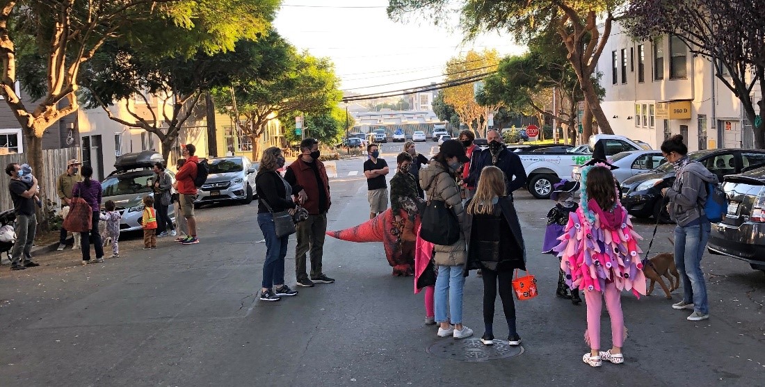
Photo of children in Halloween costumes on Minnesota Street in 2020

Halloween festivities on Minnesota Slow Street in 2020

This Halloween season, Slow Streets are becoming Spooky Streets. All across San Francisco, community groups are transforming their local Slow Streets into neighborhood gathering places for trick-or-treating, costume parties and more.

On October 31 from 3 to 6 p.m., organizers from Kid Safe SF and the Great Highway Park Initiative are turning the Great Highway into The Great Hauntway, a beachside block party with a costume contest, arts and crafts and a “spooky disco.” That same day, neighbors in Sunnyside are gathering on Slow Hearst Street for a Halloween party at 4 p.m. On Minnesota Street, the Dogpatch Neighborhood Association is hosting their second annual MinneSLOWta Spooky Slow Street Stroll on October 30—the same day that Slow Sanchez Street will host a Halloween Stroll.

Safe, car-light spaces for people to walk, bike and roll are essential every day, but especially on Halloween. Statistically, this holiday that revolves around children being out in the streets, often later in the evening, is the most dangerous day of the year for young pedestrians. To create safer conditions on San Francisco streets for little vampires, ghosts and witches, the SFMTA encourages people to bike, walk or take Muni on Halloween—and for people who do have to drive to use extra caution. Because Outside Lands falls during Halloween weekend this year, the SFMTA is offering expanded, coordinated service between Muni and BART to enable people to opt for transit and keep streets safer.

Slow Streets add an additional layer of safety—which explains their popularity as Halloween gathering places. On Slow Streets corridors, vehicle traffic is designed to be limited to local access and through traffic is discouraged. Just recently, the Slow Streets team released its Evaluation Summary Report containing data on the past year of the program, which was launched initially as an emergency response to the COVID-19 pandemic, but supports SFMTA’s larger Vision Zero goals of ending traffic fatalities on city streets. Around 71% of San Francisco residents surveyed reported that their street became safer after being designated as a Slow Streets street. Programmatic data analysis shows that Slow Streets see a 35% decrease in daily traffic and a 14% decrease in vehicle speeds—along with a 36% decrease, on average, in collisions across the Slow Streets network. As conditions on Slow Streets corridors improved, more and more people--especially kids--felt safe biking and walking along them.

Last Halloween was the first year that neighborhoods had the option to celebrate with Slow Streets—and so many did. We’re thrilled to see the tradition continue this year, and hope everyone has a safe, spooky Halloween!

Hosting or attending a Halloween event on a Slow Street near you? We would love to learn about it and see pictures from the celebration! Get in touch at SlowStreets@SFMTA.com


Published October 29, 2021 at 08:29AM
https://ift.tt/3vWCoRn
Thursday, 28 October 2021

New Law Brings Safer Speed Limits to San Francisco

New Law Brings Safer Speed Limits to San Francisco
By Eillie Anzilotti

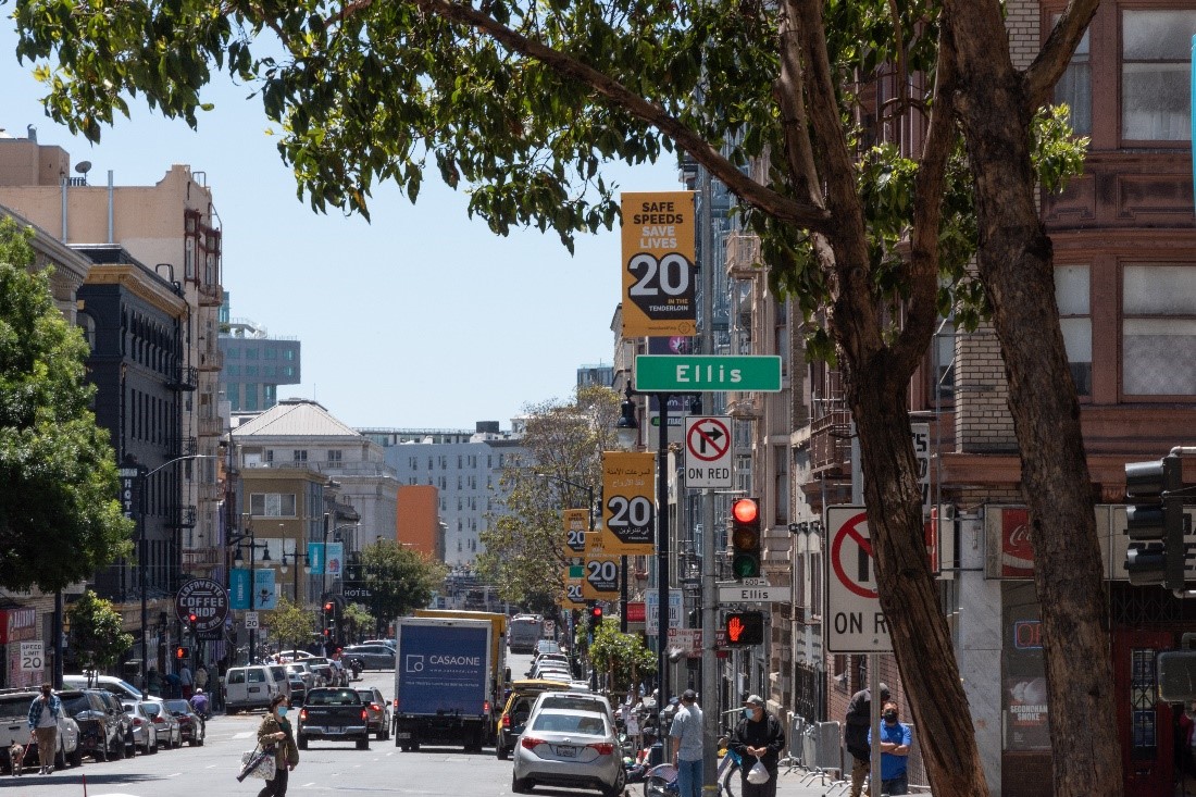
Photo of Ellis Street showing 20 mph speed limit

With the passage of California Assembly Bill 43 (Friedman)—which allows local jurisdictions to reduce speed limits in key areas—San Francisco is poised to make major progress toward our goal of achieving Vision Zero – eliminating traffic-related fatalities.

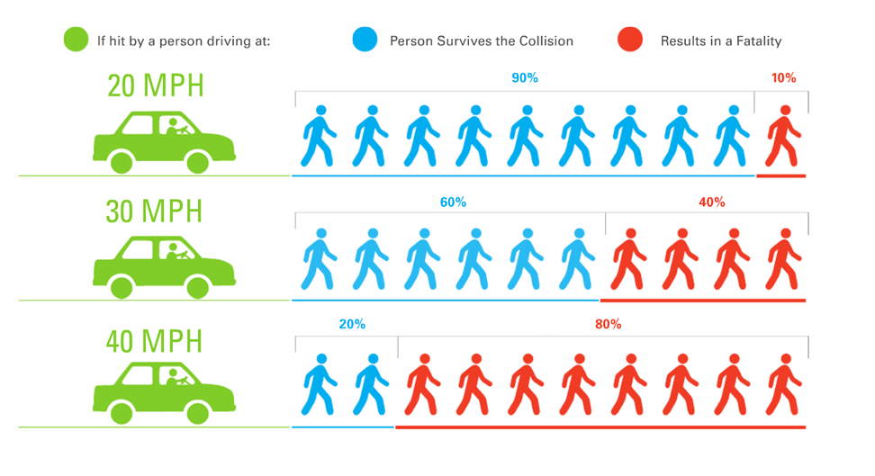
Because speed is the leading cause of serious and fatal crashes in San Francisco, reducing speeds is the single most effective tool for achieving Vision Zero. Before AB43, cities across California—including San Francisco—were limited in their ability to adjust local speed limits. Even slowing traffic down by 5 mph can make a difference of whether or not someone survives a crash, and AB43 will enable SFMTA to set speeds that promote safer streets for all along key corridors.

Image shows that if a person is struck by a vehicle driving 20 mph, there is a 90 percent chance that the person survives the collision, and a 10 percent chance that it results in a fatality. If a person is struck by a vehicle driving 30 mph, there is a 60 percent chance that they survive, and a 40 percent chance that the collision results in a fatality. If a person is struck by a vehicle driving 40 mph, there is a 20 percent chance that they survive, and an 80 percent chance that the collision results in a fatality.

The SFMTA will implement the changes authorized through AB43 in two phases. First, under the provision that goes into effect in January 2022, the SFMTA will move to lower speed limits by 5 mph (from 25 mph to 20 mph, or 30 mph to 25 mph) in key business activity districts (streets where at least half of the property uses are dining or retail).

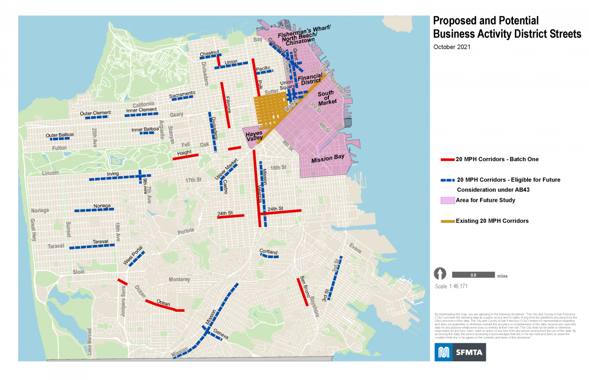
We have mapped out key corridors where these speed reductions will come into effect next year—including Haight, Polk, and Valencia streets—as well as other areas for future consideration. These speed limit changes still require SFMTA Board approval, and staff will be bringing them a proposal with an implementation plan for the first seven corridors in December. These first seven corridors for speed limit reductions from 25 to 20 mph include:

  • 24th Street, from Diamond to Chattanooga streets and from Valencia to San Bruno Avenue;
  • Fillmore Street, from Chestnut to Union streets and from Jackson to McAllister streets;
  • Haight Street, from Stanyan Street to Central Avenue and from Webster to Steiner streets;
  • Polk Street, from Filbert to Sutter streets;
  • Ocean Avenue, from Geneva Avenue to Victoria Street and from Junipero Serra Boulevard to 19th Avenue;
  • San Bruno Avenue, from Silver to Paul avenues; and
  • Valencia Street, from Cesar Chavez to Market streets

We plan to accompany the rollout of the new speed limits along the streets with public education and outreach campaign on the importance of slow speeds for saving lives. We will return to the SFMTA Board in 2022 with additional proposed speed limit reductions that are eligible as business activity districts.

Map of proposed and potential business activity district streets. 20 MPH corridors identified as Batch One include stretches of Fillmore, Haight, 24th, Polk and Valencia streets, Sn Bruno Avenue, Ocean Avenue. 20 MPH corridors identified as "eligible for future consideration under AB43" include sections of inner and outer Clement, inner and outer Balboa, Chestnut, Union, Pacific, Columbus, Grant, Powell, Geary, O'Farrell, Divisadero, 9th Avenue, Upper Market, inner Mission, Irving, Noriega, Taraval, West Portal, outer Mission, Cortland, Geneva and Third Street. Neighborhoods marked on the map as "Area for Future Study" include Fisherman's Wharf/North Beach/Chinatown, Financial District, South of Market, Hayes Valley, and Mission Bay. Areas on the map marked as "Existing 20 MPH corridors" include Market Street, and all streets in the Tenderloin bounded west by Van Ness Avenue, north by Sutter Street, East by Mason, and south by Market Street.

The second phase will be implementing another portion of the bill that authorizes the city to lower speeds by 5 mph on streets that are designated as “safety corridors”—streets that have the highest number of serious injuries and fatalities. In San Francisco, 75% of serious and fatal collisions occur on just 13% of city streets.  This is especially important for advancing equity in San Francisco, as over half of corridors on the High Injury Network are in a Community of Concern. This particular aspect of the bill does not come into effect until June 2024, though, and requires the California Department of Transportation (Caltrans) to establish definitions of “safety corridors” through its roadway standards manual.

We have already implemented 20 mph limits throughout the Tenderloin, where every street is on the High Injury Network, and will continue to prioritize improvements in Communities of Concern.

In our upcoming 2021 Vision Zero Action Strategy, the SFMTA is committing San Francisco to a comprehensive approach to lowering speeds on key corridors across the city. We will continue to pair speed limit reductions with our existing strategies, like the Vision Zero Quick-Build Program, to slow speeds on our streets.

We appreciate the leadership of Assembly Transportation Committee Chair Laura Friedman, along with San Francisco co-sponsors Assemblymember David Chiu and Assemblymember Phil Ting in introducing this transformative legislation.  Their leadership along with Mayor Breed, the Board of Supervisors,  WalkSFSF Bike Coalition, and San Francisco Bay Area Families for Safe Streets and all the many citizens who wrote letters, called into hearings and tweeted their support for this important step to address speeding on our streets, were essential to its success.  We stand committed to safer streets in SF and will work urgently to reduce speed limits to save lives.


Published October 28, 2021 at 03:33PM
https://ift.tt/2ZEDB4b

Wednesday, 27 October 2021

Vaccine-Related Service Changes Go into Effect November 1

Vaccine-Related Service Changes Go into Effect November 1
By Mariana Maguire

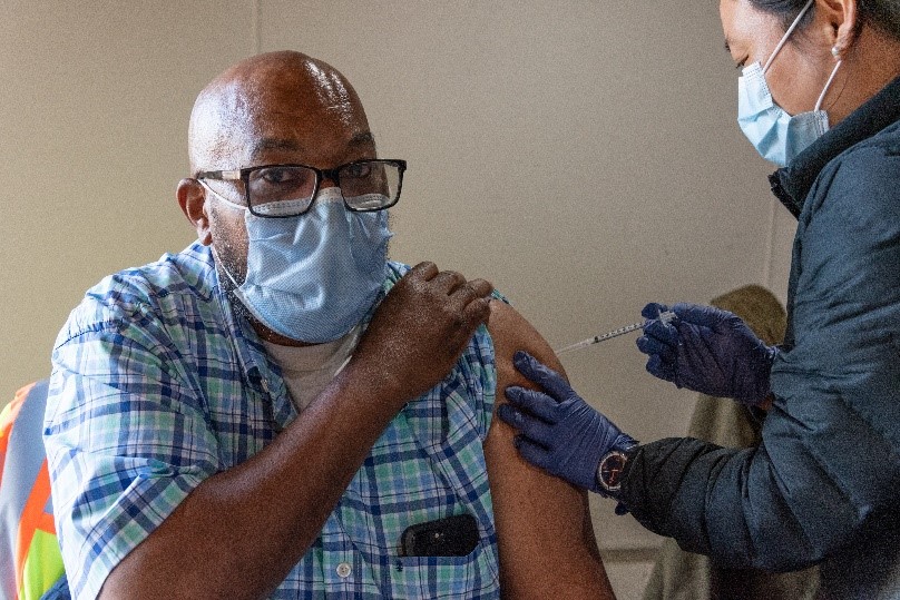
Photo shows a man receiving a vaccination.

An SFMTA staff person receives the COVID-19 vaccine at the Woods Muni Maintenance Division

To address operator shortages due to the city’s mandate that only vaccinated employees may work after November 1, the SFMTA will temporarily suspend “short” line service on a few Muni lines. Short service refers to buses that run on a segment of a longer Muni route to help improve frequency on higher-ridership portions of the line. The long routes on these lines will continue to operate, connecting customers where they need to go. There will be no cancellation of any Muni routes in response to staffing challenges associated with the city’s vaccine mandate.

Starting November 1, we are planning to temporarily suspend the 1 California Short, 14R Mission Rapid Short (weekends only), 30 Stockton Short, and 49 Van Ness Short (on weekdays only).  These changes are intended to reduce impacts to service systemwide, but customers may experience additional crowding and longer wait times on various bus routes as a result. These changes may impact also NextMuni predictions.

Why These Routes

We made the difficult decision to cut the supplemental short line service because it may be temporarily eliminated without jeopardizing access to any stops or connections along the full route. Based on feedback we received from the public regarding service planning for early 2022, we heard that priorities include preserving and restoring connections and service in hilly areas, as well as ensuring ongoing access for people with disabilities and seniors. Temporarily suspending short service allows us to meet these needs while we work to put additional staff in place.

Next Steps

Currently, we don’t have a precise timeline for when we will be able to restore additional service or increase frequencies on these short routes. However, we continue to work with our operators to address their vaccination status so that they can return to work as quickly as possible. We are also hiring and training new operators.

We are moving forward with additional Muni service in early 2022, pending approval by the SFMTA Board of Directors on December 7. At the same time, we will continue to adjust operations in response to  operator availability.

We appreciate your patience as we work to address the vaccination mandate. We will keep customers and the public updated. For the latest, please follow us on Twitter @sfmta_muni or Facebook.


Published October 27, 2021 at 06:41PM
https://ift.tt/3nDQFi6

Tuesday, 26 October 2021

Animated Map Shows Record Expansion of Transit Lanes

Animated Map Shows Record Expansion of Transit Lanes
By Michael Rhodes

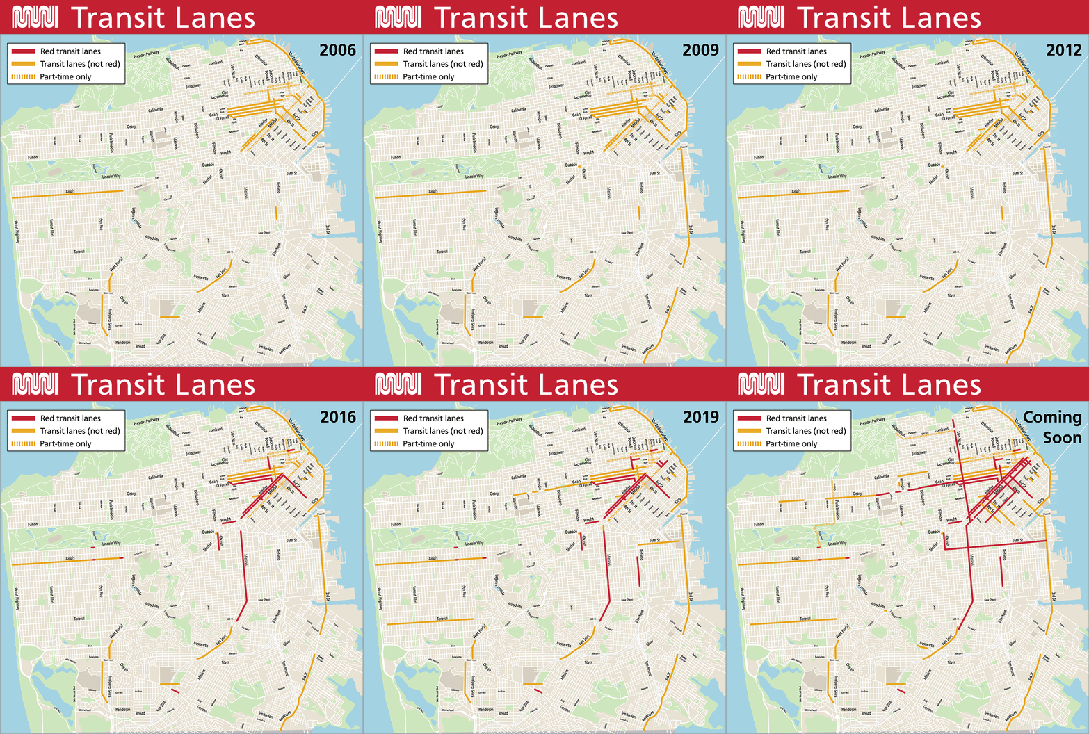
A map showing the expansion of transit lanes in San Francisco from 2006 to 2021, as well as lanes that are coming soon. A summary of key highlights from the map is included in the accompanying blog post.

An animated map showing the expansion of transit lanes in San Francisco. View as a PDF.

It’s been a record year for transit lanes in San Francisco: we’ve installed nearly 14 miles of new or upgraded lanes since summer 2020. That’s the fastest expansion of transit lanes in the city’s history. These transit lanes benefit Muni routes that serve nearly two-thirds of current customers. It’s all part of our efforts to give transit riders priority on congested streets and improve Muni speed and reliability. Better Muni service means more people will opt to take transit instead of driving, that reduces congestion and supports our environmental goals.

To commemorate this milestone, we’ve put together an animated map showing the evolution of San Francisco’s transit lane network over the last 15 years. We hope you find it as mesmerizing as we do to watch transit lanes expand across the city during this time.

Transit lanes are dedicated to Muni vehicles as well as other buses and taxis in most cases. They help improve Muni’s travel time and reliability and protect transit riders from traffic congestion. Red transit lanes were first introduced in San Francisco in 2013 and have proven to be even more effective than non-red transit lanes, leading to about a 50% reduction in violations.

We’ve been steadily adding to the transit lane network since the 1970s, when the original Transit First Policy was adopted, but the past five years have been especially busy. And as the final map shows, many more transit lanes are fully approved and coming soon, including the much anticipated Van Ness Avenue transit lanes.

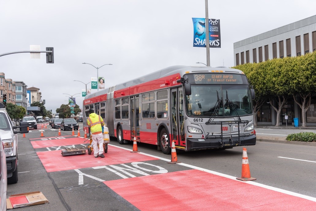
SFMTA paint shop crews install new red transit lanes on Geary Boulevard

An SFMTA paint shop crew installs new red transit lane on Geary Boulevard

A few highlights to look out for in the map:

  • Transit lanes on the T Third, installed as part of the line’s launch in 2007
  • The city’s first red transit lanes, installed on Church Street in 2013
  • The major expansion of red transit lanes in 2014, including Geary, O’Farrell, Market, Haight and 3rd streets
  • The evolution of Market Street in downtown from a short segment of transit lanes in 2006 to full transit lane coverage by 2021
  • The extension of transit lanes on Geary Boulevard, our busiest bus corridor, in 2018 and 2020 to cover nearly the entire 38 Geary /38R Geary Rapid  lines (with more red paint on its way!)
  • The upgrading of existing transit lanes on Mission Street in SoMa from part-time to 24/7 in SoMa in 2021 (soon to be upgraded with red paint)
  • A short but important new transit lane on the 4th Street bridge added in 2021, filling a key gap in the T Third’s transit lanes
  • The record-setting expansion of transit lanes in 2020 and 2021 as part of our Temporary Emergency Transit Lanes program, which benefits nearly half of all current Muni riders
  • The state’s first urban arterial HOV lanes, installed on Lombard Street in September 2021

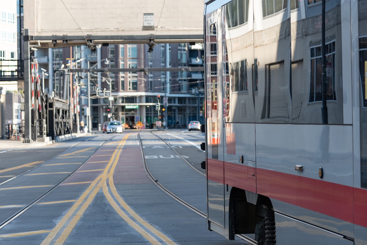
photo of train on a new transit lane on the historic 4th Street BridgeA train crosses a new transit lane on the historic 4th Street Bridge
What’s Next

Transit lanes have proven their worth in getting Muni riders where they’re going faster yet again this year, and more are on the way. In addition to installing transit lanes that are already approved, we’ll be starting outreach on a new round of Muni Forward projects in the coming year to deliver faster, more reliable and less crowded service to Muni customers. These projects will include transit lanes and other transit priority measures that keep Muni moving. Sign up for our Muni Forward mailing list to receive updates about new transit lanes coming your way.

Map Notes

For those who can’t get enough detail about transit lanes, here are a few more notes about how we created the map:

  • We didn’t differentiate between one-way and two-way transit lanes on the map, except on Market Street
  • We included any dedicated lane within a city street as a transit lane, including rail tracks that can’t be used by buses. Subways, tunnels and rail rights-of-way that are entirely separate from any roadway (such as the J Church right-of-way through Dolores Park) were not included.
  • We included HOV lanes on Lombard that serve the 28 19th Avenue bus line, but didn’t include a short stretch of HOV lane on Bryant Street because it’s not used by transit
  • In a few cases, transit lanes go away temporarily during roadway construction, such as on 4th Street for the Central Subway. In rare cases, transit lanes are removed because transit is rerouted to a new street, such as the transit lane on Harrison Street that served the old 12 Folsom route before it was eventually rerouted a block north to Folsom Street.
  • Not all approved Temporary Emergency Transit Lanes on the 43 and 44 lines are shown as we’re monitoring transit performance to help us determine when to move forward with these lanes. Learn more on the 43/44 TETL project webpage.


Published October 26, 2021 at 11:02AM
https://ift.tt/2ZuiUYw

Monday, 25 October 2021

70 Years at Elkton Shops: Part 1

70 Years at Elkton Shops: Part 1
By Jeremy Menzies

In this two-part blog series, we will look back at the history of one of our city’s hardest working transportation properties. For almost 115 years, the Elkton lot, located on San Jose Avenue between Ocean and Niagara Avenues, has been the epicenter of SF streetcar operations. In this post, we will explore the first 70 years at the property when it was known as “Elkton Shops”.

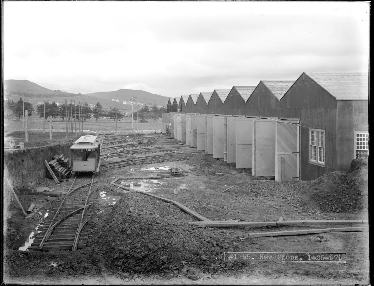
Built between 1905 and 1907 by the United Railroads of San Francisco (URR) on a several acre field in the outskirts of the city, Elkton Shops was the most comprehensive transit facility in the city. The new shops, mainly surrounded by farmland, were named after a Southern Pacific Railroad stop just steps away on Ocean Avenue.

A lone cable car sits on a muddy ladder track outside the newly built Elkton Shops in this January 1907 shot.A lone cable car sits on a muddy ladder track outside the newly built Elkton Shops in this January 1907 shot.
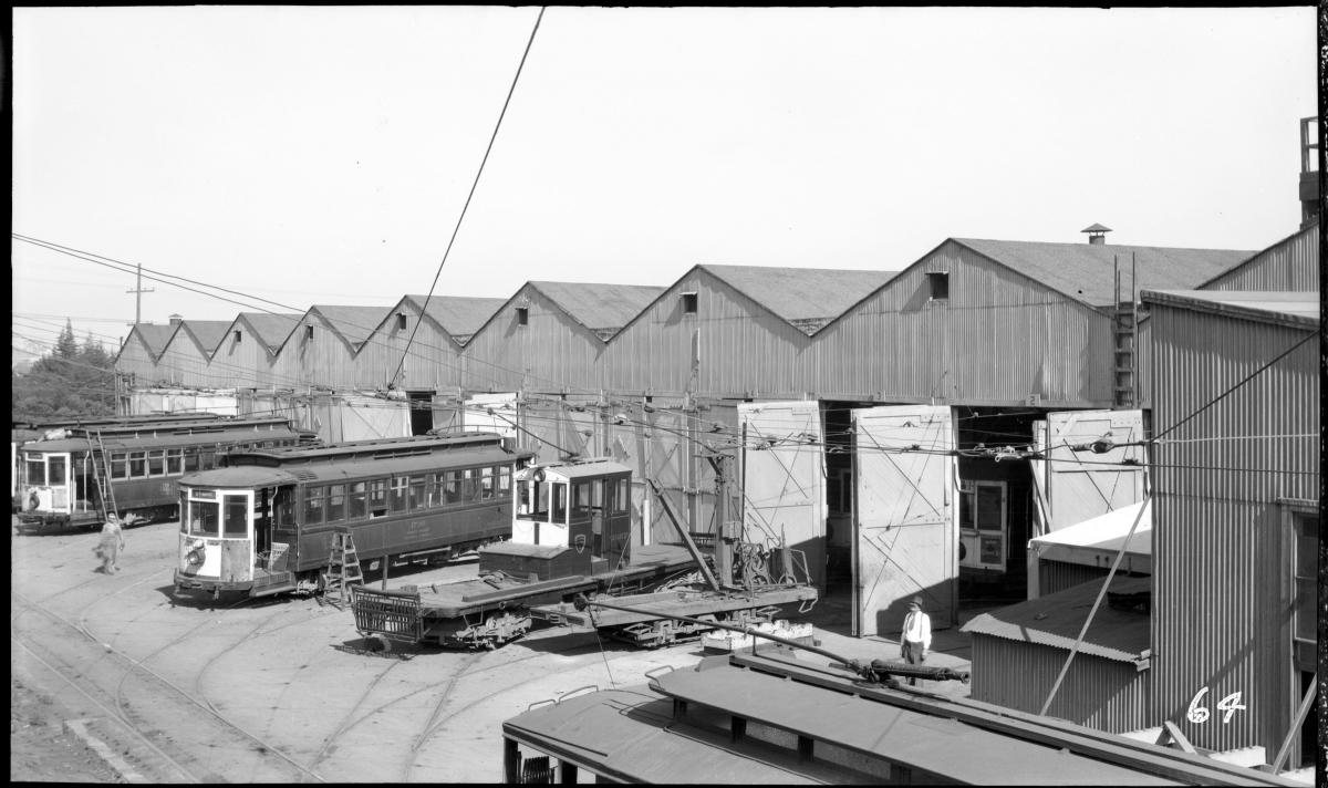
In 1921, Elkton changed hands, going to the Market Street Railway Company after URR suffered years of financial troubles. During its heyday in the 1920s, Elkton Shops was a powerhouse of repair and production. A staff of over 350 people were responsible for building and overhauling hundreds of streetcars and cable cars to keep the railway’s sprawling system running.

This 1928 photo was taken at the peak of production at Elkton Shops when staff was turning out 26 brand new cars a year on top of 316 complete overhauls and myriad other work.This 1928 photo was taken at the peak of production at Elkton Shops when staff was turning out 26 brand new cars a year on top of 316 complete overhauls and myriad other work.
Every type of job from replacing broken windows and upholstering seats to machining wheels, overhauling electric motors, and painting cars was performed in the shops. According to a 1928 article in the company’s newsletter, the average time it took to completely overhaul a streetcar at Elkton was 19 days. On average, 22 cars would be in the shops undergoing the process at any one time.

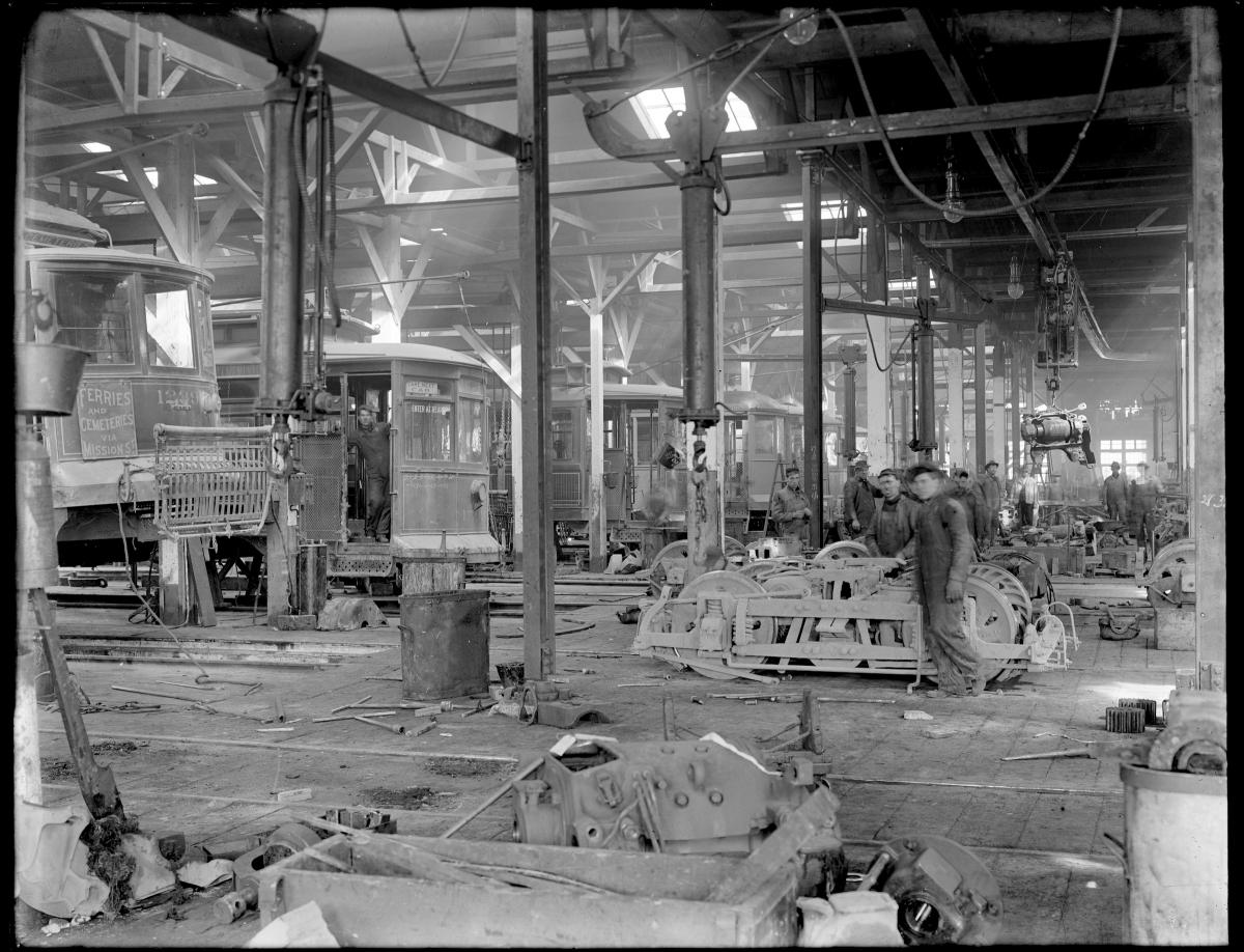
A view inside the overhaul shop in 1912 showing a row of streetcars at left and staff tearing down trucks and motors at right.A view inside the overhaul shop in 1912 showing a row of streetcars at left and staff tearing down trucks and motors at right.
In 1944, the Market Street Railway Co. was purchased by the city and Elkton became a part of the now greatly expanded San Francisco Municipal Railway. The heyday of streetcars would soon be coming to an end but the ramshackle old shops continued to hold a valuable place in the future of Muni.

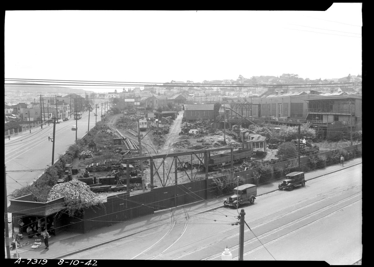
A view inside the overhaul shop in 1912 showing a row of streetcars at left and staff tearing down trucks and motors at right.This 1942 shot shows Elkton’s rear yard crowded with everything from cobblestones to streetcar wheels.
Following World War II, Muni began quickly expanding its bus fleet and in 1948, Elkton’s rear yard was cleared and excavated to build the Ocean Division bus yard. The new yard would provide fueling, maintenance and storage for Muni’s growing fleet, including newly leased Mack buses. Elkton Shops remained in service next to the bus yard for another two decades.

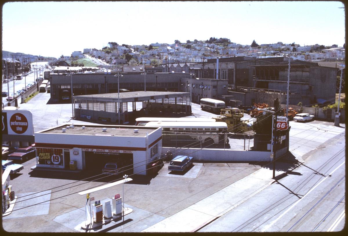
Looking southwest from San Jose and Ocean Avenues, this view shows Muni’s Ocean Division in 1972. At the left is a service station, center the fueling and shop buildings and at right are the Elkton Shops.Looking southwest from San Jose and Ocean Avenues, this view shows Muni’s Ocean Division in 1972. At the left is a service station, center the fueling and shop buildings and at right are the Elkton Shops.
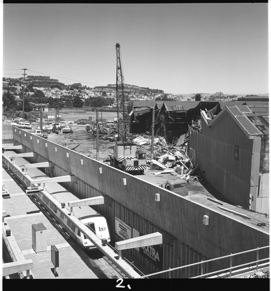
The death knell for Elkton occurred in the mid-1970s as the city moved to bring Muni Metro to life with “light rail vehicles.” As these new trains travelled through a subway underneath Market Street, Muni needed a new facility to house and maintain this brand-new fleet. In 1975, Ocean Division was demolished and construction began on what would become the city’s first modern rail repair shop. Just two years later on May 27, 1977, workers at Elkton Shops punched their last timecards in the run-down old building. Four days later, the huge turn of the century shop buildings met their fate with the wrecking ball.

The end of an era came on May 31, 1977 when Elkton Shops was torn down after 70 years of service. In less than 3 years, a rail yard filled with brand new light rail vehicles would stand in place of the old shop buildings.The end of an era came on May 31, 1977 when Elkton Shops was torn down after 70 years of service. In less than 3 years, a rail yard filled with brand new light rail vehicles would stand in place of the old shop buildings.
Tune in next month for part two of this series and learn about the next phase of life at this storied property.


Published October 25, 2021 at 11:09AM
https://ift.tt/2ZsJG3E

Friday, 22 October 2021

Plans for 2022 Muni Service Take the Next Step

Plans for 2022 Muni Service Take the Next Step
By Mariana Maguire

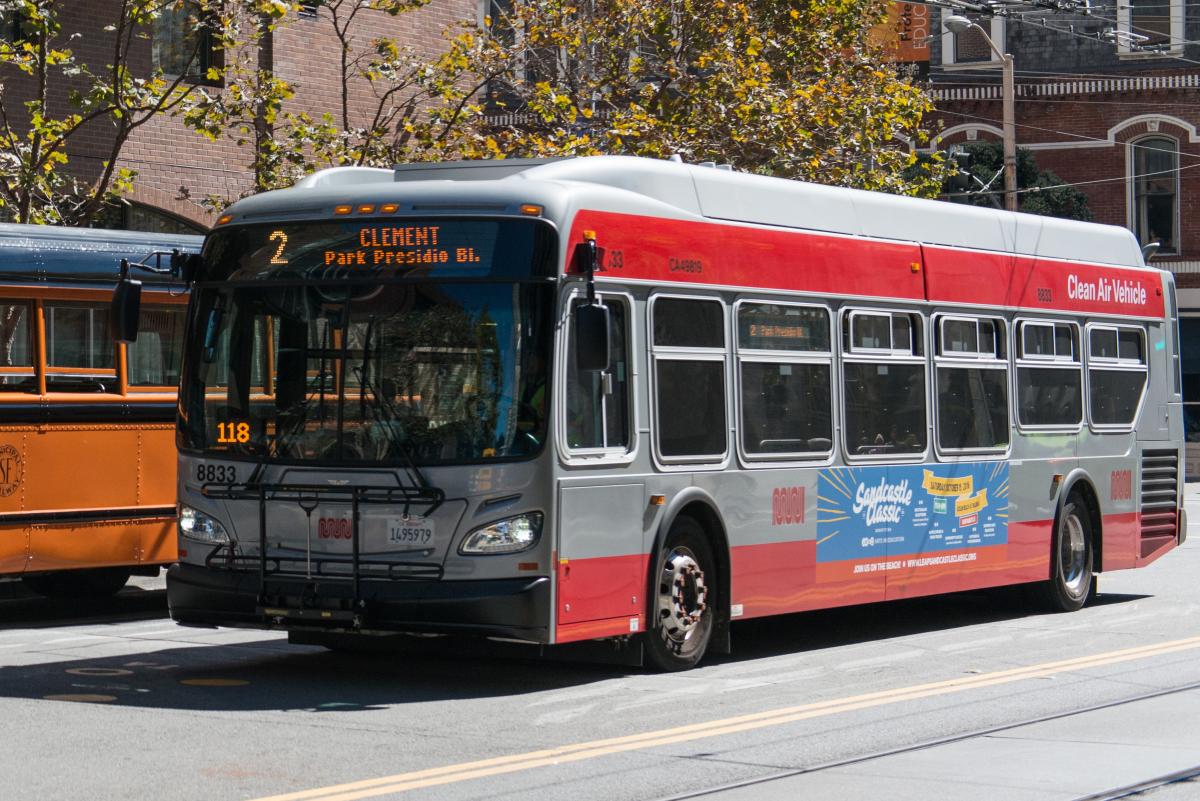
Photo of a 2 Clement Muni bus

A 2 Clement Muni bus serving its route to Park Presidio Boulevard. The 2 Clement is proposed to return to service in early 2022.

When we asked about what SFMTA should do with resources to expand a bit of service, the SFMTA received more than 4,500 responses to our survey asking San Franciscans what they want to see when we’re able to add more service in February 2022.   

We also received detailed feedback about Muni service at meetings, pop-ups and via email and our hotline. In response to that feedback, in early 2022 we are restoring connections, particularly for people with disabilities and seniors. Taking the time to evaluate our service and working with the public, we have also developed ideas for new connections, allowing Muni to take more people more places. 

These changes will restore key pre-pandemic connections, preserve or restore Muni access in hilly areas and focus on access for people with disabilities and seniors. At the same time, they will provide new direct connections from the Western Addition, Tenderloin and Richmond District to Caltrain, Oracle Park (Giants’ Stadium) and SoMa, and will provide new through-service between North Beach, Fisherman’s Wharf, Russian Hill and the Marina through all the western neighborhoods.  

In the survey responses, we also heard a desire for increased frequency to reduce crowding and wait times on high ridership Muni routes, so we are looking for opportunities where resources allow us to do that as well. Once we know the extent of the impact of the city's vaccination mandate, we will restore as much service as we can, and then increase frequency on high ridership routes to reduce crowding and wait times as resources allow.   

Proposed 2022 Muni Service Route Restorations and Improvements 

We are proposing to restore five of the seven pre-pandemic routes that are currently still suspended, although some of those routes would be restored with some changes to balance resources.  

  • The 2 Clement would be restored to Presidio Avenue and California Street and operate every 15 minutes all day on weekdays 

  • The 6 Haight/Parnassus would return every 20 minutes, and the 52 Excelsior and 66 Quintara would return to their past routes 

  • The 10 Townsend would be restored to Sansome and Montgomery streets and run along 16th Street in Potrero Hill 

  • The 21 Hayes would be restored every 15 minutes to Grove and Hayes streets 

  • The 31 Balboa would be rerouted to 5th Street, Townsend Street, 3rd Street and Harrison Street, with a terminal at the 4th and King Caltrain Station 

These routes are especially important to access hospitals such as St. Mary’s and UCSF, senior centers, low-cost food options and other key connections among neighborhoods. We also heard the need for more connections to Caltrain, between Potrero Hill and the Financial District. 

The 28R 19th Avenue Rapid would also be restored in full for stronger North/South connections and the 43 Masonic would be extended to its pre-pandemic route north of Presidio and California to the Presidio, the Marina and Fort Mason. This responds to the need we heard for connections to Fort Mason and nearby grocery stores. 

While we don’t propose to restore the 3 Jackson and 47 Van Ness in early 2022, we are proposing some changes to the 5 Fulton12 Folsom/Pacific28 19th Avenue30 Stockton38R Geary Rapid and 49 Van Ness/Mission to help bridge service gaps, including more frequent service to reduce crowding and wait times and route extensions to make connections to grocery stores, hospitals, schools and diverse workplaces. 

Changes could also be made to some routes that were temporarily changed during the pandemic, such as the 23 Monterey48 Quintara/24th Street57 Parkmerced and 58 Lake Merced that could potentially address demand for service along Brotherhood Way, Sloat Boulevard, better access to businesses in Noe Valley, and safety concerns along Clipper Street. 

The proposal also includes options for the J Church: When rail service was restored to the J Church line in December 2020, we did not reintroduce the J Church into the subway, ending the line at Church and Duboce. This change allows us to limit the number of trains in the subway, reduce congestion and improve reliability for the entire Muni Metro system. In early 2022, the J Church could remain as it currently is, an all-surface route terminating at Church Street and Duboce Avenue, to maintain the improvement in reliability on the J Church and the 75% reduction in delays we are seeing in the subway. But, it could also be returned to the Market Street Subway evenings only, when there is less congestion in the tunnel, or even full-time.  

Next Steps 

We will be seeking approval of the service plan by the SFMTA Board on December 7, 2021, and expect to implement the additional service in February 2022. This time frame may be pushed back depending on transit operator availability related to the vaccine mandate

We will present this plan for input at several upcoming meetings where the public can provide public comment. See SFMTA.com/2022Network for upcoming meetings. To provide feedback, email TellMuni@SFMTA.com or call 415.646.2005. 

We expect to finalize the proposal for these improvements to Muni service in November. We will continue to seek additional funding, which we will need to make any further changes. Looking forward to the next 6 months, it is our goal to restore more if we can tackle the long-term funding. We will also continue  community dialogue and planning to develop an expansion of our Rapid network and other frequency improvements to address crowding and reduce wait times as the system continues to recover.  There are many competing needs for our Muni system.  We are doing our best to balance as many of them as possible with the resources that we have.  


Published October 22, 2021 at 03:32PM
https://ift.tt/3nkh2tn

Celebrating Quicker Muni Trips on a Safer Geary

Celebrating Quicker Muni Trips on a Safer Geary
By Amy Fowler

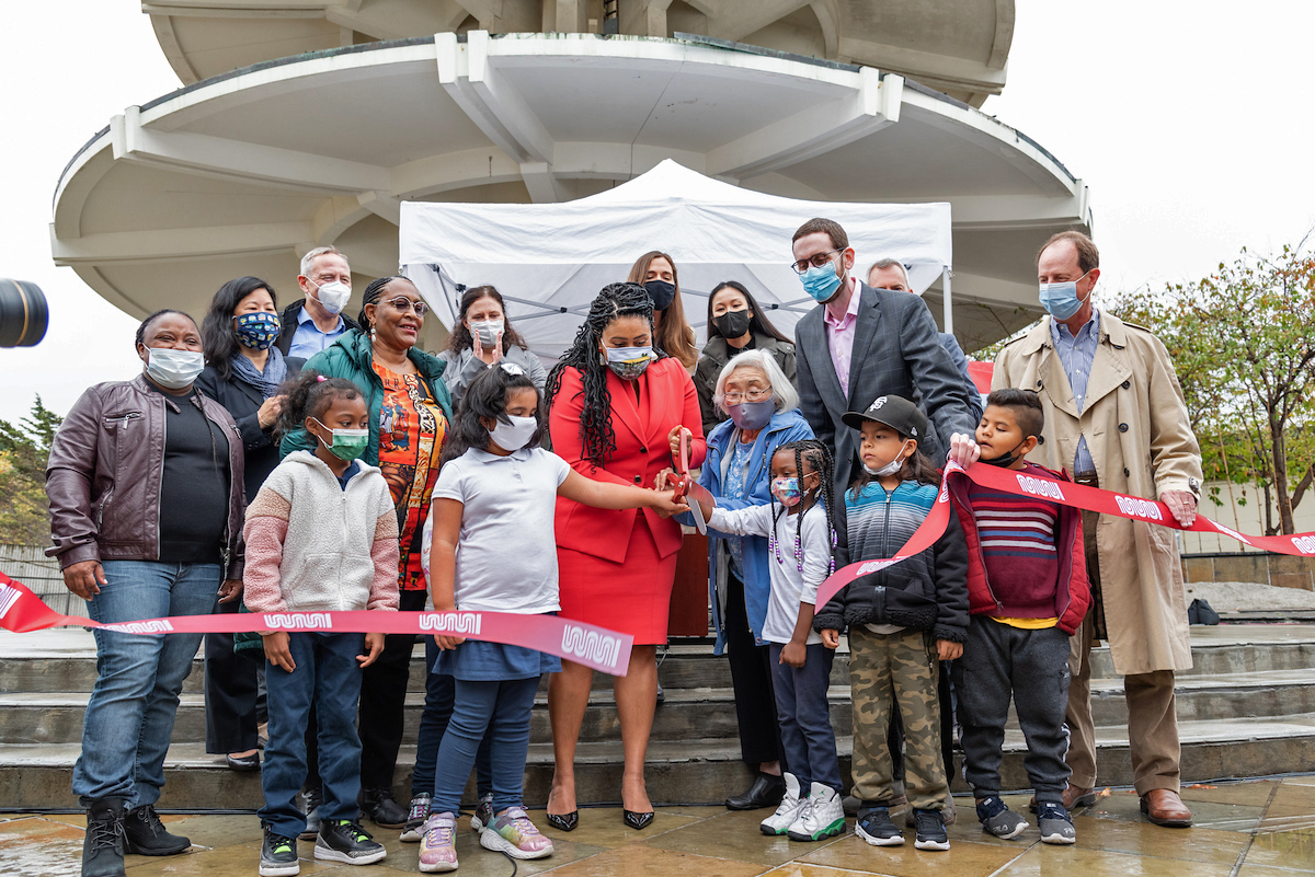
Image of Mayor London Breed, other public officials and community members cutting the ribbon at the Geary Rapid Project ribbon cutting event

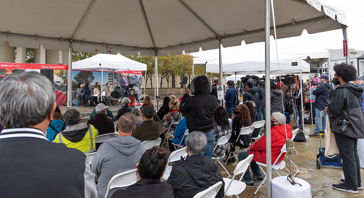
The sky was gloomy but the mood was celebratory at the Japantown Peace Plaza on Wednesday. Fortunately, the rain stopped just long enough for the SFMTA, along with Mayor London Breed and other city departments and community members, to celebrate the completion of the Geary Rapid Project. This major civic improvement project has helped to revitalize one of San Francisco’s busiest corridors between Market and Stanyan streets with more reliable bus service, safer streets, upgraded utilities and new trees.

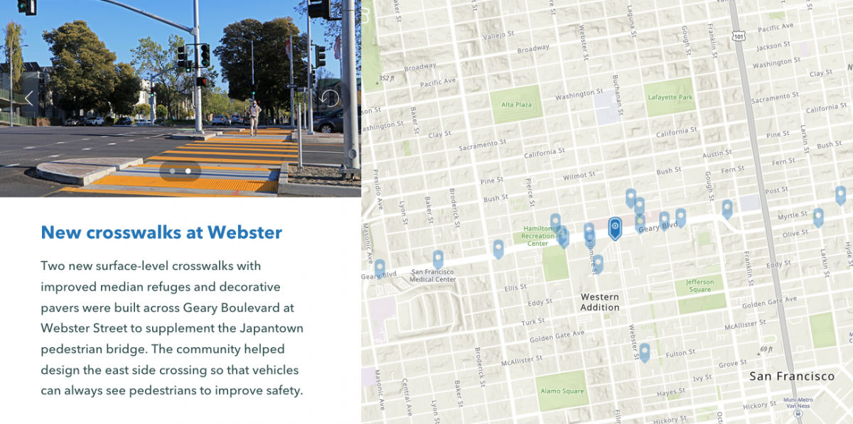
One safety improvement in particular was a much-anticipated addition for residents of the Fillmore, Japantown and St. Francis Square communities: a new signalized crosswalk at Geary and Buchanan. That and three other new crosswalks in the area are providing safer crossing opportunities for people walking and helping to reconnect neighborhoods that were divided by the Geary Expressway and “urban renewal” in the mid-twentieth century.

Pre-pandemic, the combined Geary routes boasted one of the highest bus riderships in the country, with more than 56,000 daily customers relying on the 38 Geary and 38R Geary Rapid. As riders return, they are experiencing a faster, more reliable ride thanks to transit improvements that were made along the three-mile stretch of Geary.

Dedicated transit lanes, bus stop optimization and signal retiming were implemented at the beginning of the project in late 2018. These quick-build improvements alone resulted in 38R Geary Rapid travel time savings of up to 20%. More recent improvements include coloring the transit lanes red to improve compliance and installing 12 new transit bulb-outs—sidewalk extensions at stops that reduce delays by allowing buses to remain in the travel lane. The Transit Signal Priority system, which helps buses get the green light at intersections more often, has also been upgraded. Now that the full suite of transit improvements has been installed, we’re beginning to assess how well they’re working and will share full evaluation results in 2022.

SFMTA Director of Transportation Jeffrey Tumlin makes opening remarks at the Geary Rapid ribbon cutting event

Other upgrades include a host of safety improvements to address Geary’s designation as a high-injury corridor. Thirty-four new pedestrian bulbs-outs were built along the corridor to shorten crossing distances for people walking and slow turning vehicles. Other additions include accessible pedestrian signals, curb ramps, countdown signals and longer crosswalk timing to allow people of all abilities to cross Geary safely. The Tenderloin, where there is a disproportionate number of severe and fatal collisions, was a focal point for many of these improvements.

The Western Addition has also been spruced up with the addition of 31 new trees. The trees, plus visual narrowing of the lanes and reducing the number of travel lanes from eight to six, all work together to give the area more of a neighborhood feel and slow down speeding vehicles who have treated the thoroughfare like a highway.

Image of virtual interactive tour website

Visit our virtual tour to explore an interactive map of Geary Rapid Project highlights.

This three-year capital project was completed on time and on budget. To minimize the need to dig more than once, construction was coordinated with other City agencies, including 1.5 miles of new sewer mains and almost three miles of upgraded water mains by San Francisco Public Utilities Commission (SFPUC). Public Works has rejuvenated 1.5 miles of deteriorated streets between Masonic and Van Ness avenues with fresh paving.

The Geary Rapid Project is the first of two phases of improvements planned as part of the Geary Corridor Bus Rapid Transit (BRT) project. Outreach and preliminary design is currently underway on the second phase, the Geary Boulevard Improvement Project, which would bring similar transit and safety improvements west of Stanyan Street to 34th Avenue.


Published October 22, 2021 at 02:43PM
https://ift.tt/3E9uUNM

Tuesday, 19 October 2021

Street Transformations to Address COVID-19 Keep San Francisco Moving

Street Transformations to Address COVID-19 Keep San Francisco Moving
By Eillie Anzilotti

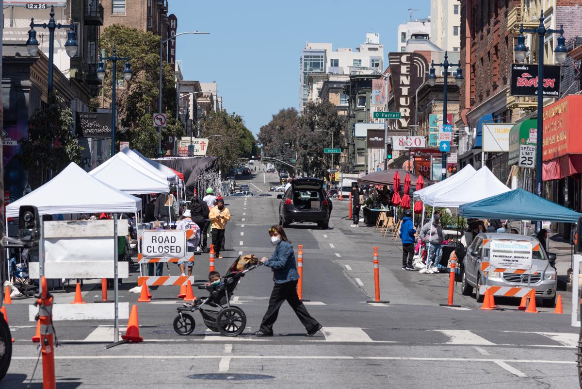
Photo of a slow street in the Tenderloin neighborhood

A street closure in the Tenderloin as part of the COVID-19 response efforts.

Since the start of the COVID-19 pandemic in March 2020, many aspects of people’s lives have changed – including how we get around town. To reflect this new reality, the SFMTA pivoted in the way we design and operate our streets. From streets that prioritized people walking and bicycling in some of San Francisco’s major parks to Temporary Transit Lanes (TETLs) that protected Muni lines from the return of traffic congestion, San Francisco reimagined how streets could be used for people.

We have documented some of these transformations in a new report that highlights emergency street operations, Temporary Emergency Transit Lanes, the Slow Streets Program, Tenderloin street closures and reusing streets within or close to parks for recreational purposes. Within each effort, the report touches on the ways in which city programs have been responsive, equitable and people-centered.

Some highlights of our COVID-19 response work over the last year include:

  • The SFMTA implemented over 700 street changes to remove parking and close streets based on the request of essential service providers, including medical care, food banks, testing sites and more. The majority of these requests were filled in less than three days.
  • 12.5 miles of Temporary Emergency Transit Lanes (TETLs) were installed, significantly reducing travel times for tens of thousands of riders. For instance, after transit lanes were installed, transit travel times on Mission Street in the South of Market neighborhood stayed constant, even as traffic volumes increased by 20%. Travel times on the 14 Mission and 14R Mission Rapid are now 20% faster than pre-pandemic.
  • The SFMTA installed 45 lane miles of Slow Streets during the pandemic. On average, traffic volumes decreased by over 50% after Slow Streets treatments were installed, while bicycle ridership increased by over 70%.
  • Two miles of safer and calmer street treatments were implemented in the Tenderloin, including block closures for essential services, physical distancing lanes for increased walking space, shared spaces and play streets.

In response to unprecedented circumstances, the SFMTA has delivered a suite of responsive, innovative programs and projects within short timelines. Some aspects of these new programs and projects, such as Slow Street corridors, have demonstrated benefits beyond emergency response and are now moving towards a permanent, post-pandemic future.

Additional programs will continue to be monitored for their value and effectiveness within a rapidly evolving environment. As the pandemic continues and the needs of our streets and residents continue to shift, the SFMTA is committed to keeping San Francisco moving.


Published October 19, 2021 at 02:38PM
https://ift.tt/3n8e5Mo

Monday, 18 October 2021

Planning for Additional Muni Service in early 2022

Planning for Additional Muni Service in early 2022
By Erin McMillan

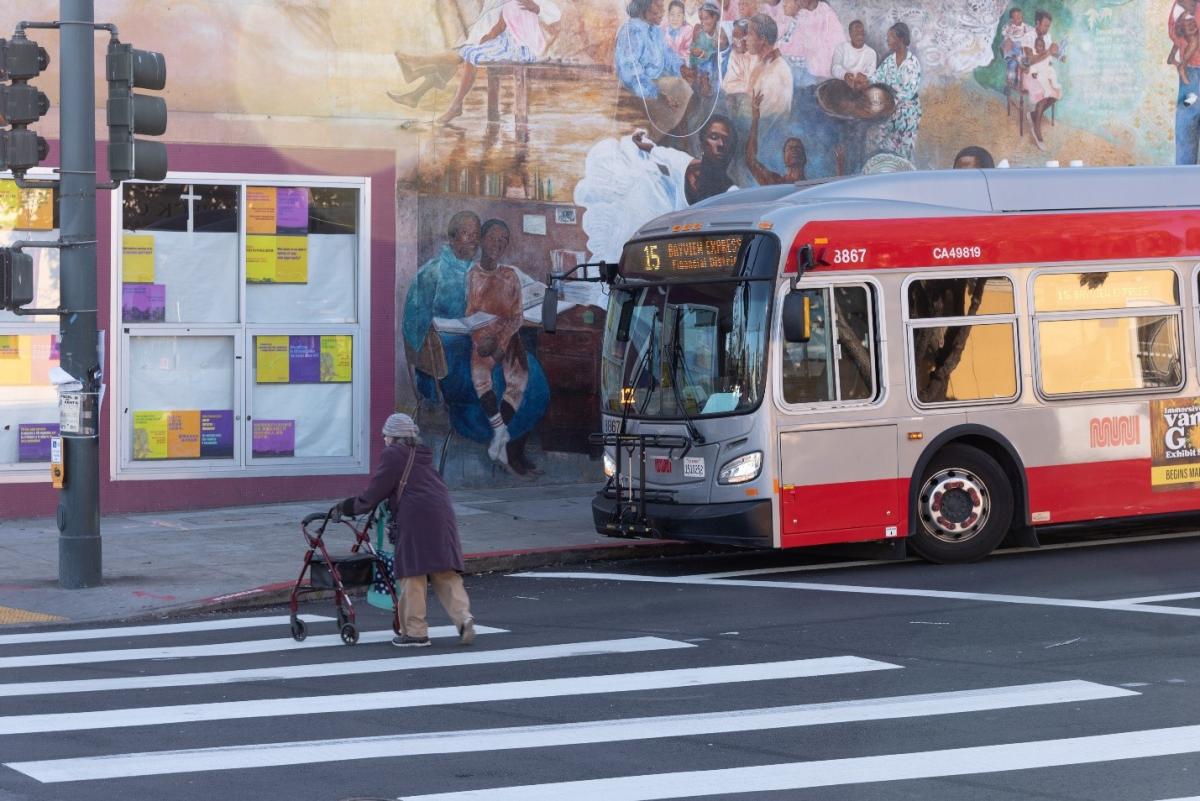
The 15 Bayview Hunters Point Express waits for person crossing the streetThe 15 Bayview Hunters Point Express waits for person crossing the street

Over the past couple of months SFMTA staff have been reaching out for feedback on three alternatives for adding 10% more bus service in early 2022. And we heard you! SFMTA needs to focus on restoring service to provide key connections for people with disabilities and seniors, and that’s what we plan to do. We also heard that there is demand for improving frequency of high-ridership Muni lines to address crowding and wait times, which we'll do with any additional funds.

While we plan for Muni service in early 2022, the city mandate that employees show proof of being fully vaccinated against COVID-19 as a condition of employment will go into effect November 1. We are proud that 82% of SFMTA employees are now fully vaccinated. But if hundreds of our employees are still unvaccinated as of November 1 and are put on leave or terminated, it will significantly impact Muni operations and parking control in San Francisco.  This means unexpected gaps in Muni service and lower-than-scheduled frequencies.

While we work on contingency planning for this upcoming challenge, SFMTA staff are taking the feedback we heard about the three alternatives for Muni service additions in early 2022 and developing a proposal that takes into account San Francisco’s priorities for Muni service as well as the potential impacts the vaccine mandate could have on service over the next months. An early 2022 Muni Service Network proposal is expected in early November.

In our survey about expanding Muni service, we presented three alternatives.. Each of these options would go into effect in early 2022. We wanted to learn if Muni customers prefer restoring the seven all-day bus routes that were temporarily suspended since the pandemic started, or whether the resources used to operate those routes would be better used to increase frequency on nearby busy routes to reduce crowding and wait times.

At over 30 stakeholder meetings, neighborhood festivals and pop-ups, and in an online, telephone and in-person survey that received over 4,500 survey responses, we asked the public to balance trade-offs between access and frequency to help us decide how to use available resources for Muni service in early 2022.

We received a significant amount of detailed feedback. For example, some J Church riders find the new surface-only alignment that has addressed delays caused by subway congestion inconvenient, as it means transferring for downtown destinations. Seniors in Japantown are missing a connection to low-cost food service at the Jewish Community Center. People with disabilities and seniors wanted easier and more direct access to St. Mary’s Medical Center.  

Now our transit planning team is applying what we heard to develop a proposal that would go to the SFMTA Board for consideration in December. SFMTA staff are sharing what we heard with the public from the survey at Open Houses and Office Hours and will be seeking policy guidance from the SFMTA Board and San Francisco Board of Supervisors in October and November.

As we navigate what the future holds for SFMTA Muni service, we also must identify  sustainable long-term revenue sources. In adjusting Muni service, we must make our remaining one-time relief funding from the federal government last until 2024. Without additional revenue, we risk drastic service cuts as soon as 2023. In tandem with our efforts to restore Muni service that best serves San Francisco’s needs, we will be working to identify a path forward for sustainable, long-term funding.

We will keep customers and the public updated about changes to Muni service over the next months. For information about plans for service in early 2022, please visit the 2022 Muni Service Network webpage. 


Published October 18, 2021 at 03:50PM
https://ift.tt/3lSoah6

18,000 Upgraded Parking Meters are Coming Citywide

18,000 Upgraded Parking Meters are Coming Citywide
By Jessie Liang

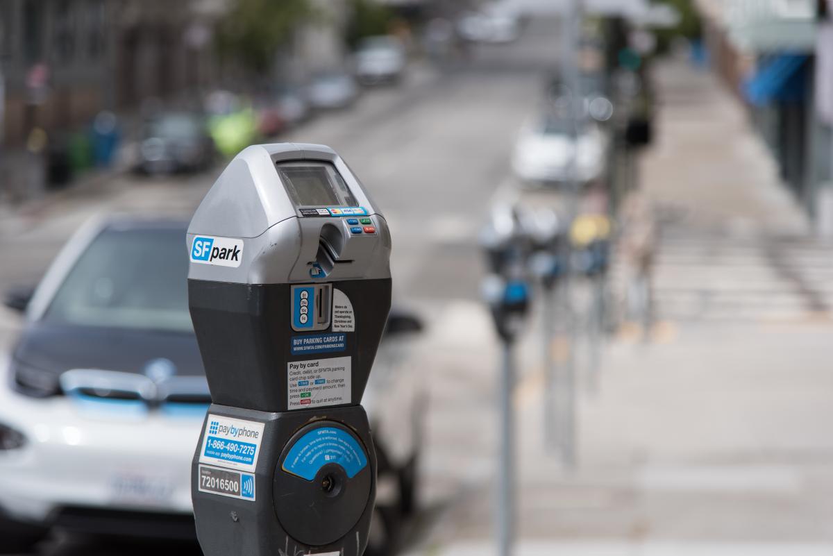
Photo of a parking meterBeginning early next year, SFMTA will be replacing more than 18,000 parking meters throughout San Francisco. The parking meter hardware upgrade is taking place under a $70 million contract with MacKay Meters, Inc, which was approved by the Board of Supervisors. According to the agreement, more than half of the 28,000 paid parking spaces in San Francisco will see their meters replaced. With this project we expect to save an estimated $6 million in operating costs over the next decade. 
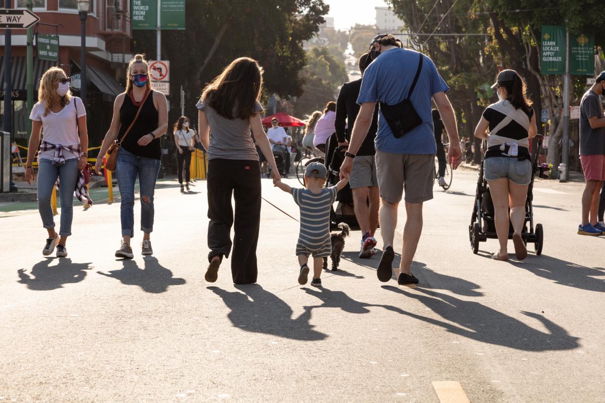
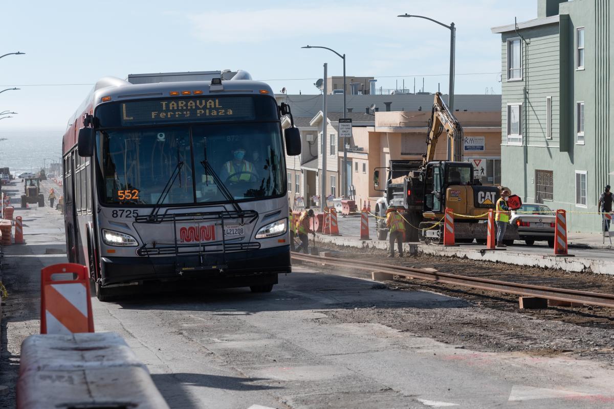
The new meters will improve the user experience by providing a wider and brighter screen, accepting contactless payment, and allowing customers to receive a parking receipt via text message. 

Many of the city’s parking meters and paystations purchased in 2014 are nearing the end of their useful life due to subsequent technology improvements and the age of the hardware. In addition, the existing meter hardware was equipped with outdated 3G technology to communicate payment and maintenance information which will no longer be supported by service providers after the end of 2022. 

The new meter technology will transmit data more efficiently and accurately, which not only reduces the cost of maintenance but also saves operating costs of maintaining an aging system.

 The SFMTA manages 23,500 single-space and 4,500 multi-space metered parking spaces for vehicles and motorcycles under the Agency’s jurisdiction and for the Port of San Francisco. The agreement authorizes the SFMTA to procure approximately 16,000 single-space parking meters and 2,200 multi-space paystations, associated Meter Management Systems (MMS), and vendor support services including programming and integration with other parking management systems. 

The replacement work of parking meters will start from February 2022. For more information about parking meters, please visit the SFMTA parking website. 


Published October 18, 2021 at 10:51AM
https://ift.tt/3BVxp5E

Thursday, 14 October 2021

Sunday Streets Returns October 17, with Phoenix Day

Sunday Streets Returns October 17, with Phoenix Day
By Pamela Johnson

Images of pedestrians and people on bicycles enjoying a car free streetFor 13 years, the SFMTA and Livable City have brought "Sunday Streets" to San Francisco neighborhoods. Sunday Streets encourages communities to transform miles of car-congested streets into car-free spaces for neighbors to gather, kids to play, and for organizations and businesses to connect. On October 17, 2021, after more than 18 months of Covid-related shutdowns, Sunday Streets Phoenix Day will again bring free recreational activities, resources, and fun to the streets for tens of thousands of San Franciscans to enjoy. While Sunday Streets was celebrated in one neighborhood at a time in the past, this year's Phoenix Day spans various districts in the City for a simultaneous celebration of community, health, and resilience. This year's theme is "One City. One day. Rising together.”

 Highlights this year include historic Sunday Streets SF routes, a 20+ mile community bike ride, three neighbor-run block parties, pop-ups, and free community-hosted activities across the city. Along the way, participants will be offered free health and wellness activities as well as cultural offerings and open space for the whole family to enjoy.  As part of the block party program for Phoenix Day, the City has issued more than 30 permits for neighbors from different communities to participate in the day's festivities.

 Phoenix Day is about communities coming together to celebrate healthy fun as San Francisco reopens during the COVID-19 pandemic. Supporting the City’s economic recovery and its residents physical and mental health includes bringing joy back to our communities as we gather again outside to have fun with family and friends. At the same time, we are committed to keeping our community safe from COVID-19 and encourage people to wear masks in crowded outdoor spaces and always indoors, use hand sanitizer, and stay home if they are sick.

 In this critical moment for San Francisco it's more important than ever to transform our streets into places that foster human connection and civic pride. Sunday Streets Phoenix Day will be a monumental opportunity to do that together. 

About Sunday Streets

In 2008 the Sunday Streets SF program was started as a one-day pilot by then Mayor Gavin Newsom and the SF ShapeUp Coalition. It was inspired by the La Ciclovía initiative in the Colombian capital of Bogotá.  Since starting the program in 2008, the nonprofit Livable City in partnership with SFMTA and City and County of San Francisco has grown Sunday Streets into one of North America’s premiere open street programs serving 100,000 residents in diverse neighborhoods across San Francisco.

Visit Sunday Streets SF Phoenix Day to learn more.


Published October 14, 2021 at 10:11AM
https://ift.tt/3AFzlxW

Thursday, 7 October 2021

Focus on Muni Reliability and Street Safety for Proposed Bond Measure

Focus on Muni Reliability and Street Safety for Proposed Bond Measure
By Bonnie Jean von Krogh

 L Taraval Bus passing by construction on Taraval L Taraval Bus passing by construction on Taraval Street
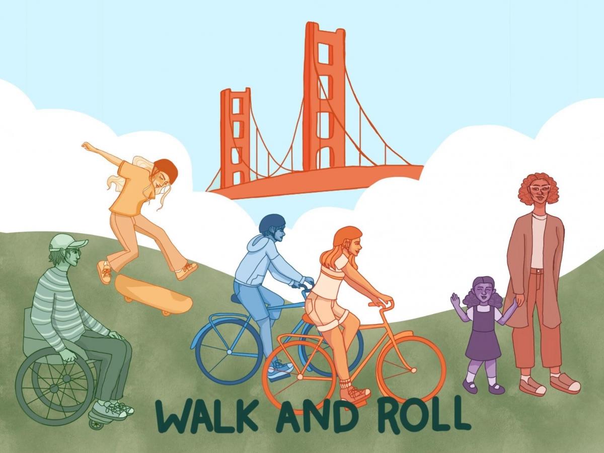
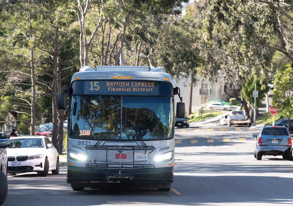
Reliable transit and safe streets are essential to making San Francisco an equitable and just city. In these truly unprecedented times, the SFMTA has worked hard to sustain critical services and buy time for our revenues to recover before current federal relief funding runs out.

But some investments in our transportation infrastructure just can’t wait. That’s why two mayoral transportation community task forces over the last eight years (Transportation 2030 and Transportation 2045) recommended a General Obligation (GO) Bond. The city’s 10-Year Capital Plan calls for a Transportation GO bond on the June 2022 ballot.

The bond proposal focuses on your top priorities. It would keep Muni equipment and facilities working efficiently, provide quick and convenient transit access, improve Muni service for communities that depend on transit, ensure Muni service is inclusive and accessible to all and make street safety improvements for people walking and biking.

Proposed Bond Program Components

Make the Transportation System Work Better

  • Speed up Muni repairs and keep public transit moving by repairing, upgrading and maintaining aging facilities and equipment
  • Enable faster, more reliable, and more frequent Muni service by improving public transit infrastructure
  • Increase subway capacity, reduce delays, and deliver dependable, high-frequency transit by modernizing the Muni train control system

Many Muni bus yards were built decades ago, with some over one hundred years old. While addressing all of SFMTA’s facility needs requires a variety of funding solutions, this proposed bond can fund high-priority needs to repair Muni buses faster, preventing breakdowns and supporting reliable Muni service.

Our train control system is also over 20 years old. Upgrading it will allow us to run longer trains to reduce crowding, increase speed in the subway and improve reliability for surface trains. These improvements can help Muni Metro become a modern rail system to better service our growing communities by providing fast service that is reliable.

 Improve Street Safety and Traffic Flow

  • Improve safety and visibility at intersections by upgrading traffic signals, signage and crossings
  • Strengthen walking, bicycling and Muni connections along major corridors by redesigning streets and sidewalks
  • Slow speeds and reduce crashes by implementing proven traffic calming and speed reduction tools

The proposed bond can improve safety, accessibility and visibility for people walking and biking. Streets in historically disadvantaged communities are almost twice as likely to be on the High Injury Network, where we see the most deaths and serious injuries on our streets. The proposed bond includes funds to make strategic street safety and visibility improvements with an equity focus by prioritizing communities with a high percentage of households with low incomes and people of color.

By funding traffic signal upgrades with safety features for people walking, we can make intersections work better for everyone, especially people with disabilities, older people and children. Redesigning streets with wider sidewalks, curb ramps, safer bikeways and traffic calming elements are proven tools to make streets safer and more accessible for all. These improvements are in support of the city’s Vision Zero policy goal to eliminate all traffic deaths in San Francisco.

Street improvements will also help us reduce travel times and delays for Muni. Proven successes include smart traffic signals that give Muni priority, wider sidewalks at bus stops for easier, more accessible boarding, and dedicated transit lanes to keep buses moving.

When buses run faster and are not stuck in traffic, Muni can service more people with the same number of vehicles and drivers. This saves money that can be reinvested elsewhere in the system.

Next Steps

Under-investment in transportation has been a decades-long trend that can’t be fixed with any single revenue source. Visit our Transportation 2050 website for more information about SFMTA’s effort to chart a more sustainable course with your help. The GO Bond would provide a dedicated local funding source that can help meet San Francisco’s transportation needs.

The bond proposal will be presented for feedback at a number of public hearings including the SFMTA Citizens’ Advisory Council, the SFMTA Board Policy and Governance Committee, the SFMTA Board of Directors and the city’s Capital Planning Committee.


Published October 07, 2021 at 04:31PM
https://ift.tt/3iCutn1

Wednesday, 6 October 2021

International Walk & Roll to School Day is October 6, 2021

International Walk & Roll to School Day is October 6, 2021
By Christine Osorio

Cartoon image of people walking, biking, skateboarding and using a wheelchair

Banner artwork created by Annika, an 8th grader at James Denman Middle School, as part of 2020’s Walk & Roll to School art contest

On Wednesday, October 6, thousands of students across San Francisco will walk, bike, scoot and roll to school. Walking and rolling is a fun and healthy way for families to get to to the classroom. Schools also benefit from Walk & Roll because it eases traffic congestion around schools during drop off and pick up times.

Hosted by the SF Safe Routes to School partnership, this event builds year-long excitement around getting to school in people-powered ways that are good for our health, environment and communities, as well as promoting COVID-19 safety.

San Francisco Unified School District elementary classrooms will compete for the highest participation, with a prize package for the top 30 classrooms in the district.

Middle and high school students: help get the word out to your classmates about the 2021 Walk & Roll to School Day by sharing this video: https://youtu.be/mIKHgNLfmCo

We want as many middle and high school students to use human-powered ways to get aroundon Wednesday, October 6! Submit your participation form here on the day of the event to win prizes, too.

The SF Safe Routes to School team is available to assist students, caregivers, teachers and principals on how to get started. To learn more, visit walksf.org/walkandroll.

This project was made possible in part by Proposition K sales tax dollars provided by the San Francisco County Transportation Authority.


Published October 06, 2021 at 08:32AM
https://ift.tt/3lhmCgl

Tuesday, 5 October 2021

Employee Vaccination Update

Employee Vaccination Update
By

15 Bayview Hunters Point Express bus

As you may be aware, for the health and safety of City and County of San Francisco workers and the public, the city’s Department of Human Resources instituted a policy that all city employees need to be fully vaccinated by Nov. 1. 

The SFMTA fully supports vaccination, as it has been proven to be the best tool to protect each other against the dangers of COVID-19. Since the vaccines received emergency approval at the end of 2020, we have been educating our employees about the safety and efficacy of COVID-19 vaccines, encouraging them to get vaccinated and providing them with opportunities to get vaccinated on work time.  

Unfortunately, as of Sept. 30, we had 640 employees who were either unvaccinated or had not reported their vaccination status, which represents 11% of the SFMTA workforce. 

If several hundred of our employees are still unvaccinated as of Nov. 1 and are terminated, it will significantly impact transit operations and parking control in San Francisco. Up to four schools could be without crossing guards and approximately eight schools could see a reduction in the number of crossing guards serving them. 

Impact on transit operations: The number of unvaccinated transit operators is roughly equivalent to the total number of operators we plan to train and hire between June 2021 and December 2022. If this number is not significantly improved, we will be forced to reduce service back to May 2021 levels. 
 
Impact on parking control: If we can’t reduce the number of unvaccinated parking control officers before Nov. 1, the agency will be forced to partially suspend abandoned vehicle enforcement, booting, and commuter shuttle enforcement as well as reduce residential parking permit enforcement and meter enforcement. It could also impact disabled placard enforcement and shrink our Chase Stadium detail.  

We absolutely do not want any of our employees to lose their jobs or their incomes and are going to keep working to support them in complying with the mandate in every way we can. We have multiple teams working across the agency to improve this situation over the course of the next month, but as we hope and work for a better outcome we are simultaneously planning for the worst. 

We have begun continuity of operations planning based on pre-built scenarios, and it is time for us to inform our city leaders and the public of how this situation may impact the daily lives of our city’s residents. 

We will keep customers and the public updated and will report on this topic in more detail at our Board of Directors meeting today. You can tune in at 1 p.m. at SFGTV. For the latest, please follow us on Twitter @sfmta_muni or Facebook.


Published October 05, 2021 at 01:18PM
https://ift.tt/2ZZCz2B

Monday, 4 October 2021

Warriors Ticket Holders Ride for Free

Warriors Ticket Holders Ride for Free
By Stephen Chun

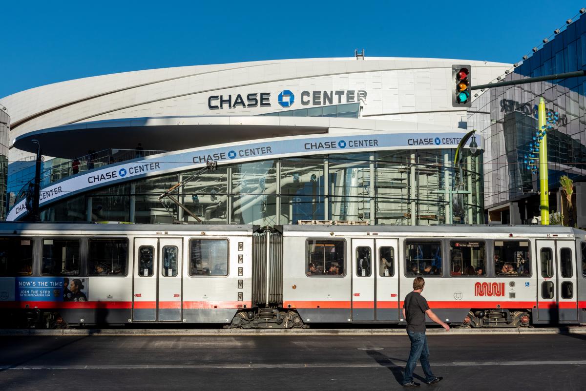
Photo of T Third in front of Chase CenterCalling all Warriors fans and Muni riders! As you know, an exciting preseason is underway, with the anticipated season opener scheduled to tip off in just a few weeks. As the Warriors look to a promising year with a committed staff and tenacious roster, it’s going to be an electrifying season for the six--time NBA Champs.
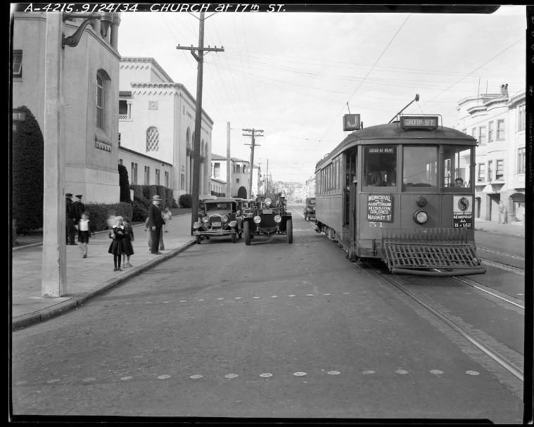
To catch these blue and (golden) yellow must-see games at 1 Warriors Way, consider taking Muni for free! Your game ticket (electronic or physical) is your all-day Muni ticket. The ticket provides quick and free Muni for bus and light rail lines (but not cable cars), up until the end of the service day at 2 a.m. after the event. Just show your ticket to the Station Agent or board through any door on our coaches. Muni uses all-door boarding across our system, so fans can board through any door and arrive quickly to the game! For the Muni Metro stations, if the booth is not occupied, proceed through the gate nearest the Station Agent window; the gate will open automatically. Here are additional guidelines for your fast, reliable and frequent trips.

This transit accommodation which aims to boost (affordable) ridership to Chase Center, is provided by the Transit Bundling Program. Sponsored by Mayor London Breed and the Golden State Warriors, Warriors ticket holders receive free service on Muni all-day on game day. But wait! There’s more!  Any ticket to a Chase Center event can also ride Muni all-day for free. It’s the same procedure and paid for by the Warriors. Thanks, Dub Nation!

The Warriors chose Mission Bay as the site for the new arena back in 2019 largely because of its transit-rich location with easy access to Muni and regional connections such as BART, Caltrain and Ferry services. Walking, biking or scooting are also additional modes of transportation.

As a reminder and to help stop the spread of COVID-19, federal law requires wearing a mask in Muni stations and while riding transit. Additionally, some Muni routes have been modified as a result of COVID-19 pandemic restrictions, the city’s emergency order and ongoing resource constraints. For details on Muni’s current routes and service, visit individual route webpages or the Muni Core Service Plan.   We’ll see you at Chase Center. Go Warriors! Go Muni!

Muni Service to Chase Center:

KT: K Ingleside-T Third Street - service to / from downtown San Francisco and Embarcadero BART Station. The stop is located on 3rd Street.

78X 16th Street Arena Express – service to / from 16th St Mission BART to Chase Center before and after the event. This shuttle stop is located on 3rd St near Illinois

22 Fillmore - serves as a connection to 16th St Mission BART. Exit 3rd St & Warriors Way. This stop is located on 3rd and Gene Friend Way.

15 Bayview Hunters Point Express - serves as a connection to Montgomery St BART. Exit 3rd St & Warriors Way.


Published October 04, 2021 at 09:04AM
https://ift.tt/3a7uiLD

J Church Pilot Eases Subway Congestion for Muni Metro

J Church Pilot Eases Subway Congestion for Muni Metro
By Jonathan Streeter

In December 2020, the J Church returned as a surface-only route, much like its earliest predecessor, which opened in 1917.  Although the J Church travelled as far as the Embarcadero for more than 100 years, establishing Duboce Avenue as the terminal for this route as a test case was the result of careful analysis undertaken to improve the line’s poor reliability. This routing also allows us to address crowding and delays in the Muni Metro subway that plagued the system for decades.

photo of the J Church near Dolores in 1926

The J Church in 1926

Surface Route

The J Church has historically had the lowest ridership of any Muni Metro line. Keeping it as a surface-only route should improve the J Church’s reliability and frequency, increase Muni Metro subway performance and reduce crowding. In addition, to enable the pilot we provided temporary accessibility and pedestrian safety upgrades at an intersection that is on the city’s High-Injury Network -- those San Francisco streets that have the highest severe and fatal collisions.

In addition to delays, there are other drawbacks to having the J Church Line in the subway. Once in the subway, the J’s lower-capacity one-car trains are unable to ease crowding at peak hours.  The shorter trains are necessary due to the limited length of platforms along portions of the surface route.  When the J line did go in the subway, those trains used the Embarcadero switch back to turn around, which limited its availability for other trains. Additionally, J Church (and N Judah) trains heading into the tunnel at Duboce Avenue must cross the path of all outbound subway traffic, which can cause system-wide delays.

Performance

When we surveyed J Church customers in 2019, 63% said the wait for a train was too long. Nearly four out of five people (78%) said they would walk farther to a stop for more reliable service or a shorter trip overall, including 52% of people with disabilities and 58% of seniors.  

Prior to the COVID-19 pandemic, poor reliability on the J Church meant that only about three out of four trains were showing up within five minutes of the expected time. Now, reliability has improved so that nearly nine out of 10 trains arrive without delay. Travel time on the J Church line’s surface route is less variable than the subway and didn’t change much during the pandemic. Avoiding subway congestion has eliminated the main source of unpredictable delays.

When transferring to the subway, customers at Church Station are seeing a high frequency of trains, minimizing the wait time for downtown destinations. At present the average wait time for an inbound train is two to three minutes. By comparison, the J Church frequently takes that amount of time simply to clear the Market Street intersection when heading northbound towards Duboce Avenue, and often took several minutes to enter the tunnel at Duboce.

Transfer Experience Improvements

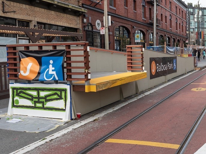
To support the shortened route, we installed temporary ramps in August 2020 that enable J Church customers with mobility limitations to access the Church Street Station elevator at Market Street or the N Judah accessible ramps at Duboce Avenue. We also installed a new temporary transit stop just south of Market Street to create a more seamless transfer to the subway. Learn more about these transfer improvements and proposals for additional upgrades at the J Church Transfer Improvements webpage.

Temporary accessible ramp on the 200 block of Church Street

Temporary accessible ramp on Church Street south of Market Street

Next Steps

This pilot project, fully operational since December 2020, will be reviewed by the SFMTA Board of Directors in December 2021 as a part of our overall 2022 Muni Service Network plan. If approved, the J Church shortened route would remain in place in 2022, but the line could still be returned to the subway in the future as our service plan continues to evolve.

To sign up for updates and provide feedback visit our J Church Surface Route webpage.


Published October 04, 2021 at 09:11AM
https://ift.tt/3oxIO84

Friday, 1 October 2021

Essential Trip Card Program Provides Crucial Accommodations

Essential Trip Card Program Provides Crucial Accommodations
By Stephen Chun

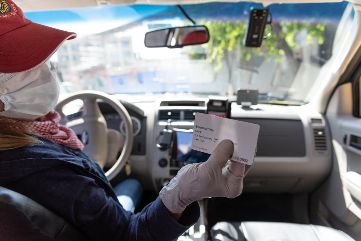
Photo of taxi driver holding essential trip card voucherDuring a time of unprecedented uncertainty, we reflect on a very successful 18 months since the launch of our Essential Trip Card (ETC) program.  The ETC is administered through the SFMTA’s Paratransit program (SF Paratransit) which has provided door to door van and taxi (paratransit) services for more than 40 years to people who are unable to independently use Muni, for some, all the time, because of a disability or disabling health condition.  
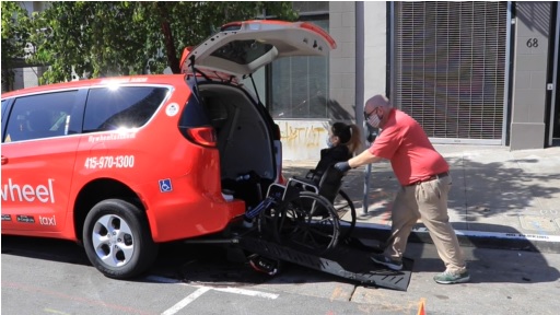
In response to the Muni service reductions in April 2020, the ETC program was launched to provide seniors and persons with disabilities with safe and door-to-door taxi service to essential services during the pandemic as a supplement to the existing Muni service. Such essential trips include grocery shopping, pharmacy visits, medical treatments, and later, vaccination appointments.

Once enrolled, ETC participants receive a monthly taxi subsidy of $60 (for a $12 cost) to pay for taxi rides, similar to a regular card payment for a taxi. This allows participants to take approximately four to five one-way trips each month via taxi while receiving an 80% discount.

In an effort to continue providing discounted taxi services and prioritizing access to vaccinations for its participants, the SFMTA issued a one-time allotment increase of $60 (for an additional $12 cost) in February 2021, when vaccines started becoming widely available. This provision avoided participants dipping into their existing monthly trip budget while being able to use a taxi services to get to and from their vaccination appointments. And while an ETC participant is limited to a $60 monthly subsidy, those with extenuating circumstances who may have greater transportation needs can request a permanent increase of their monthly taxi allotment to $120, or rather another $60 allotment increase (for a $12 cost).

The ETC has been a critical and previously mentioned, a successful program for those seniors and riders with disabilities. Even as SFMTA provides additional service to ensure that 98% of residents live or work within two blocks of a Muni stop, the ETC program remains a lifeline for important trips that are difficult for seniors and persons with disabilities to make on Muni.  Furthermore, as trip numbers were higher after the vaccination availability than from before, this program has instilled greater self confidence for seniors and persons with disabilities to make essential trips as such and provides a safety net for greater mobility and engagement as they resume their normal activities.

Since its inception, approximately 4,400 seniors and persons with disabilities have enrolled in the program and over 86,000 trips have been performed.  A strong partnership between SFMTA, SF Paratransit and the taxi industry, executing successful community-based outreach and incorporating public feedback, including those from the Paratransit Coordinating Council, were all key components in implementing the program so quickly and with such success!

SF Paratransit and ETC intends to roll the program into FY21-22 and is committed to continuing to provide safe, reliable and discounted taxi service trips for seniors and people with disabilities. For eligibility, registration and FAQ’s, please visit the Essential Trip Card webpage.

As an added note, SF Paratransit for those with disabilities who are eligible under the Americans with Disabilities Act (ADA) is provided throughout San Francisco, including Treasure Island, to the northernmost part of Daly City in San Mateo County and to the Marin Headlands on weekends. Also, once ADA-certified to use paratransit, a participant may also be eligible to receive ADA paratransit services in other cities and states. Please visit our SF Paratransit Eligibility and Registration page for more information.

Photo of taxi driver assisting wheelchair user enter into the vehicle


Published October 01, 2021 at 09:41AM
https://ift.tt/3uxd43L