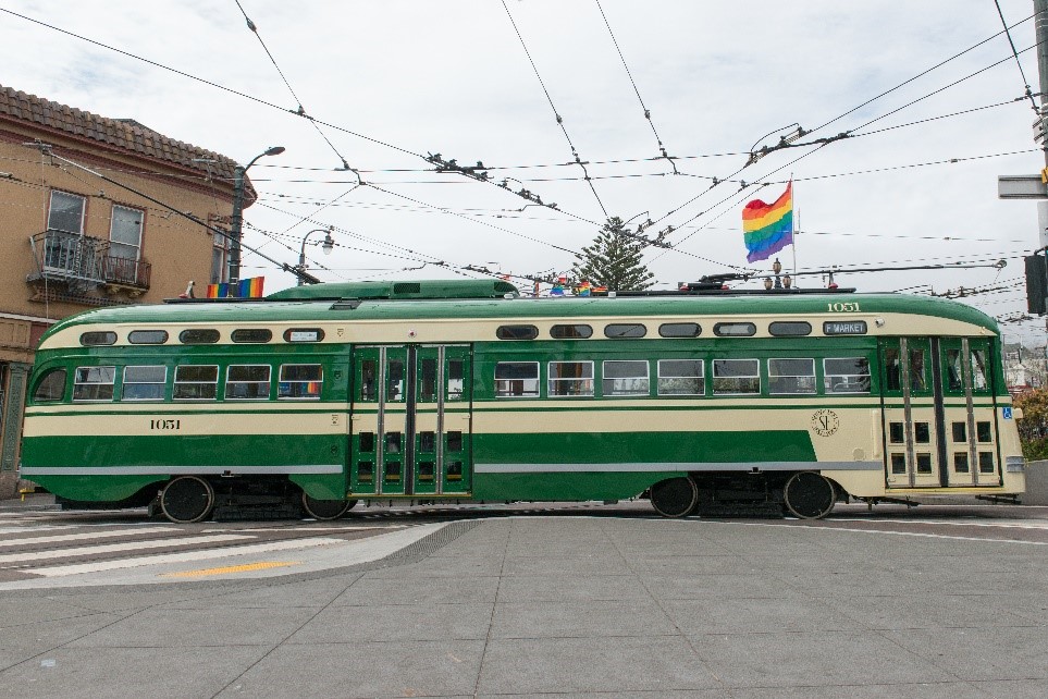
Thursday, 20 May 2021

Get Out and Get Going on Bike to Wherever Day, May 21

Get Out and Get Going on Bike to Wherever Day, May 21
By Pamela Johnson

Heading out to run an errand, meeting friends, taking in the sights at the Botanical Garden or Japanese Tea Garden in Golden Gate Park (both now open) or getting a bite to eat? On May 21, join people across the city bicycling for this year's annual Bike to Work Day event in the form of Bike to Wherever Day. 
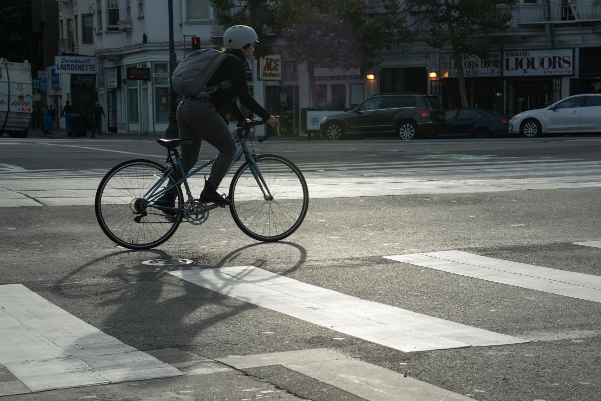
Image of person riding a bicycle

Bike to Wherever day is a celebration of bicycles as a fun and healthy way to get around the city, hosted by The San Francisco Bicycle Coalition encouraging people to pedal to their destinations for the day. The event promotes the bicycle both as an alternative commute and as a healthy and safe alternative to driving to…wherever!

The SFMTA encourages everyone, including those who don't usually bike, to get out and bike on this special day.  After grabbing a bike (your own or a bikeshare bike), stop by one of the 12 energizer stations that will be hosted citywide as you get going around town. There, you can pick up your free Bike to Work Day canvas tote bag, filled with goodies and collectibles, courtesy of the SF Bicycle Coalition.

Resources to Help You Plan Your Bicycle Trip

The SFMTA has developed handy resources to help you plan your bicycle trips.  Visit the interactive bike network map, that highlights recommended routes and shows bikeshare station locations. At our Get Out, Get Going website you can find an interactive multi-mode map with information about other sustainable ways to get you to your destination that you could pair with your bicycle trip, including walking and using shared mobility devices, like a scooter or moped.  

Like never before, people are riding bicycles all across San Francisco. The SFMTA supports sustainable transportation modes like the use of bicycles, especially for everyday travel. To help meet the needs of an increasing number of people riding bicycles in San Francisco, we support bicycling by building dedicated bike lanes around the city, and by making streets safer and more comfortable for bicycling. We also implemented the Slow Streets Program with nearly 30 new corridors implemented since the start of the pandemic as a way to limit traffic on certain residential streets to be used as a shared space for people traveling by foot and by bicycle.

The SFMTA is proud to sponsor Bike to Wherever Day, San Francisco's favorite biking holiday.  Be sure to check out the history of walking and bicycling in San Francisco through the years. Remember when bicycling on Bike to Whenever Day to ride predictably by following rules of the road and to have fun.


Published May 20, 2021 at 07:59AM
https://ift.tt/3ubDvuh

Wednesday, 12 May 2021

Pay-By-Plate Coming to Parking Meters

Pay-By-Plate Coming to Parking Meters
By Pamela Johnson

A change from pay-by-space to pay-by-license plate is coming to half of all parking meters in San Francisco on the heels of a four-month pay-by-plate parking meter pilot focused on Indiana Street in the Dogpatch that ended in March 2021.  

How it Works

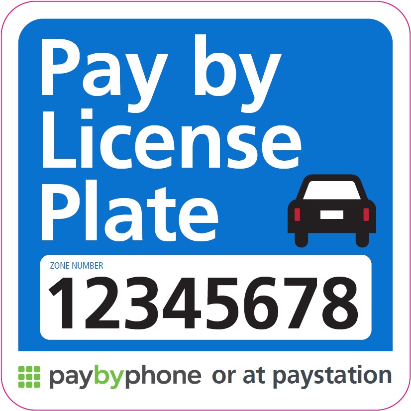
Instead of entering your space number to pay for parking, you will enter your license plate number. When you pull into a parking space, head to the nearest paystation on the block, or reach for your smartphone, key in your license plate number and pay. Since the PayByPhone app stores your license plate number, you won’t have to remember or type it in every time when using the app. New overhead signage and decals on the paystations will let you know that the pay-by-plate system is in effect.

Image of pay by license plate sign

Look for signs that indicate Pay by License Plate is available

This new system comes with many benefits. Pay-by-plate gives you the option to pay at any pay station on your side of the block as you head to your destination. If you pay for parking but leave before your paid time expires, you may return to the same block and park without having to pay again, as long as you are within the original paid time. It also streamlines enforcement, giving parking control officers more time to focus on safety issues like double-parking and neighborhood concerns like residential permit parking enforcement.

The SFMTA is currently testing the pay-by-plate system to make it as effective as possible before rolling it out more widely. In early April, based on experience with the Dogpatch pilot, the SFMTA switched parking meters from pay-by-space to pay-by-plate on the 000 - 100 blocks of 10th Street, between Market and Howard Streets.  By December of 2022, half of the 28,000 parking spaces in San Francisco are expected to be converted to pay-by-plate.

According to Ted Graff, Director of Parking for the SFMTA’s Streets Division, “The move to pay-by-plate makes on-street parking more efficient. It takes advantage of new technology to streamline enforcement and reduce costs. And we plan to reinvest the time and money we save to make the parking experience, and parking enforcement, better all around the city.”

To learn more about the Dogpatch Parking Meter Pilot,  or how to pay for parking at a meter please visit the SFMTA parking website.


Published May 12, 2021 at 11:03AM
https://ift.tt/3tEjiNb

Monday, 10 May 2021

Temporary HOV Lanes Approved for Historic Pilot Program

Temporary HOV Lanes Approved for Historic Pilot Program
By Stephen Chun

Muni buses and private vehicles with two or more occupants will soon see an innovative solution for San Francisco: High Occupancy Vehicle lanes (HOV) on city streets, approved by a 5-1 vote on April 20 by the SFMTA Board of Directors. The historic pilot program, in partnership with Caltrans, aims to increase person-carrying capacity and improve transit reliability on several major corridors through Golden Gate Park, the Marina District and Cow Hollow.

Photo of the 28-19th Avenue bus with a passenger boarding

This HOV pilot will help customers who ride the 28 19th Avenue Muni line

The HOV lanes will be in effect weekdays from 5 a.m. to 8 p.m. in the far-right lanes on State Route 1’s Crossover Drive (southbound only), Park Presidio Bypass and Park Presidio Boulevard between Lincoln Way and just north of Lake Street, and on U.S. 101’s Lombard Street and Richardson Avenue between Francisco and Lyon streets and Franklin and Gough streets.  

Caltrans is currently in the final stages of roadwork on Lombard Street.  Once that work is complete and Caltrans grants final approvals of the changes, the new HOV lanes will be striped. Park Presidio Boulevard should be restriped shortly thereafter. 

With these changes in place, the far-right lane can continue to be used by motorists for right turns, driveway access and access to curbside loading and parking spaces. No parking and loading spaces will be removed as part of the project. 

The pilot will end within 120 days after the city’s COVID-19 state of emergency order is lifted. The project could not be made permanent without an extensive public process and a second round of approvals by the SFMTA Board. A few weeks after implementation, the Agency will begin evaluating the project and gathering community input to determine if the pilot should be made permanent. 

Project Benefits 

In alignment with the Agency’s mission, the aim of these HOV lanes is to assist in moving more people as quickly and efficiently as possible. Efficient transit brings shorter and more reliable travel times for those who rely on public transit the most. These continued efforts to provide quicker travel times also improve the sustainability of our recovering economy.  

Studies conducted late last year show that one-third of vehicles on these routes already carry two or more occupants. As each of the project’s roadways is three lanes, there should only be minimal impact to traffic initially. Over time, if the share of single-occupant vehicles increases, transit and high occupancy vehicles would be protected from increasing traffic congestion.  The lanes could be converted from HOV-2 to HOV-3 later, increasing the required occupants per vehicle to three or more people if both the SFMTA and Caltrans agreed that doing so would further increase the total capacity of the roadway. 


Published May 10, 2021 at 03:15PM
https://ift.tt/3bfc2ku

Thursday, 6 May 2021

Subway Stations Reopen and Historic Streetcars Return May 15

Subway Stations Reopen and Historic Streetcars Return May 15
By Shalon Rogers

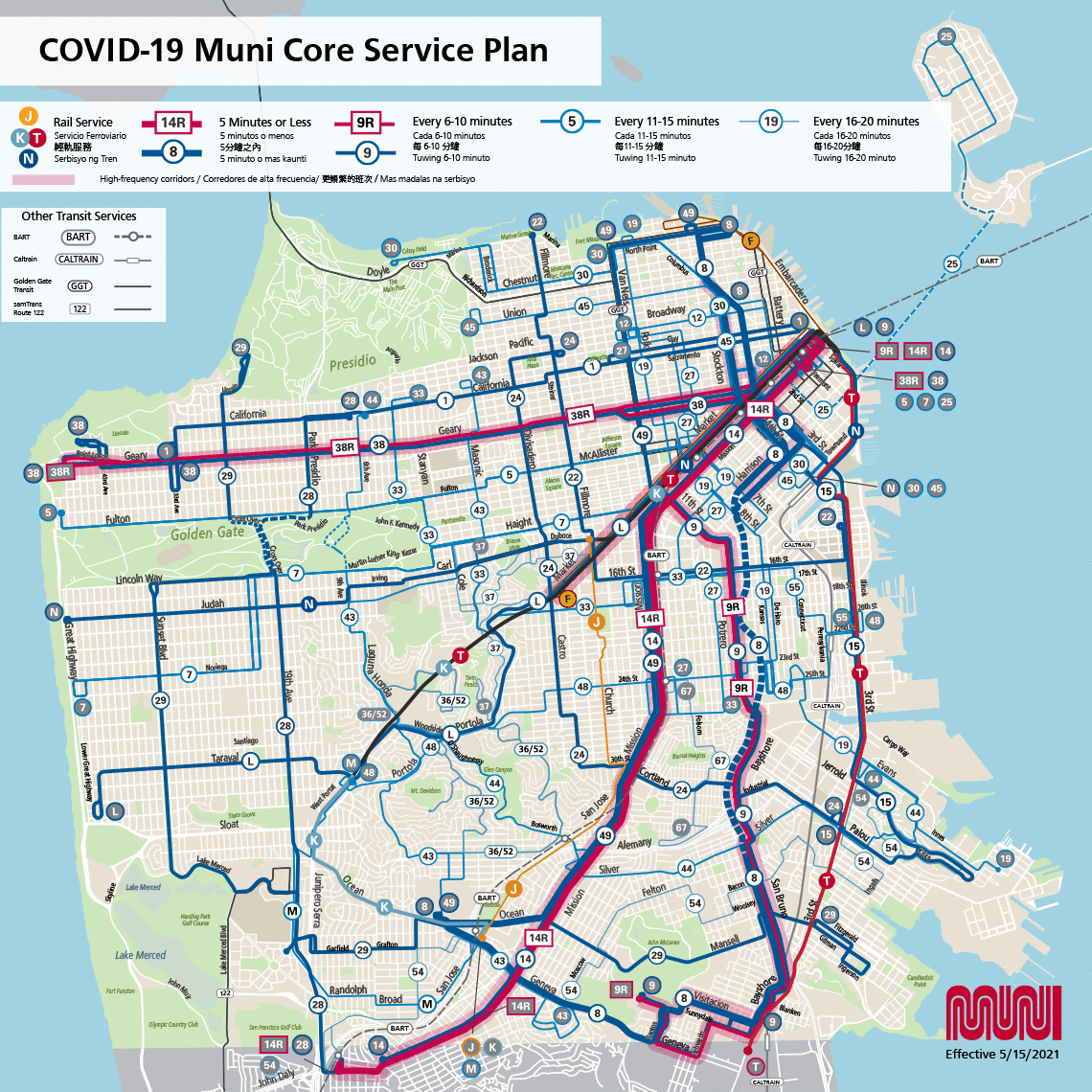
COVID-19 Muni Core Service Plan Map

PDF version

The COVID-19 Muni Core Service plan, effective May 15, showing all Muni service including new and returning Muni lines.

The SFMTA will reopen all of its Muni Metro subway stations on Saturday, May 15, with the return of rail service on the N Judah and KT Ingleside-Third routes.  To continue maximizing Muni access citywide, we’re also adding a new bus route: the 36/52 Special,  serving the hilltop neighborhoods of Forest Hill, Miraloma and Sunnyside. In addition, we are excited to bring back San Francisco’s historic streetcar route--the F Market & Wharves.

N Judah Metro rail service will resume its full route between Ocean Beach and 4th and King Street (Caltrain), and the T Third will be extended to West Portal and then continue on, running as the K Ingleside to Balboa Park Station. With the return of rail service to these routes, customers will have faster transit times downtown, as well as to other popular destinations including the Castro, City College, Ocean Beach, Golden Gate Park, Oracle Park, Chase Center, UCSF Parnassus, UCSF Mission Bay and Caltrain.

The J Church will remain a surface-only route from Balboa Park to Church and Market streets. For subway service, customers may transfer at Market Street to any train downtown, or the KT outbound, at the Church Street Station. The L Taraval and M Ocean View buses will continue to operate in lieu of rail service.

After working closely with Castro, mid-Market and Fisherman’s Wharf merchants, the full F Market & Wharves route from Fisherman’s Wharf to Market and Castro will return to service on our beloved, historic streetcars to help support the city’s reopening and return of tourism.

In response to customer feedback for improved service to connect hospitals, grocery stores and vaccination sites in hilly areas, we are also introducing a temporary new combined route--the 36/52 Special. This bus route will serve the hilltop neighborhoods of Forest Hill, Miraloma and Sunnyside in a loop between Forest Hill Station and Glen Park Station.

We continue to work closely with district supervisors, community members and other stakeholders to bring back additional service and modify existing service to serve customers’ needs as the city continues to reopen and recover. Since January 23 of this year, 91% of San Franciscans have been within 2-3 blocks of a Muni stop. And, this includes 100% of residents in San Francisco’s neighborhoods identified in the Muni Service Equity Strategy. By mid-August, SFMTA is aiming to add back additional routes to close service gaps so that 98% of San Franciscans will have access to Muni within 2-3 blocks .
 

Below is the complete list of service changes. Please note that details are subject to change. For the most up to date information with free language assistance and accessibility, please call 311 or (415) 701-4311 or visit the Core Service Plan webpage.

May 15 Muni Service Changes

Service hours for each route are noted below. Owl network service hours are 10 p.m. to 5 a.m. daily. For more information on frequency and hours of service, read more on the COVID-19 Muni Core Service Plan.

F Market & Wharves

  • The historic streetcar will return to service between 17th and Castro streets and Jones and Beach Streets. Service hours:
    • From Castro: Approximately 11 a.m. to 7 p.m. (first trip departing from Castro Station is 10:50 a.m.)
    • From Fisherman’s Wharf: Approximately 12 p.m. to 8 p.m.
  • Use the L Bus or L Owl for local service along Market Street during the hours when the F is not running.  

KT Ingleside-Third: The K Ingleside and T Third will interline as the KT Ingleside-Third, expanding service between Balboa Park and Sunnydale. This route will use the newly reopened Muni Metro subway, serving all stations between West Portal and Embarcadero.

  • Service hours
    • Weekdays: 6 a.m. to 9 p.m.
    • Weekends: 8 a.m. to 9 p.m.
  • Between the hours of Owl service (10 p.m. to 5 a.m.) and rail service, Muni Metro buses will provide service from 9 p.m. to 10 p.m. on weekdays, and 5 a.m. to 8 a.m. and 9 p.m. to 10 p.m. on weekends.
    • The K Bus will run between Balboa Park and West Portal Station from 9pm to 10pm daily.
  • During the weekend, for the hours between Owl service (10 p.m. to 5 a.m.) and rail service, the K Ingleside bus will run between Balboa Park and Embarcadero-Ferry Plaza from 5 a.m. to 8 a.m. and the T Third bus will run between Embarcadero-Ferry Plaza and Sunnydale.

N Judah

  • Rail service will resume for the entire route with two-car trains replacing Metro buses.
  • Service hours
    • Weekdays: 6 a.m. to 9 p.m.
    • Weekends: 8 a.m. to 9 p.m.
  • Muni Metro buses will cover the hours between Owl Service and rail service, running 5 a.m. to 6 a.m. and 9 p.m. to 10 p.m. on weekdays and 5 a.m. to 8 a.m. and 9 p.m. to 10 p.m. on weekends.

K Bus, L Bus and L Owl

  • These lines will no longer serve Forest Hill Station directly. Please visit K Bus,  L Bus and L Owl route pages for more information. 

36/52 Special*

  • Temporary new combined route between Forest Hill Station and Glen Park Station serving the Glen Park, Sunnyside, Midtown Terrace and Miraloma communities. The route will serve Laguna Honda Hospital.
  • The inbound (clockwise) route will include an additional loop on Clarendon.

8 Bayshore

  • The current 8AX Bayshore “A” Express service will become the 8 Bayshore short between City College and Kearny at Pacific. Service for this route ends at 7:30 p.m. daily.
  • The 8 Bayshore long will continue to travel between City College and Fisherman’s Wharf.
  • The 8 Bayshore will return to its pre-pandemic route traveling north on Kearny, instead of Stockton.

Frequency Adjustments 
The following routes will have reduced frequency after 7 p.m. to better match resources with observed ridership demand.

After 7pm only

Routes

Daily from 10 or 12 minutes to 15 minutes

  • J Church (Muni Metro)
  • 15 Bayview-Hunters Point Express
  • 22 Fillmore
  • 28 19th Avenue
  • 29 Sunset
  • 44 O’Shaughnessy

Daily from 15 minutes to 20 minutes

  • M Ocean View Bus
  • 12 Pacific
  • 55 Dogpatch

Daily from 20 minutes to 30 minutes

  • 37 Corbett

Weekday only from 12 minutes to 15 minutes

  • 30 Stockton
  • 43 Masonic
  • 45 Union-Stockton
  • 48 Quintara-24th St

Weekend only from 15 minutes to 20 minutes

  • 48 Quintara-24th St


36/52 Special*

  • Temporary new combined route between Forest Hill Station and Glen Park Station serving the Glen Park, Sunnyside and Miraloma communities. The route will serve Laguna Honda Hospital.
  • The inbound (clockwise) route will include an additional loop on Clarendon.

8 Bayshore

The current 8AX Bayshore “A” Express service will become the 8 Bayshore short between City College and Kearny at Pacific. Service for this route ends at 7:30 p.m. daily. 

  • The 8 Bayshore long will continue to travel between City College and Fisherman’s Wharf.
  • The 8 Bayshore will return to its pre-pandemic route traveling north on Kearny, instead of Stockton.

Frequency Adjustments 
The following routes will have reduced frequency after 7 p.m. to better match resources with observed ridership demand.


Published May 06, 2021 at 08:13AM
https://ift.tt/3nQpXTk

Wednesday, 5 May 2021

The 115-Year History of Streetcars on Market Street

The 115-Year History of Streetcars on Market Street
By Jeremy Menzies

With the F Market & Wharves returning to service on May 15th, here’s a brief look back through the past 115 years of streetcar service along Market Street, our most traveled thoroughfare.

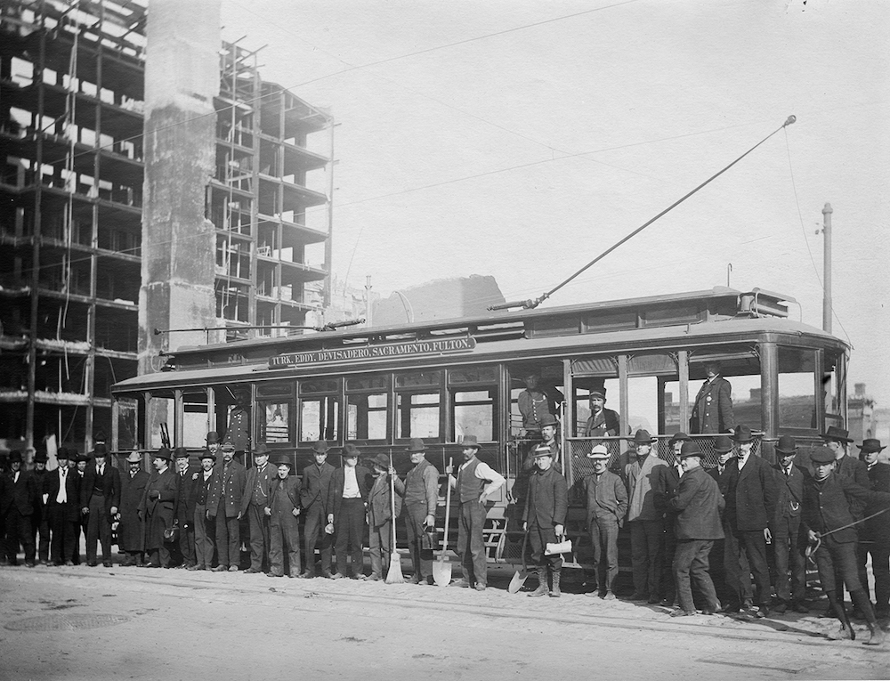
May 2, 1906 was the first day that an electric streetcar ran on Market Street. After the earthquake and fires on April 18, 1906, San Francisco was eager to rebuild, and public transit played a crucial role in getting the city back on its feet.

Prior to electric streetcars, transit on Market was dominated by cable cars, which ran from the Ferry Building to the Pacific Ocean, but were considered slow and inefficient compared to the newer electric streetcar technology. With the introduction of electric cars on Market Street, people had a faster way to get to downtown businesses and rebuild from the ashes of the disaster.

group of people standing along side of streetcar with burned ruins of a building in the background

This photo documents the first streetcar to run on Market Street, just two weeks after the devastating April 18, 1906, earthquake.

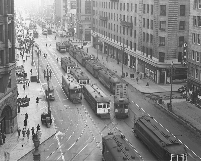
In the years following the 1906 disaster, nearly all cable lines were converted to electric cars and Market Street became an incredible hub of streetcar traffic. By the 1930s, four different streetcar tracks ran along Market, operated both by the Municipal Railway and by the privately-owned Market Street Railway Co. Dubbed the “Roar of the Four,” due to the noise of hundreds of cars rolling through the urban canyon of Market Street, streetcars were certainly king of the road.

overhead view of Market Street crowded with streetcar traffic and pedestrians

This 1940 photo shows morning streetcar traffic at Market and Geary at 8:41 a.m. Most public transit service in the city was provided by electric streetcars, and almost all lines merged onto Market Street at some point.

After the end of World War II, transit ridership was in steep decline across the nation as people embraced the “one car per family” dream of Postwar America. Streetcar ridership fell significantly during this time and the majority of Muni’s routes were converted to bus operation. Rail service was, however, retained for five lines (J, K, L, M, & N) because the exclusive rights of way in the Twin Peaks and Sunset Tunnels allowed for shorter travel times to the city’s outer neighborhoods.

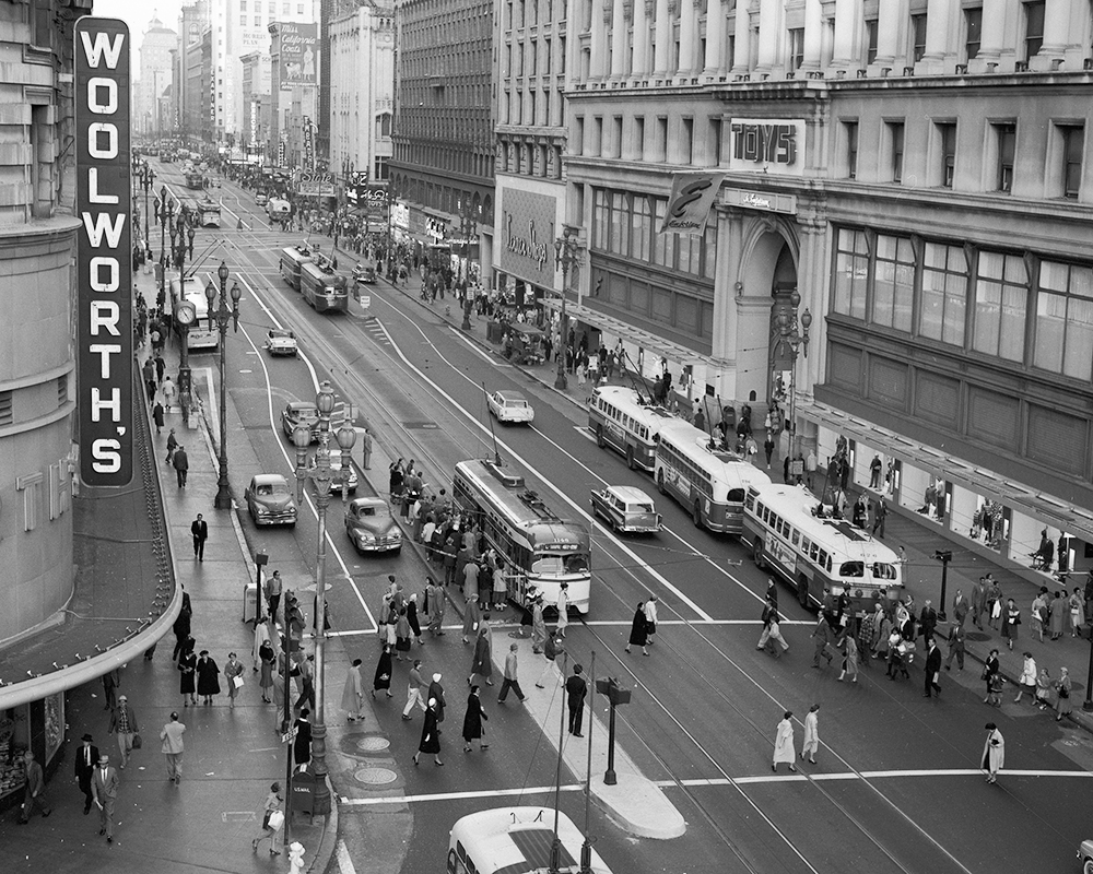
overhead view of streetcars, buses, and pedestrians on Market Street

Trolley buses and Muni PCC streetcars ply the roadway at Market and Powell in this 1958 photo. Bus conversion and the scrapping of hundreds of old streetcars in the 1950s meant fewer rail lines running on Market.

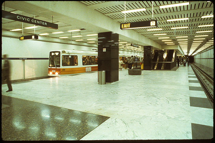
With the opening of the Muni Metro & Market Street Subway in the early 1980s, traditional streetcars disappeared from regular transit service on the surface of Market Street for over a decade. Replaced with Light Rail Vehicles running underground, San Francisco’s first subway system was born.

muni metro in the 80s

The opening of the Muni Metro system allowed new light rail vehicles to run underground between the Ferry Building and West Portal instead of jockeying with cars, buses, pedestrians and cyclists on the surface.

When the opening of Muni Metro removed surface rail on Market Street, residents and businesses began advocating for the creation of an historic streetcar service from Castro to Fisherman's Wharf. After years of planning and construction, the F line was launched on September 1, 1995.  Originally running from Castro to downtown, service was extended to Fisherman's Wharf in March 2000.

This month, we are happy to welcome the F Market & Wharves back to Market Street and Fisherman’s Wharf, along with more service increases that, just like 115 years ago, will help San Francisco recover.

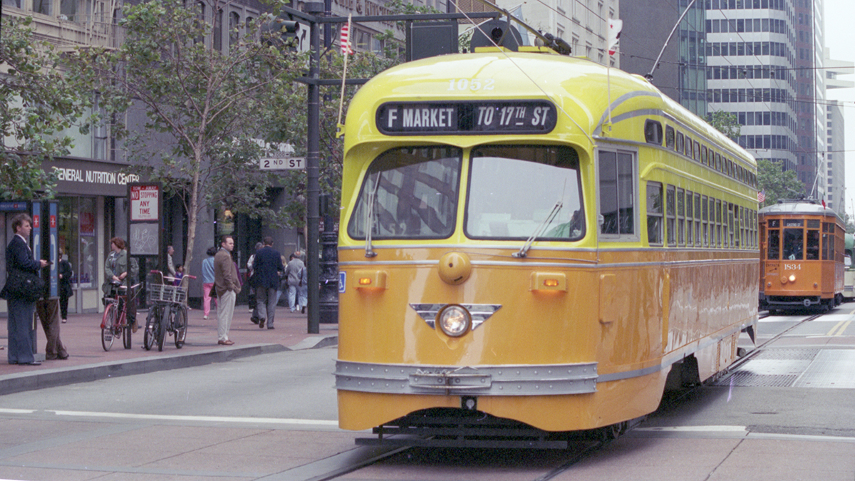
Yellow and orange streetcar on Market street

Presidents Conference Committee (PCC) streetcar 1052 parades along Market for the opening of the F Market & Wharves in 1995. 

Check out more details in our previous blog about the May 15 return of the F Line.


Published May 05, 2021 at 04:13PM
https://ift.tt/3vHXnpQ

Tuesday, 4 May 2021

Join Us in Transforming Evans Avenue

Join Us in Transforming Evans Avenue
By Adrienne Heim

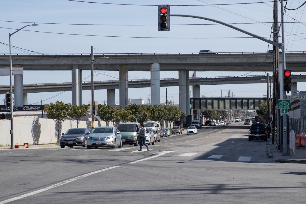
Photo of Person walking across Evans Avenue at Napoleon Street

Pedestrian crossing Evans Avenue at Napoleon Street

This month we are reaching out to community groups and businesses along Evans Avenue for feedback on making this corridor safer and more inviting for everyone, by means of a Quick-Build project.

 Entering Evans Avenue from Cesar Chavez Street eastbound toward the Bayview-Hunters Point neighborhood, the street offers an unusual prospect for a corridor in San Francisco. Passing under freeway lanes and railway tracks, past industrial parks, retail and government buildings, the street eventually connects to Heron’s Head Park at Jennings Street.

Named after Robley D. Evans, a Commander in the U.S. Navy from 1864-1908, Evans Avenue served as one of three vital routes into the Hunters Point Naval Shipyard when it was operating from 1940 to 1974. Between Cesar Chavez and 3rd streets, the roadway consists of two travel lanes in both directions. The average traffic volume along this 0.7-mile stretch ranges from 12,000 vehicles per day (near 3rd Street) to 23,000 (near Cesar Chavez Street).  

Muni’s 19 Polk  serves Evans Avenue and connects to Muni lines including the T Third, 15 Bayview Hunters Point Express, 44 O'Shaughnessy and 91 3rd/19th Avenue Owl.

Why a Quick-Build project for Evans Avenue?

A quick-build project allows us to increase safety for all users of Evans Avenue by implementing relatively fast improvements with inexpensive treatments within months, such as: paint, traffic delineators, street signs and parking and loading adjustments. (See gallery below for examples of such treatments).

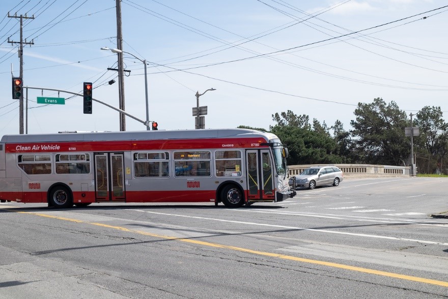
19 Polk turning off Cesar Chavez Street onto Evans Avenue

19 Polk turning off Cesar Chavez Street onto Evans Avenue

Evans Avenue is also a bike route, connecting bike lanes south of 3rd Street and on Cesar Chavez Street.

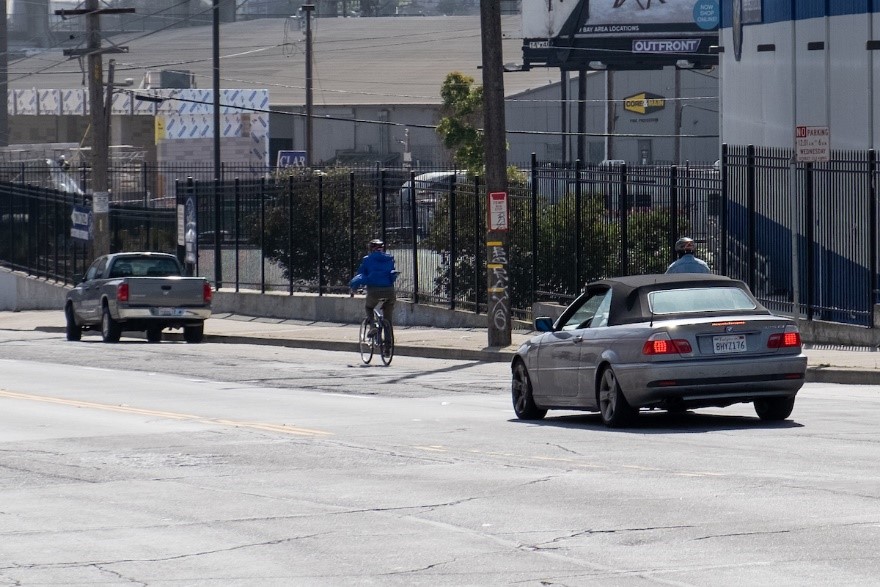
A person bicycling eastbound on Evans Avenue

A person riding a bicycle eastbound on Evans Avenue

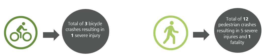
Evans Avenue is on San Francisco's Vision Zero High Injury Network, the 13% of San Francisco streets where 75% of the city’s traffic injuries and fatalities occur. From 2015 to 2020, 81 traffic collisions have been reported on Evans Avenue between Cesar Chavez and 3rd streets. This corridor is seeing rising traffic and the potential for conflicts due to ongoing and future development in the area.

image showing a total of 3 bicycle crashes resulting in 1 severe injury, total of 12 pedestrian crashes resulting in 5 severe injuries and 1 fatality


We have developed three design concepts to improve transportation safety along this stretch of Evans. Now, we want your feedback.

You can take our survey online or place your cell phone camera over the QR code.

QR code image

The survey will be open until May 21, 2021. 

We will analyze the feedback received from this survey and from direct outreach to local stakeholders before moving forward to the Engineering Public Hearing. After that, this project will be submitted to the SFMTA Board for review and approval. If given the green light, construction is expected to begin in fall 2021.

Learn more about the project and subscribe to project updates by visiting the Evans Avenue Quick-Build Project: Improving safety and access on Evans Avenue


Published May 04, 2021 at 04:11PM
https://ift.tt/3vEBzLO

Monday, 3 May 2021

Welcome Back to the F Market & Wharves Historic Streetcars

Welcome Back to the F Market & Wharves Historic Streetcars
By Mariana Maguire

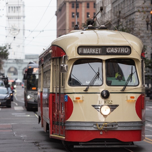
Photo: F Market & Wharves historic streetcar making its way up Market Street from the Ferry Building to Castro.

Photo: F Market & Wharves historic streetcar making its way up Market Street from the Ferry Building to Castro.

To support San Francisco’s economic recovery and reopening as tourism returns, the SFMTA will bring back the long-awaited F Market & Wharves historic streetcars on Saturday, May 15, between Fisherman’s Wharf and Castro and Market streets seven days a week.

SFMTA staff worked closely with Castro Merchants, SF Travel, Community Benefit Districts including Mid Market, Yerba Buena, Fisherman’s Wharf, Castro Upper Market, as well as district Supervisors and other key stakeholders in the effort to bring the F Market & Wharves back into service in time for the summer season. The F Market & Wharves is popular with tourists and visitors and is a priority for small businesses along Market Street and the Embarcadero.

Photo: One of SFMTA’s historic F Market & Wharves streetcars on display in the Castro.

Photo: One of SFMTA’s historic F Market & Wharves streetcars on display in the Castro.

Service Hours

With resources enabling a single daily shift, stakeholders were invited to select the specific hours of operation for the restored line. Based on their choice, trains from Castro to Fisherman’s Wharf will run from approximately 11 a.m. to 7 p.m. Return trips from Fisherman’s Wharf to Castro, will run from  12 p.m. to 8 p.m.

Read more about the full route and stops.

When Better Market Street begins construction, we plan to continue to run the F Market & Wharves full route as a combination of historic streetcar service and bus shuttle. The project team is exploring ways to limit construction impacts and will continue to work closely with businesses to support F Market & Wharves service.

Additional Rail Service Returning

On May 15th we will also reopen all Muni Metro subway stations. Full rail service will be restored on the N Judah between Ocean Beach and Caltrain. The combined KT Ingleside-Third will operate between Sunnydale and Balboa Park, through West Portal.

With the restoration of the F Market & Wharves, N Judah and KT Ingleside-Third on May 15th, the full Market Street corridor and several of the city’s major commercial hubs will have more service and connectivity. Since January 23rd, 91% of San Franciscans are now within 2-3 blocks of a Muni stop. And this includes 100% of residents in San Francisco’s neighborhoods identified in the Muni Service Equity Strategy.

Along with the Muni service being restored in May, we expect to be able to expand service so that 98% of San Franciscans will have access to Muni within 2-3 blocks by the end of the summer. SFMTA staff is working hard to support San Francisco’s economic recovery and reopening and the return of tourists, office workers and other visitors.


Published May 03, 2021 at 09:38AM
https://ift.tt/3tddCcP