Tuesday, 13 December 2022

New T Third Route in Central Subway Starting January 7

New T Third Route in Central Subway Starting January 7
By Mariana Maguire

Map showing the new alignment of the T Third to Chinatown-Rose Pak Station, connecting from 4th and King streets and continuing north to Central Subway; existing Muni Metro system's J Church, K Ingleside and M Ocean terminating at Embarcadero Station; the N Judah continuing along the Embarcadero to Caltrain at 4th and King streets.

New T Third service via Central Subway starts January 7 with service between Sunnydale and Chinatown-Rose Pak Station.

On Saturday, January 7, the T Third starts its historic new route, providing a direct Metro connection between Sunnydale and Chinatown-Rose Pak Station. Service runs Mondays through Fridays, 6 a.m. to midnight. every 10 minutes and Saturdays and Sundays, 8 a.m. to midnight every 12 minutes. The new T Third line vastly improves transportation to and from some of San Francisco’s most densely populated areas and major shopping corridors, expanding transit options and new connections.

The new T Third route will travel north to the new Central Subway from 4th & King platform. It will no longer turn onto King Street or run along the Embarcadero and the Market Street subway. Also, the K Ingleside will now travel between Balboa Park and Embarcadero Station.

New Connections

Customers traveling to stops along the Embarcadero, the baseball stadium at 2nd and King streets should transfer to the N Judah. Customers should transfer at Powell Station to Union Square/Market Street Station for the T Third going to Sunnydale.

To transfer to the new T Third at Union Square/Market Street Station from the J Church, K Ingleside, M Ocean View, N Judah or BART at Powell Station, you can connect entirely underground. From the Powell Station platforms, take the elevator or follow signs to concourse level, then follow signs to Union Square/Market Street Station.  

Customers on the T Third connecting to other Muni Metro routes or BART should follow signs on the Union Square/Market Street Station platform toward Stockton/Ellis streets.

Navigating the Union Square/Market Street Station

The new Central Subway stations have many new features, including long escalators – the longest in the United States west of the Mississippi – and two glass elevators at every level for more accessibility.

Customers who need to use the elevators to the platform should bypass the fare gates near the street entrances at Union Square/Market Street Station. Instead, use the fare gates in the center of the concourse.

MuniMobile and Lifeline customers may use any fare gate at the Union Square/Market Street Station.

Special Chase Center Event Service

During events at Chase Center, the SFMTA will run special event service about every 10 minutes in addition to normal T Third service. The additional special event trains – with “S Chase Center” head signs – will serve all stops between Chinatown-Rose Pak Station and UCSF/Chase Center. From end to end the ride takes only 20 minutes. Best of all, your event ticket is your Muni fare. No additional Muni fare needed!

Customers traveling past Chase Center during this special event service should check train head signs and only board “T Third” trains for a one-seat ride to their destination.

We know new T Third service in the new Central Subway is a big change that will take time to get used to. We’re here to help! Stay tuned for helpful wayfinding guidance and orientations, and check out our Frequently Asked Questions for helpful commuting tips.

Send us your questions at TellMuni@SFMTA.com so we can help you navigate better and become a Muni Metro pro!


Published December 13, 2022 at 12:29PM
https://ift.tt/KVWzuQx

Friday, 9 December 2022

Public Artwork Unveiled Inside New Station in Yerba Buena

Public Artwork Unveiled Inside New Station in Yerba Buena
By Enrique Aguilar

Have you had a chance to explore the Central Subway's new stations? Special weekend service is Saturdays and Sundays, from 8 a.m. to 12 a.m. midnight, through the end of the year. Ride the trains and be mesmerized by beautiful artwork at each new station. 

Muni customers will encounter public art when using the four new Central Subway stations to reach their destinations. The art was commissioned by the San Francisco Arts Commission and funded by the City’s Art Enrichment Ordinance, which allocates 2% of the total eligible costs of public works projects for public art. Public art helps draw out the identity of a space, aids in understanding a neighborhood's historical or cultural significance, and builds a connection between the visitor and surrounding community. 

The Yerba Buena/Moscone Station includes artwork by Catherine Wagner, Leslie Shows and Roxy Paine. The installations can be found on the station's surface and concourse levels. 

  • Catherine Wagner transformed photographs she took in the late 1970s that document the monumental construction of the George Moscone Convention Center, and focus on ideas of transformation. Titled Arc Cycle, the artwork reproduces several iconic images from this photographic series, translating them into laser-etched granite at the concourse level, and art glass at the station’s entry.  

  • Leslie Shows created Face C/Z, installed in the ticketing hall on the concourse level. Based on an image of iron pyrite made with a consumer grade scanner, the artwork was hand fabricated in a unique style combining mirrored, fused, painted, and engraved glass, sheet metal, and other permanent materials The pyrite (or "fool's gold") image speaks to ever-shifting notions of value in industry and aesthetics, the many historical "gold rushes" of California, and the idea that anything might be made valuable under the right circumstances.  

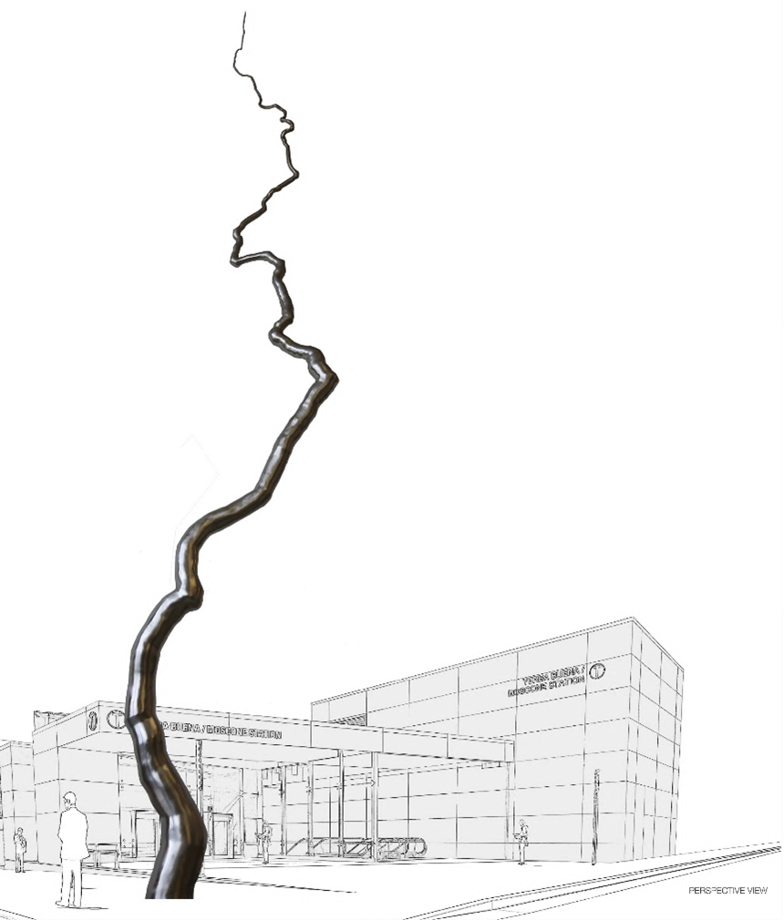
  • Roxy Paine created a monumental, 110 feet tall sculpture for the public plaza at 4th and Clementina streets outside of the station. Titled Node, the artwork is conceived to emerge from the complex manmade structures existing beneath the sidewalk, including the subway, communication networks, electrical and water supply, and waste systems that are all lifelines of a functioning city. According to Paine, the sculpture is "an elegant line connecting earth to sky, people to underground systems, and sculpture to city." Node is expected to be installed in early 2023. 

Rendered image of an art node piece in front of a building with a person in the foreground

Mockup of art installation on the station's plaza

Watch an interview video with artists Leslie Shows and Catherine Wagner to learn more about their inspiration for their work on display at the new Yerba Buena/Moscone station. A special thank you to the San Francisco Arts Commission for making public art possible at the four new stations. 

Full revenue service will begin January 7, Monday through Friday, 6 a.m. to midnight and Saturdays and Sundays, 8 a.m. to midnight. 

Stay tuned for additional blogs showcasing public art at the other new Central Subway stations. 

For more artist information:


Published December 09, 2022 at 03:35PM
https://ift.tt/SnQGkNW

Hop Onboard Muni and Enjoy Downtown Union Square

Hop Onboard Muni and Enjoy Downtown Union Square
By Pamela Johnson

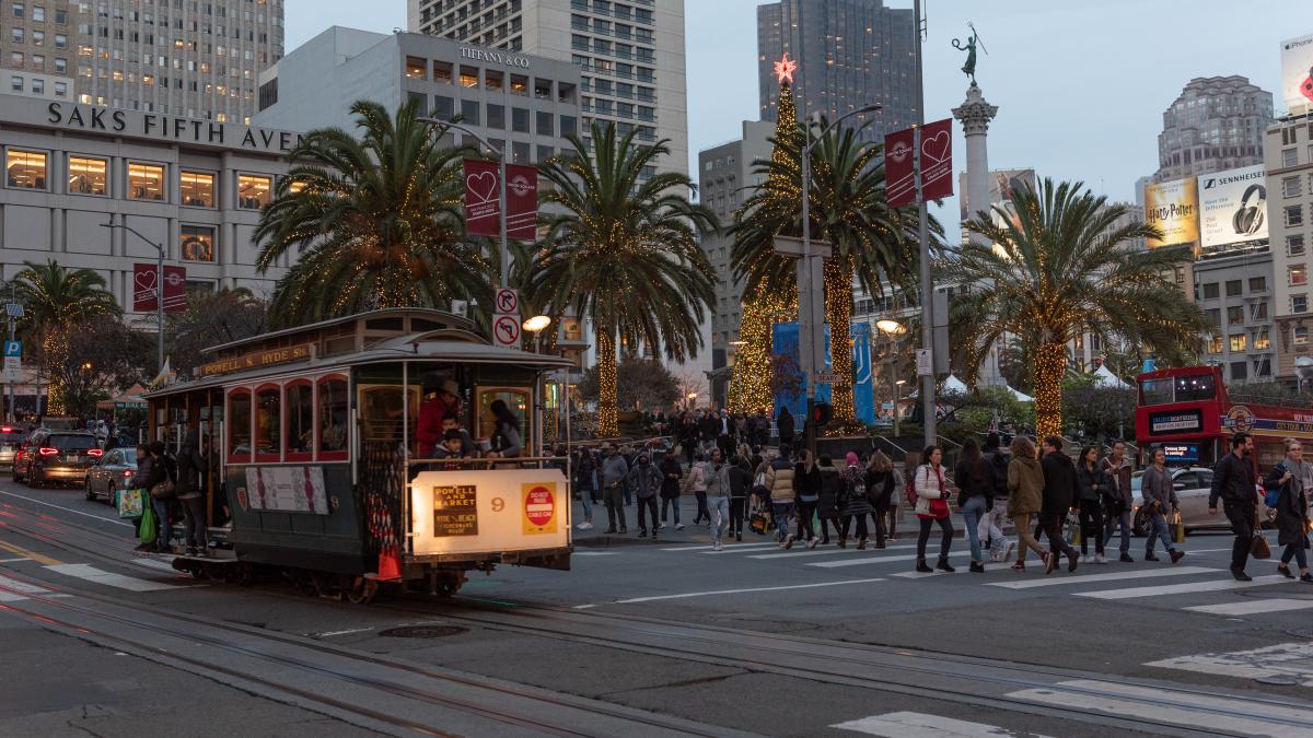
A filled Cable Car at a busy intersection in Downtown San Francisco decorated in holiday festivities with dozens of shoppers and vehicles

The iconic Cable Cars are just one of the many options to get you to all the holiday festivities in Downtown Union Square!

The SFMTA would like to wish you a Happy Holidays! With festivities, dining, shopping and all the many holiday activities to choose from, Downtown Union Square, much like the rest of the city is making optimistic strides in the city’s economic recovery. Catching Muni, paratransit or a taxi to downtown supports small businesses and is a big boost to our transit goals. Below is a comprehensive list of transit and parking options to head into the heart of the downtown shopping and festivities this holiday season.  

Central Subway Special Weekend Shuttle 

Muni Metro Light Rail  

Muni Bus Lines 

Cable Cars 

  • Invented here nearly 150 years ago and named a National Historic Landmark in 1964, hop on any of our beloved world famous Cable Cars this season. Be sure to lookout for several Cable Cars decorated in the spirit of the holidays by our dedicated and talented staff. Passengers will travel up and down the hills of San Francisco in this annual holiday tradition.  

Additional Services  

  • Free One-Hour Parking at Union Square Garage - the Mayor will be providing one-hour of free parking at our Union Square garage through the end of the year, regular posted rates apply thereafter. All facilities have increased staffing and security, restriped its parking spaces, and upgraded much of its overhead lighting, to make parking easier and safer this holiday.   

  • Additional SFMTA parking garages - Ellis O’Farrell, Sutter-Stockton and Fifth & Mission / Yerba Buena 

  • If you drive, parking in a city-owned garage may be the way to go. And parking rates at city-owned garages are typically 40% less expensive than parking prices in privately-owned garages.  

  • Taxi - with knowledgeable and trustworthy drivers, save some gas and catch a taxi. You’ll not only ride in a clean and safe vehicle, your taxi can use our red transit-only lanes to get to your destination quicker. And since November 9, the Taxi Upfront Fare Pilot Program has been helping customers book a taxi trip through a taxi e-hail app and pay a flat-rate, upfront fare.  Being able to request a taxi through approved third-party apps provided customers with upfront information about their fares, relieve meter anxiety and allow customers to price shop for similar on-demand services.

  • Essential Trip Card - older adults, people with disabilities and other eligible participants can benefit from this discount program paying 20% of the cost of a regular cab. Don’t forget our Shop-a-Round program, a convenient, low-cost shuttle that makes it easier to go grocery shopping for all your holiday meals. The shuttle takes groups of riders to grocery stores or supermarkets in San Francisco where they want to shop. The service offers registered older adults and people with disabilities personalized assistance that is not available on Muni bus and rail lines. 

  • SF Paratransit - is a van and taxi program for people unable to independently use or access public transit because of a disability or disabling health condition. Participants may also use their Essential Trip Card for this service.  

For real-time updates, follow us on https://twitter.com/sfmta_muni or visit SFMTA.com/EmailText to sign up for real-time text messages or email alerts. 

For details of Muni re-routes, visit SFMTA.com/Updates. This website will be updated when it is closer to the event date. 

For additional notifications and agency updates, subscribe to our blogs, daily or weekly updates. 


Published December 09, 2022 at 10:20AM
https://ift.tt/dDzhng9

Thursday, 8 December 2022

Riders are Feeling the Difference on Geary

Riders are Feeling the Difference on Geary
By

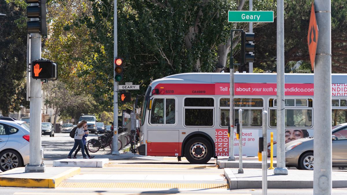
Image of 38 Geary bus and new improved crosswalks on Geary Boulevard

The results are in: the Geary Rapid Project has delivered a faster, more reliable bus trip and a safer street, according to the SFMTA’s recently published evaluation report for the project.  

A faster, more reliable bus ride 

One out of every ten passengers stepping onto a Muni vehicle will ride on Geary Blvd., which makes reducing travel time on the corridor a key piece of improving transit in the city. The transit lanes installed as part of the Geary Rapid Project protect buses from traffic congestion, while smarter traffic signals allow buses to get green lights more often. Similar transit upgrades have been made across the city as part of the Muni Forward program, making your next San Francisco destination closer than ever. 

Transit travel time improved after the quick-build phase of the Geary Rapid Project in late 2018 and early 2019, and again after the full project was completed in 2021 — with savings as great as 18%. Westbound travel times generally improved the most — up to 3.6 minutes during the PM peak — providing a daily 38R Geary Rapid rider 18 hours of savings per year. Although the biggest time savings were seen during commute hours, with 36,000 riders traveling on Geary around the clock each day, even smaller gains outside of peak hours adds up to major travel time savings for all Geary riders combined.  Travel time reliability also improved up to 37%, which means that the time spent waiting for the next bus is more consistent. 

A safer street  

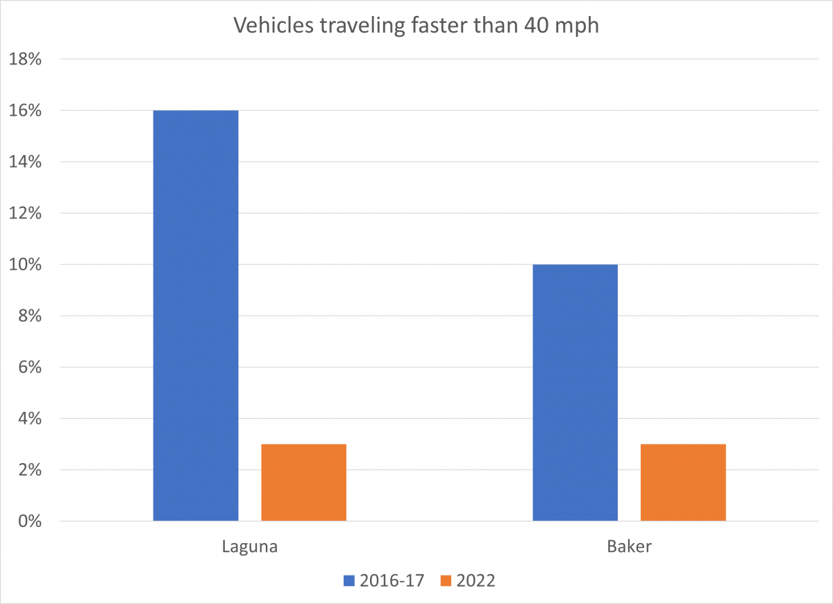
Reducing Muni-involved collisions is critical to protect our passengers and operators. It also keeps Muni service running smoothly; even non-injury collisions cause buses to be taken out of service. Adding dedicated transit lanes on Geary Boulevard has substantially reduced the rate of Muni-involved collisions on the corridor. The collision rate of 38/38R buses decreased by two-thirds and is now about half that of the current citywide Muni bus collision rate. Several years of data will be necessary to fully evaluate the project’s impacts on reducing traffic collisions in general. But one promising indicator is that there was a 70-80% reduction in vehicles traveling over 40 mph (more than 5 mph over the speed limit). A suite of improvements to calm the “expressway” section of the corridor, including a reduction in general-purpose travel lanes to two per direction, new crosswalks, narrower travel lanes and bulb-outs (sidewalk extensions) were implemented to encourage people driving to slow down. 

Graph comparing the share of vehicles traveling faster than 40mph before and after the Geary Rapid Project was implemented. At Laguna Street, speeding rates dropped from about 16% to 3% of vehicles. At Baker Street, speeding rates dropped from about 10% to 3% of vehicles. Before counts were taken in 2016-2017. After counts were taken in 2022.

Comparison graph of 40 mph travel speeds before and after the Geary Rapid Project. 


Keeping transit lanes clear 

One of the final portions of the project was painting the transit lanes red. This “red carpet” treatment makes it easier for drivers to know where they’re allowed to drive. When we make transit lanes extra clear with red paint, drivers are less likely to get a citation for unintentionally driving in a transit lane. Previous SFMTA studies showed that the number of private vehicles illegally using transit lanes declines about 50% when the lanes are painted red. Sure enough, the number of vehicles entering the lanes on Geary dropped by 47% from 2019 to 2022, even as traffic congestion returned after COVID restrictions eased (vehicles driving legally in the transit lane to turn right or access curbside parking or driveways were not included). 

The full evaluation report is available on the SFMTA website and covers several additional metrics, including street space allocation, Muni customer experience and parking availability. 

The success of the Geary Rapid Project has informed the final design for the second phase of upgrades, the Geary Boulevard Improvement Project, which proposes to expand these improvements west into the Richmond District.  

A photo is worth a thousand words to show the improvements made on Geary Boulevard. These birds-eye shots provide representative examples of the street design on Geary before (August 2018) and after implementation (February 2022) of the Geary Rapid Project.


Published December 08, 2022 at 02:02PM
https://ift.tt/MbdDK28

Shared Spaces are Here to Stay. Permit Renewals are Due January 15, 2023.

Shared Spaces are Here to Stay. Permit Renewals are Due January 15, 2023.
By Anne Yalon

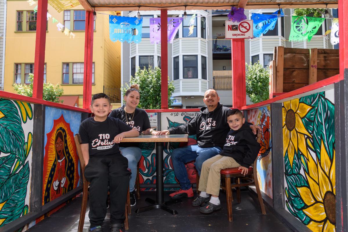
A family shown sitting in a colorful outdoor dining booth.

Shared Spaces, amongst many other benefits, allows our residents and families to enjoy safe and social outdoor dining. Seen here are the the owners of Tio Chilo’s Grill and their children in the restaurant’s parklet on 24th Street in the Mission. 

San Francisco’s popular Shared Spaces program allows merchants, restaurants and arts and culture organizations to use the curbside, sidewalk and other public spaces to conduct local business activities and stay afloat. What emerged as an economic lifeline during the pandemic is making San Francisco’s streets more energized, engaged and activated.

Many of the Shared Spaces parklets have become central gathering places for the local community. “Our parklet makes me feel like when I go to Mexico, where outdoor seating is everywhere. People end up joining their friends in our parklet. It is a space for our customers and our community," said Liz Vazquez, owner of Tio Chilos Grill. Ray Bair, owner of Cheese Plus, said, "My Shared Space has been a community gathering space. It's an ideal location because we are on a corner. I go out to it every afternoon and see so many people from the neighborhood sitting and enjoying the space. It's so satisfying to see people using the space for what the Shared Spaces program was intended for."

Now, Shared Spaces is transitioning from an emergency initiative to a permanent program. In July 2021, the San Francisco Board of Supervisors unanimously passed legislation introduced by Mayor London Breed to make the Shared Spaces Program permanent. Permits from the pandemic-era Shared Spaces Program were extended to June 30, 2022 and then later to March 31, 2023. Parklet owners have until January 15, 2023 to renew their permits which, once approved, will go into effect on April 1, 2023.

The extension has allowed additional time for small businesses to make any necessary modifications to their shared spaces as they transition into a longer-term permit. Because many of the Shared Spaces were built very quickly, some of them need to be modified to meet the most up-to-date guidelines for safety and accessibility.

So far, 450 permit applications have been submitted for the long-term Shared Spaces program. San Francisco operators who want to keep their existing outdoor Shared Space beyond March 2023 need to renew their permits by January15, 2023. Permit holders wishing to end their existing Shared Space also need to notify Shared Spaces.

Parklet owners who are still deciding if a Shared Spaces permit will work for their business or need to modify their Shared Space to fit the city’s design guidelines can watch the 2-minute design guidelines videos. These videos explain how to make Shared Space safe and accessible for all. They focus on intersection safety and visibility, and emergency access for the fire department. Another video about disability access is in the works.

More information for parklet owners is available at these upcoming events:

Application and site plan workshop

When: Tuesday, Dec. 13, 2 p.m.-3:30 p.m

Where: The Crossing, 200 Folsom St. San Francisco. Register here.   

Who: Current parklet operators wishing to apply for a permit.

This interactive, in-person training will ensure that parklet operators and professionals designing and building parklets understand how to create a site plan and an application. Have a question? Bring your application and site plan with you and have our team of experts review it and provide feedback.  Please RSVP and submit your questions in advance here. The training will be 1 hour and 30 minutes in length, including a 45-minute Q & A.   

Parklet Design Training 

When: Thursday, Dec. 15, 9:30 a.m-11 a.m.  

Where: 49 South Van Ness, Room 136.egister here  
Who: Designers, builders and contractors of parklets.
This interactive, in-person training will ensure that professionals designing and building parklets understand design requirements and best practices for safety and accessibility at Shared Spaces parklets. Attendees will receive a certificate of attendance and will be listed on the program website as having attended the City’s training. Please RSVP and submit your questions in advance here. The training will be 1 hour and 30 minutes in length, including a 30-minute Q & A.  

Roadway Closure application and site plan workshop

When: January (check the Shared Spaces website for updates)

More information is available on the Shared Spaces website. To see photos of parklets and featured parklet owners, check out Shared Spaces on Instagram and Twitter.

The SFMTA is proud to help operate the program in partnership with the Mayor’s Office, Department of Planning, Department of Public Works, Digital Services, Entertainment Commission, Office of Economic and Workforce Development, Mayor’s Office on Disability, 311, Department of Technology, Public Utilities Commission and Fire Department.


Published December 08, 2022 at 12:06PM
https://ift.tt/6KdYpsI

Wednesday, 7 December 2022

Slow Streets are Here to Stay—Here's How to Use Them

Slow Streets are Here to Stay—Here's How to Use Them
By Eillie Anzilotti

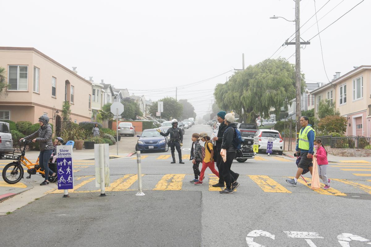
.Children, parents and a bicyclist seen crossing in the crosswalk with a police officer guiding traffic

Slow Streets provide safe travel for children, families, wheel users, older adults, persons with disabilities and the entire community

The success of Slow Streets depends on everyone working together to keep these spaces safe and joyful. 

On Tuesday, December 6 the SFMTA Board of Directors approved an ongoing, post-pandemic Slow Streets program for San Francisco. That means that Slow Streets are here to stay!  

We recognize that there are a lot of questions about how to use Slow Streets. To answer them, we created a fact sheet in English, Spanish, Chinese, Russian, and Filipino. You can find that fact sheet linked here. 

The main thing to remember is: Everybody is welcome, and please go slow! 

Slow Streets create safe corridors for people who prefer not to drive, while preserving parallel arterial streets for vehicles. On Slow Streets, kids can walk and bike themselves safely to school, families can run errands together by bike, and people with disabilities can find safe spaces to navigate their communities.  

Whether you are walking, rolling, riding a bicycle, or driving, please watch out for and be kind to your fellow Slow Street users. These streets are community spaces, and basic decency and consideration will go a long way. 

In general, we ask that communities make sure Slow Streets can still function as active roadways. That means keeping decorations out of travel lanes, and not adding any hard-to-move items, like furniture, to the streets. If you want to host an event that requires the full use of a street, the Slow Streets and the SFMTA Special Events teams are happy to help. Our program team is always available to discuss and respond to any of your questions. 

Since Slow Streets were first introduced at the beginning of the COVID-19 pandemic, they have created safe, shared community spaces on residential streets across San Francisco. Slow Streets are an essential part of how San Francisco will meet its Vision Zero and Climate Action goals. SFMTA data shows a drop in collisions on Slow Streets, which means they’re safer for all users. And having safer streets means more people are encouraged to bike, walk, and roll to get around.  

The program will be able to expand to meet community needs and contribute to a growing network of streets that are safe and welcoming to people of all ages and abilities. While the Board initially approved 16 corridors for inclusion, more will be added in the future. 

We look forward to expanding the program and offering more ways for communities to activate their Slow Streets. Keep an eye out for news and opportunities by subscribing for updates at SFMTA.com/SlowStreets! 


Published December 07, 2022 at 12:09PM
https://ift.tt/BpbtiV1

Wednesday, 30 November 2022

A Brief History of the T Third Part 1: 1860-2007

A Brief History of the T Third Part 1: 1860-2007
By Jeremy Menzies

Earlier this month, we launched free weekend shuttle service in the Central Subway. And come January 7th, our 4 new stations will connect directly to the rest of the T line from Sunnydale to Chinatown. Through this two-part blog series, we will look back at some of the history of the T from the 1860s to today!

In Part One, we’ll look over the first 150 years from the 1860s to the 2000s. Next month in Part Two, we will take a closer look at the history of the T and Central Subway projects leading up to today’s service. 

The Horsecar Era: 1860s-1890s 

Starting in the 1860s, transit service along today’s T Line was provided by horsecars. These were small rail cars (that looked much like a cable car) that were pulled along tracks by horses. Two companies, the Omnibus Railroad and the North Beach & Mission Railway, operated horsecar lines on parts of the path of today’s T. These lines were mainly meant to connect North Beach with the 3rd and 4th street corridors as far south as about Townsend Street. 

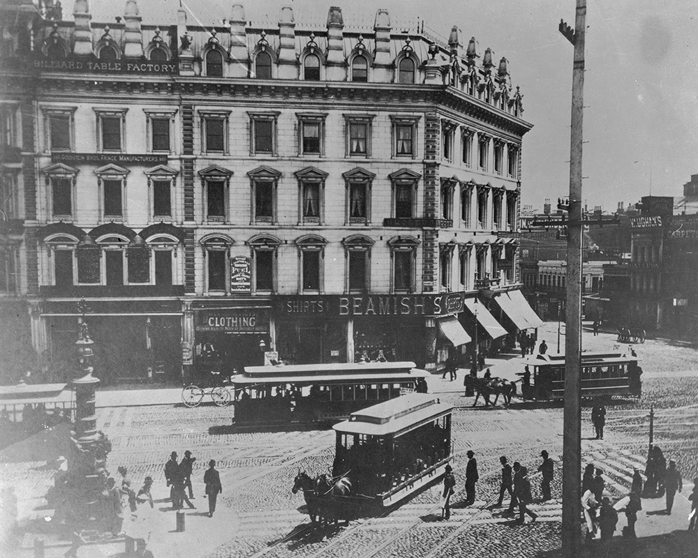
Image of a busy intersection from the 1890's with horse drawn streetcars, pedestrians and a department building are seen

This photo circa the 1880s shows the busy intersection of Kearny, Geary, 3rd and Market streets, looking south to 3rd.  In the foreground is a horsecar running up Kearny from 3rd. 

Further south on 3rd (then called Kentucky Street), horsecars were operated by the Potrero & Bay View Railroad. Here the route ran over two bridges across Mission Bay and Islais Creek (known as “Longbridge”), ending near today’s 3rd & Gilman. This route served the industrial heart of San Francisco and opened up development in the Bayview but was not very profitable because of its length. 

The Electric Streetcar Era: 1890s-1940s 

The 1890s marked the dawn of the electric streetcar era in San Francisco. A new technology, electric-powered cars could carry more people over longer distances faster than both horse and cable cars. On top of that, they were cheaper to operate and increased profit potential for transit companies. 

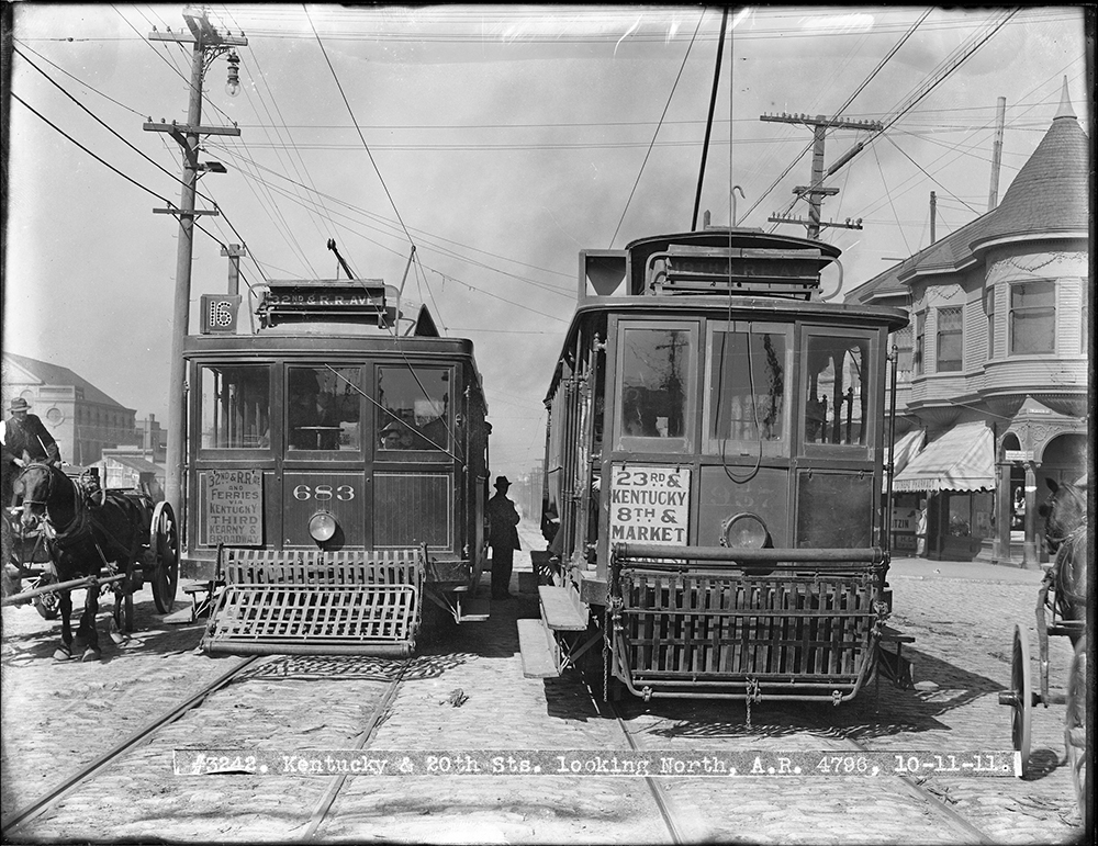
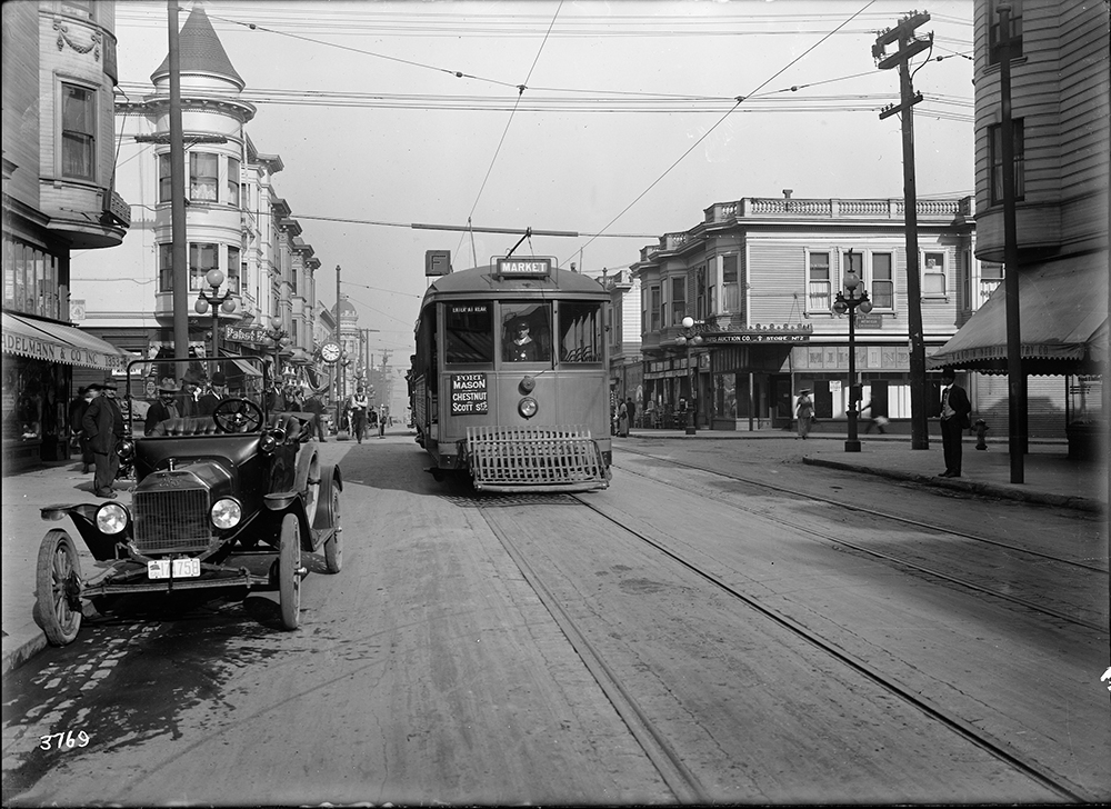
Two streetcars from 1911 shown with a person seen in the middle as well as a horse drawn carriage on the side

This 1911 photo shows two cars passing at 3rd (Kentucky) and 20th streets. On the left is a 16 Line car running to its terminal in the Bayview. At right is a 30 Line car heading north to 8th and Market. 

In 1894, the first electric streetcar line began operating along parts of today’s T Line. Known as the 3rd & Kearny Line, it followed much the same route as the early horsecars from North Beach to the Southern Pacific Railroad Depot on Townsend Street. It was extended into the Bayview to 3rd and Palou and eventually was reformed into the 15, 16, and 29 Lines. Each of these served a different portion of the corridor covering differing needs of riders travelling through downtown or all the way out to the Bayview. 

An old streetcar seen on the mainline with a few parked vehicles along the sidewalk and sundry stores in the background

A Muni F Stockton streetcar passes Vallejo Street in this photo from 1916. 

Muni’s first streetcar line to serve a similar route to the Central Subway portion of the T was the F Stockton, which opened for the 1915 Panama Pacific Exposition. The F Line ran along 4th and Stockton streets to serve South of Market, Union Square, Chinatown and North Beach before heading out to end at Chestnut and Scott streets. 

Buses along the Bay: 1950s-2000s 

Following World War II, the 3rd Street corridor was among the many that saw transit service shift from streetcars to buses. By 1951, the 15 Kearny route served much of the area once covered by the 15, 16, and 29 streetcar lines.  

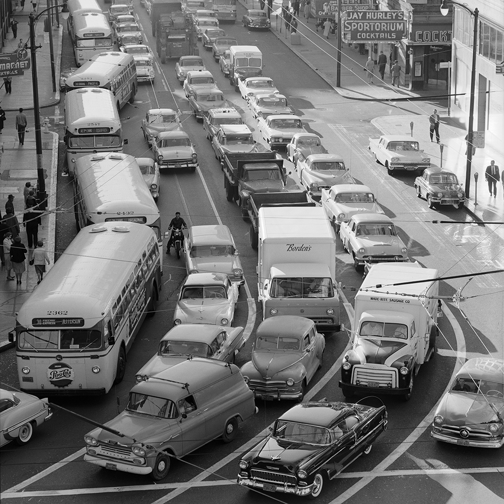
Cars and buses seen traveling during the busy commute on a congested street.

Buses on the 30, 15 and 42 fight the morning rush northbound on 3rd Street in this 1959 photo. 

Traveling along portions of today’s 8 Bayshore and T Third, the 15 route went from Powell and Jefferson streets all the way to Geneva and Mission. Eventually, it was extended to City College on Ocean Avenue. While not the only route to serve the area, the 15 carried the bulk of the load for people wishing to travel along this corridor. 

On Stockton Street, the 30 Stockton bus took over for the F, following the same route through Chinatown, Union Square, and South of Market to 4th and Townsend streets. 

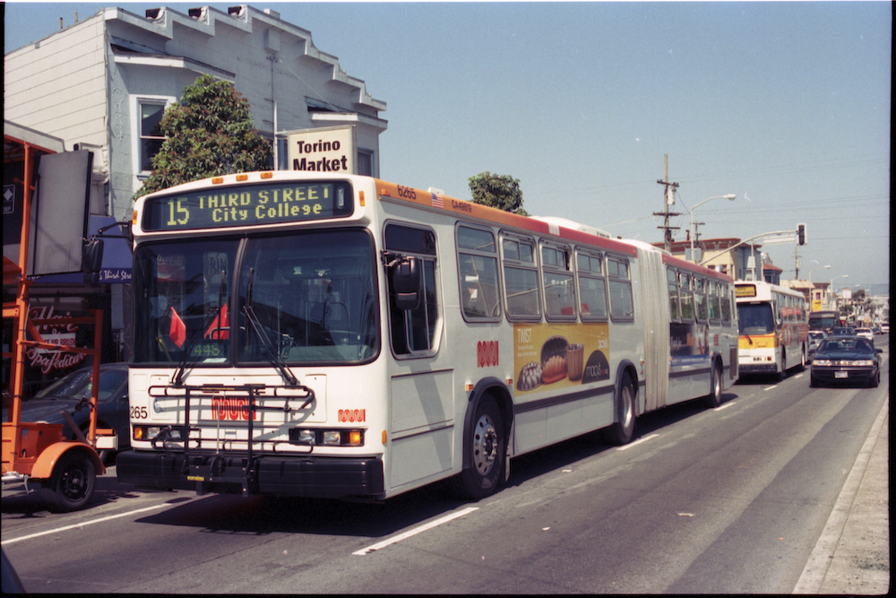
An articulated bus and coach seen traveling on a busy street

Many long-time riders will recognize this view of a 15 bus on 3rd & Palou. Discontinued with the opening of the T Line in 2007, the 15 was revived as the 15 Bayview-Hunter’s Point Express in 2021.  

Tune in next month for a closer look at the history of the T Third and Central Subway Projects. 


Published November 30, 2022 at 04:08PM
https://ift.tt/FiMCBzu