Friday, 31 January 2020

Vision Zero: Monthly Highlights

Vision Zero: Monthly Highlights
By

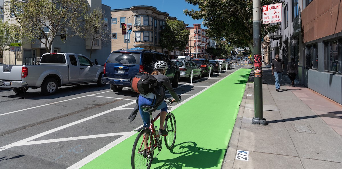
freshly painted bike path on Valencia

Vision Zero SF is the City’s road safety policy that will build safety and livability into our streets, protecting the one million people who move about the City every day.

From education to traffic engineering, from enforcing traffic laws to changing public policy, Vision Zero SF is driving an agenda to change the way we think and act on San Francisco streets.

This month, we’re featuring some improvements to benefit motorcyclists, bicyclists and pedestrians. Here is a list of what we’ve been working on this past month:

  • New daylighting treatments
  • Speed enforcements on the High Injury Network
  • New bike lanes for the Indiana Street Bikeway Project


Published January 31, 2020 at 10:54AM
https://ift.tt/2S9KS43

Thursday, 30 January 2020

An Ever-Changing Market Street

An Ever-Changing Market Street
By Jeremy Menzies

As we look towards a new future for Market Street under the Better Market Street Project, here's a brief look back in history at Market Street from the 1850s to 1970s.

From muddy cart tracks and plank walkways to wide brick sidewalks, transit lanes and bikeways, Market has been the ever-changing heart of our city since it was established in the mid 1800s.

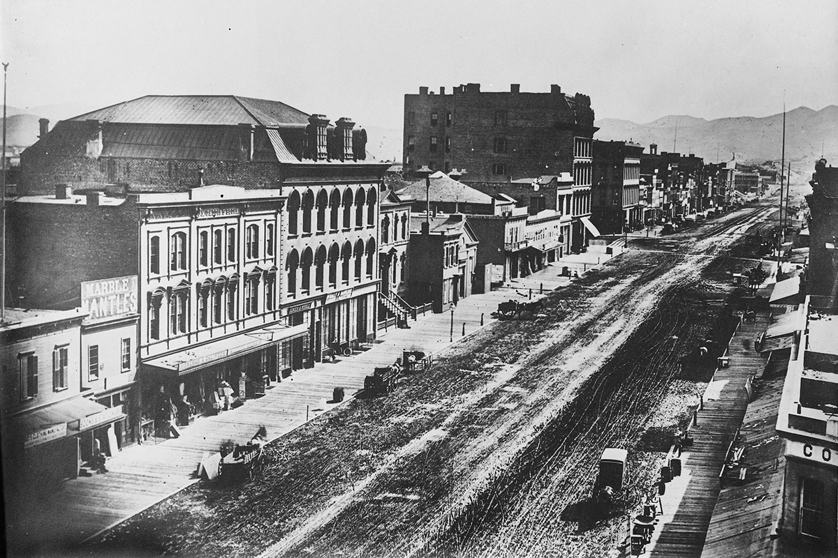
photo of muddy market street circa 1856

First surveyed in 1847 by Jasper O'Farrell, Market Street was laid out in part to provide a transition between the two opposing street grids north and south of Market. Planned as the city's widest street, Market was meant to be San Francisco's main boulevard and quickly became one of the busiest thoroughfares in town. The photo above was taken circa 1856 looking west from 3rd Street, a time when downtown looked more like a small town than a city.

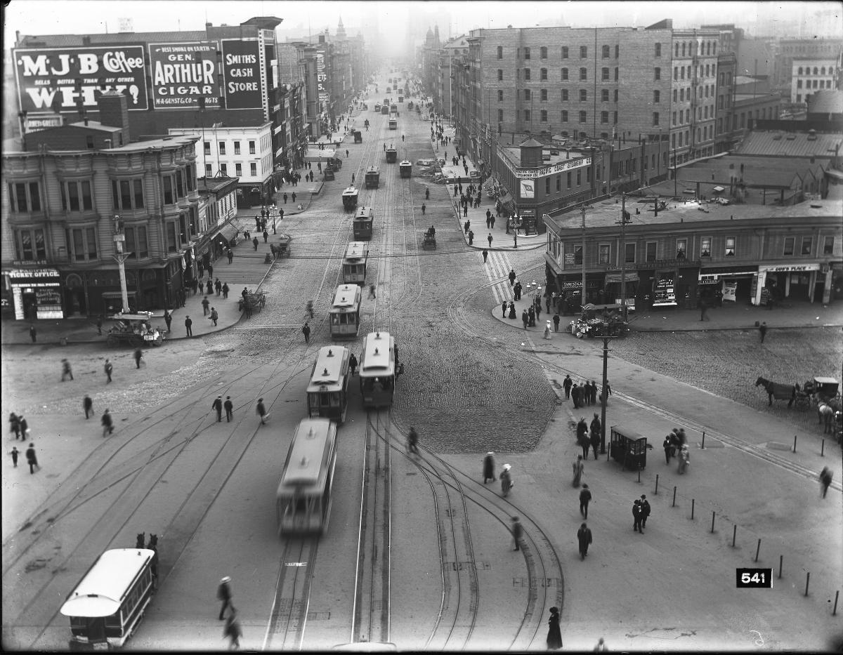
overhead view of cable cars on market street with pedestrians

Long before hybrid diesel buses and e-scooters, Market Street was home to multiple cable car and horse car lines that provided service along the corridor and connections to farther-flung destinations. Soon after their invention in 1873, cable cars grew to dominate public transit in the last decades of the 19th Century. This 1905 view was taken looking west from the Ferry Building during a peak time for cable cars on Market.

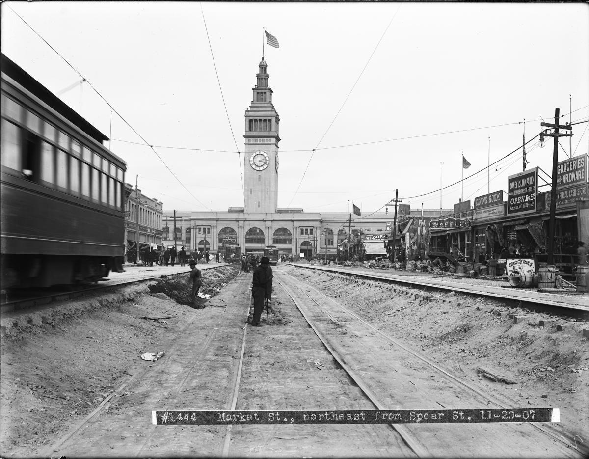
work men standing in sunken road with ferry building in background.

The 1906 Earthquake and Fire completely changed the transit landscape of San Francisco and marked a complete change to Market Street's role in our transportation network. Following the disaster, every cable car line was removed from Market and the street was reconstructed for faster, more efficient electric streetcar operation. This 1907 shot shows workers just west of the Ferry Building working on abandoned cable car tracks that would soon be buried under the pavement to make way for electric streetcars.

overhead view of streetcar traffic and people walking on market street

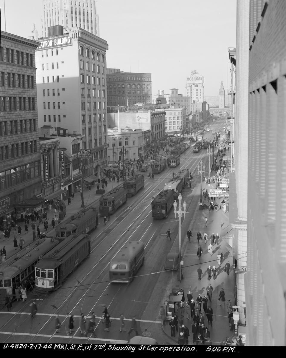
During the 1930s and '40s, four tracks of streetcar traffic (two inbound, two outbound) dominated Market Street. Dubbed "the roar of the four" due to the noise created by dozens of hulking streetcars plying the road. Transit was certainly king of the road during this period of high ridership.

traffic and people waiting for streetcars on market street

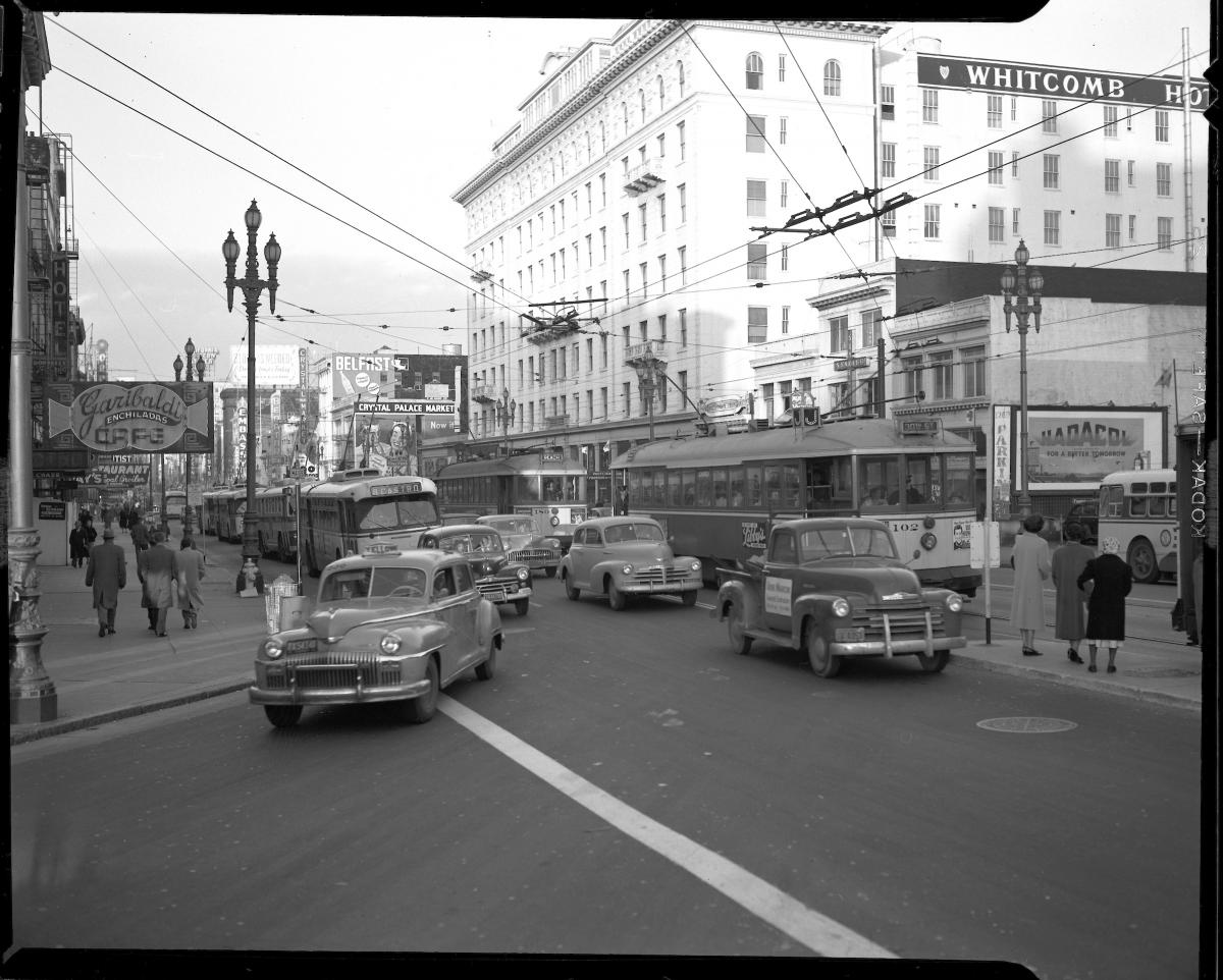
Following World War II, Market Street faced an increased traffic burden as personal car ownership climbed and transit ridership declined. Traffic on Market Street slowed down all travel modes and made for a hazardous pedestrian environment, especially during rush hours. Congestion became enough of a problem that in a 1963 report, City planners analyzed the possibility of moving all auto traffic off of Market and all streetcar traffic into an underground subway to rebuild the street as a pedestrian mall.

overehad view of construction of BART and Muni Metro tunnels on Market street

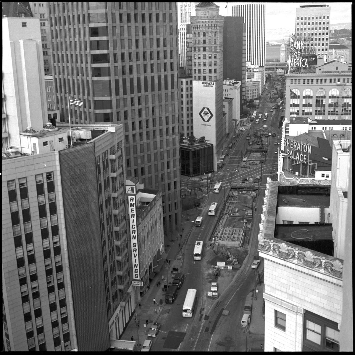
Perhaps the most significant change since 1907 came to Market in the 1960s and 70s with the construction of the Market Street Subway and BART tunnels and stations. Plans and proposals for a Market subway had been floated since at least 1912, but it wasn't until the BART proposal gained enough support to proceed that one version of that dream was realized.

Today, Market is transitioning to yet another incarnation of itself with more room for people walking, riding transit, and biking. Just one more chapter in the history of our city's most storied boulevard. Check out more photos of Market Street through the years on the SFMTA Photo Archive and follow us on Instagram!


Published January 30, 2020 at 02:56PM
https://ift.tt/318Mu2c

Wednesday, 29 January 2020

This Weekend: Magnolia Blooms and Lunar New Year at the Zoo

This Weekend: Magnolia Blooms and Lunar New Year at the Zoo
By Schad Dalton

Events: It's Super Bowl Weekend and with the 49ers making their first appearance since 2013 it is a relatively quiet weekend in the city. However, there are still lots of fun activities for those who aren't football fans. On Saturday evening, SF State University will host performances of Beethoven during the annual Yehuni Menuhin Seminar and Festival at Knuth Music Hall. Head over to the SF Zoo on Saturday to enjoy some special Lunar New Year-themed activities. For those feeling a little wintertime cabin fever, spring is just around the corner and there are some opportunities to enjoy the great outdoors, including a field trip of Lobos Creek Valley in the Presidio and the annual Magnolia Bloom at the SF Botanical Garden. Lastly, the Asian Art Museum free admission day is this Sunday (and every first Sunday of the month) in the Civic Center. Read more about our featured events below.

Magnolia Blooms in GG Park
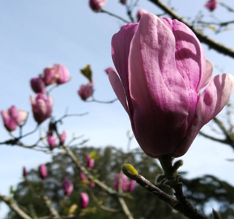
Check out the beautiful magnolia blooms at the SF Botanical Garden this Saturday in Golden Gate Park. Photo: torbakhopper/Flickr

SF Botanical Garden Magnolia Bloom

Saturday, All Day
SF Botanical Garden (Golden Gate Park)

The annual bloom of over 200 magnolia trees typically reaches its peak from mid-January through March and this weekend will offer a prime to to view the stunning natural display at the SF Botanical Gardens in Golden Gate Park. While the tree branches are generally rather bare, they make for a more visually dazzling relief as the magnolia buds bloom into pink, magenta, and white flowers that provide some of the first pops of color of the spring season. 


How to Get There on Muni: Riders may take the N Judah Line, as well as the 6 Haight/Parnassus, 7 Haight/Noriega, or 44 O'Shaughnessy routes to near the botanical garden.

Muni Service Notes: There are no planned service changes for this event.

Free SF Zoo Day for "Rats"

Saturday, All Day
SF Zoo

Are you thinking about visiting the zoo? Were you also born in the Year of the Rat? Then this Saturday has you covered with a free zoo day! If you or a loved one were born in 1936, 1948, 1960, 1972, 1984, 1996, or 2008, then admission to the San Francisco Zoo will be free in celebration of the Lunar New Year. In addition to the traditional zoo offerings, visitors this Saturday may also enjoy the Chinese lion and folk dance performances at 11 a.m. and 1 p.m.

How to Get There on Muni: Riders may take the L Taraval Line, as well as the 18 46th Avenue, 23 Monterey, 29 Sunset or the 57 Parkmerced routes to near the zoo.

Muni Service Notes: There are no planned service changes for this event.

Upcoming Events: Next weekend will host several large-scale events around town. As Spring Training draws ever closer, get an early baseball fix by swinging by Oracle Park for the annual Giants FanFest. Celebrate the Lunar New Year during the weekend-long Chinese New Year Street Fair, and don't miss the spectacular parade on Saturday evening. 

Remember that you can take Muni for the entire day for a single $5 fare. The new $5 Day Pass, available on MuniMobile®, is part of Muni’s recent fare changes. The pass is intended to encourage a safe, convenient way to pay your fare and quickly board Muni vehicles, which reduces overall travel time for everyone. The $5 Day Pass is Muni bus, rail and historic streetcars only.

“On Tap” gives you a heads up about the big events in town and what Muni routes and lines will get you to the party. Look for this feature to be posted usually on Thursdays for a look ahead to the weekend. Check out our Weekend Traffic & Transit Advisory for more details.


Published January 29, 2020 at 01:36PM
https://ift.tt/2O8hD0D

Tuesday, 28 January 2020

SFMTA Travel Decision Survey 2019

SFMTA Travel Decision Survey 2019
By Maia Moran

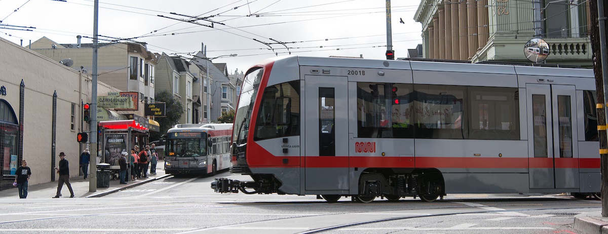
N Judah making a turn with a 6 coach picking people up

The SFMTA completed its biennial Travel Decision Survey which estimates mode share for travelers whose trips either began, ended, or were within San Francisco.  The mode share results from the 2019 Travel Decision Survey and other key data sources were shared at the SFMTA’s annual Board Workshop held on January 28. Sustainable trips are growing where investments are being made in our transportation network. Our Muni Forward Program is a great example of this, which we will explain in more detail. However, based on the overall direction that our mode share is trending, we need to do more to support accessible, long-term sustainable growth. The Travel Decision Survey indicates that the proportion of people choosing cars has increased. Less driving is fundamental to every one of our goals, making performance metrics like mode shift critical.

Mode share is a measure of the percentage of travelers using a particular type of transportation and is an indicator measuring how well San Franciscans can access their daily needs. Mode share is used to track progress towards Strategic Plan Objective 2.2: 80 percent sustainable trips by 2030.

Sustainable modes are defined as modes that support the city’s climate action goals and meet the long-term economic, social, and physical needs of the city. Because they directly support these goals, the SFMTA promotes walking, bicycling, and public transit, as well as those modes that complement their use. As mobility options shift and expand, trip categorizations have changed. In 2019, to align with the Strategic Plan, trips were categorized as sustainable or non-sustainable with the primary shift being TNC trips categorized as non-sustainable. For comparative purposes, all past data has been updated to reflect 2019 categories.

The Travel Decision Survey is a telephone survey conducted by research firm Corey Canapary & Galanis. Interviews of 840+ Bay Area residents took place from May through August 2019, capturing over 10,400 reported trips. The survey was conducted annually from 2012 to 2017 but switched to a biennial survey in 2017 to capture more significant changes in mode shift between survey administrations.

Key Findings

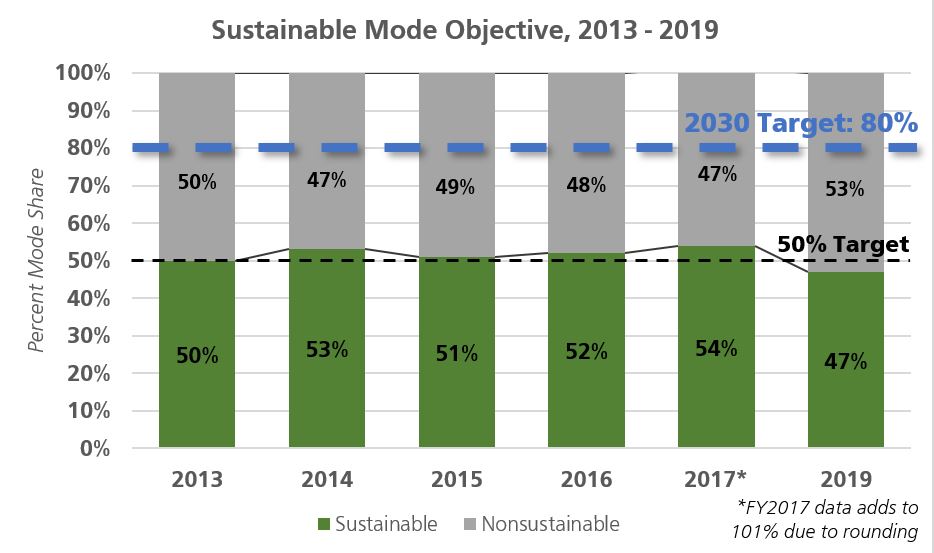
  • Sustainable mode share for all trips in 2019 is 47 percent, down from 54 percent sustainable mode share two years ago and below the 80 percent goal by 2030.
  • Compared to 2017, walking and transit mode share both decreased while the percent of all non-sustainable mode categories increased.
  • The number of raw trips taken in San Francisco has increased over time, based on Travel Decision mode share data and the SF-CHAMP model. From 2017 to 2019, the raw number of sustainable trips decreased, as well as the percent of sustainable trips.

Results

Mode Share & Trip Data

In 2019, sustainable mode share fell to below 50 percent. Between 2017 and 2019, sustainable mode share dropped from 54 percent to 47 percent. Key drops occurred in transit (4 percent decrease) and walking (3 percent decrease) mode share and there were increases across all non-sustainable options including TNC usage, carpooling, and driving alone. Biking has seen incremental increases in mode share but has remained generally steady when rounding for analysis.

Raw trip numbers have also increased, with total daily trips reaching over 4.46 million trips in 2019 representing an increase of 250,000 trips since 2017. When using raw trip numbers, non-sustainable modes increased by over 400,000 trips between 2017 and 2019 while sustainable mode dropped by 155,000 trips, indicating we are gaining non-sustainable trips more than we are losing sustainable ones. Total daily trip estimates are calculated using SFCTA’s latest SF-CHAMP model.

Sustainable mode objective 2013-2019 chart showing less than 50%

Income & Mode Choices

In addition to trip purpose and mode, the survey collected basic demographic data including age, income, race, and gender. Respondents were given the option to decline to respond to demographic questions so demographic analysis does not represent a complete picture of the survey pool.

For surveying purposes and population representation, responses from within San Francisco were recorded by zip code and aggregated into five geographic zones based on proximity to downtown, travel behavior, and geography.

An analysis of responses by zone and income indicate that in general within San Francisco:

  • Lower-income brackets used sustainable forms of transportation with more frequency than higher-income brackets,
  • Geographic regions, particularly in the southern part of the city, with less access to higher densities of transportation options observed higher rates of non-sustainable mode share.

In the Bay Area at-large, sustainable mode use was higher at middle- and upper-income brackets.

  $35,000
or less
$35,001 -
$75,000
$75,001 -
$100,000
$100,001 -
$200,000
Over
$200,000
Total
San Francisco 59% 51% 46% 43% 44% 47%
Outside San Francisco 43% 51% 61% 48% 54% 51%
East Bay 50% 48% 68% 61% 68% 60%
North Bay 15% 79% 49% 41% 44% 44%
South Bay 39% 55% 22% 29% 39% 38%

Network Improvements

Though transit mode share dropped between 2017 and 2019, a closer look at ridership changes within transit reveals a more encouraging story.  

Over the past year, transit ridership has decreased nationally by 2 percent and regionally by 1 percent. While Muni ridership overall has decreased, Muni ridership has fared better and dropped with smaller margins than regional and national shifts.

Ridership has grown significantly where investments have been made in the transit system. Muni Rapid lines have seen significant positive growth as service improvements have been implemented and transit prioritization programs have expanded.

Mobility Report 2019

The 2018 Mobility Report is available here. For more information, please visit: Travel Decision Survey 2019


Published January 28, 2020 at 12:06PM
https://ift.tt/2Gsdy35

Monday, 27 January 2020

Director of Transportation Report: January 21, 2020

Director of Transportation Report: January 21, 2020
By

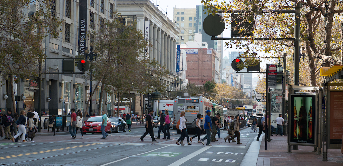
Pedestrians crossing Market Street

In this week’s Director’s Report from the SFMTA Board of Directors meeting, Jeffrey Tumlin gave updates on the following topics:

Vision Zero

  • Two fatalities since the last board meeting, both of which are also still under investigation making it too early to determine whether they are Vision Zero fatalities according to our Fatality Reporting protocol, but regardless we send our condolences to friends and families of each victim.
  • Rapid Response has been conducted for three severe injury crashes also under investigation by the San Francisco Police Department, but on 43rd and Fulton where a pedestrian was severely injured by a motorist, additional daylighting is being installed on top of the recent improvements such as larger, more visible signal heads.

Shared Scooter Permit Program Update

  • Permitted scooter companies were required to submit a plan describing their commitment to piloting adaptive scooters by Jan. 15. The pilot will continue through the course of the permit program.
  • “Adaptive Scooter” is defined as a powered shared scooter allowing access for people with various physical disabilities. The SFMTA does not require a specific vehicle type or service model. Permittees all submitted different vehicle design and service models.
  • Approximately 50 adaptive scooters will be available that include two and three-wheeled devices with the option to sit or stand.

Central Subway

  • Permanent power has now been provided to the Union Square Market Street Station in conjunction with PG&E.
  • The contractor is making substantial progress at all stations.
  • Request for Board approval will be forthcoming on key contract modifications necessary for substantial completion:
    • Automatic Train Control System
    • Closeout backlog of task order contract modifications
  • Substantial completion of the project remains for June 2020 with a revenue operations date of summer 2021.

Market Street Ribbon Cutting

  • Starting Jan. 29, Market Street will officially become car-free eastbound from 10th to Main and westbound from Steuart to Van Ness.
  • Market Street is home to half of the top 10 intersections for pedestrian and bicycle collisions.
  • Each year since 2014 the area averaged over 100 injury collisions per year - 75 percent of them involving people walking or biking.
  • Work to implement this change has already begun.

Our Board of Directors meeting is usually held on the first and third Tuesdays of each month. To watch the meeting in full, go to SFGovTV.


Published January 27, 2020 at 01:46PM
https://ift.tt/2Rwou5Z

Friday, 24 January 2020

This Weekend: Golden Gate Kennel Club Dog Show and Walk for Life

This Weekend: Golden Gate Kennel Club Dog Show and Walk for Life
By Schad Dalton

GG Kennel Club at Cow Palace
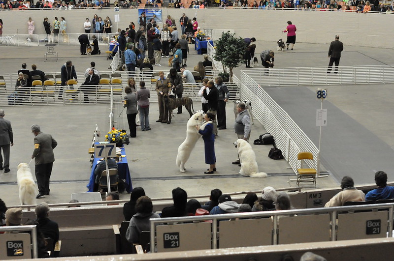
The Cow Palace will be for the dogs this weekend at the annual Golden Gate Kennel Club Dog Show at the Cow Palace. Photo: Flickr/aforonda

Golden Gate Kennel Club Dog Show

Saturday and Sunday, 8 a.m. to 5 p.m.
Cow Palace

The Golden Gate Kennel Club Dog Show returns this weekend to the Cow Palace and will feature 1.000 dogs from over 100 different breeds competing in the largest benched dog show on the West Coast. Anyone attending this event can meet and get to know the dogs (and their owners!) at the show at special benches organized by breed where you can learn more about the breeds, get training tips and more.

How to Get There on Muni: Riders may take the 8 Bayshore or the 9 San Bruno routes to the Cow Palace for this event.

Muni Service Notes: There are no planned service changes for this event.

Walk for Life

Saturday, 12:30 p.m.
Market Street East of Civic Center

The annual Walk for Life, which draws thousands of participants each year, will begin at 12:30 p.m. with a rally in the Civic Center/UN Plaza. At 1:30 p.m., the walk will move east on Market to Justin Herman Plaza.

How to Get There on Muni: Anyone interested in attending the march can get to the Civic Center via any Muni Metro line to Civic Center station, the F Market and Wharves Line, as well as the 6 Haight/Parnassus, 7 Haight/Noriega, 9 San Bruno, 14 Mission/14R Mission Rapid, 19 Polk or the 21 Hayes routes.

Muni Service Notes: The F Market and Wharves Line as well as the 1 California, 2 Clement, 5 Fulton, 6, 7, 8 Bayshore, 9, 10 Townsend, 12 Folsom/Pacific, 14/14R, 19, 21, 27 Bryant, 30 Stockton, 31 Balboa, 38 Geary/38R Geary Rapid, and 45 Union/Stockton routes will have reroutes during this event. Delays and extended wait times may be possible during the event.

Remember that you can take Muni for the entire day for a single $5 fare. The new $5 Day Pass, available on MuniMobile®, is part of Muni’s recent fare changes. The pass is intended to encourage a safe, convenient way to pay your fare and quickly board Muni vehicles, which reduces overall travel time for everyone. The $5 Day Pass is Muni bus, rail and historic streetcars only.

“On Tap” gives you a heads up about the big events in town and what Muni routes and lines will get you to the party. Look for this feature to be posted usually on Thursdays for a look ahead to the weekend. Check out our Weekend Traffic & Transit Advisory for more details.


Published January 24, 2020 at 09:39AM
https://ift.tt/38FQLwP

Thursday, 23 January 2020

Update: Car-Free Market Street and FAQ

Update: Car-Free Market Street and FAQ
By Phillip Pierce

As you may have already heard (or read in our previous blog post), starting on Wednesday, January 29 some of the busiest sections of Market Street are going “Car Free” to increase safety and improve Muni. That means no private vehicles will be allowed to travel along Market Street eastbound from 10th to Main or westbound from Steuart to Van Ness. Traffic will still be able to cross Market, but there will be no turns onto the street in the car-free area.  

Our crews are hard at work getting the street prepared and have already installed signs that will be unveiled on January 29th. In addition, we’ve created new pedestrian safety zones, added new loading zones and are extending the Muni lanes down Market Street. 
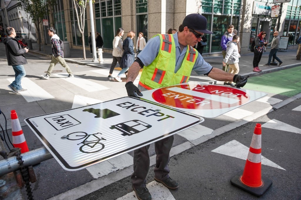
Crews installed signs along side streets in preparation for the changes on January 29. Most signs were put up and will be covered up (or “bagged”) until next week when the car free Market begins.
Crews installed signs alongside streets in preparation for the changes on January 29. Most signs were put up and will be covered up (or “bagged”) until next week when the car-free Market begins. 
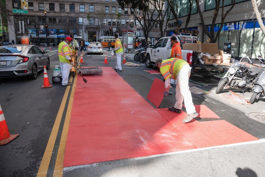
Red Muni lanes getting installed along 2nd Street near Market.
Red Muni lanes getting installed along 2nd Street near Market. As a part of the quick-build, Muni lanes are being extended east from 3rd to Main and on the last half-block of 2nd Street to improve transit in busy areas. 
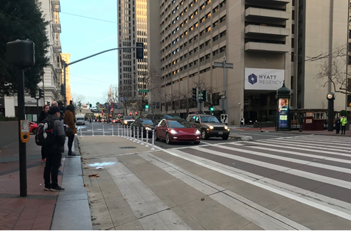
A new khaki-colored “painted safety zone” recently added at Drumm and Market will reduce conflicts and shrink street crossing distances for people walking.
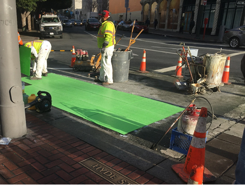
A new khaki-colored “painted safety zone” recently added at Drumm and Market will reduce conflicts and shrink street crossing distances for people walking. 

A new khaki-colored “painted safety zone” recently added at Drumm and Market will reduce conflicts and shrink street crossing distances for people walking.
A new bicycle turn lane and bike box getting installed at Hyde/8th Street.  In case you want to get into all the details, we compiled a set of some of our most frequently asked questions below. 

Frequently Asked Questions 

1. What is Better Market Street?  

Better Market Street is the City’s multi-agency project to transform 2.2 miles of Market Street – from Octavia Boulevard to Steuart Street – enhancing safety and accessibility, improving transit performance, replacing aging infrastructure, and revitalizing the corridor’s streetscape. The goal of the project is to revitalize Market Street and reestablish the street as the premier cultural, civic and economic center of San Francisco and the Bay Area while bringing the transit system up to date.   

There were 123 injury collisions on Market Street between Octavia and Steuart in the year 2018. Since 2014, there have been an average of more than 100 per year with 75 percent involving people walking or biking. You can find more info about the full Better Market Street project here.

2. What does “quick-build” mean? 

A quick-build project consists of parking and traffic modifications that are fast and relatively cheap to implement. Examples include painted safety zones, bike lanes, adjustments to parking regulations, parking and loading changes, changes to the configuration of traffic lanes. Crews typically use materials such as paint, traffic signs, traffic delineators, and traffic signal changes. Quick-build projects do not involve large capital construction elements since those involve much longer design, higher cost contracting, and construction phases.  

3. How many people use Market Street today? 

Market is our city’s busiest street for people walking, biking and riding transit. Currently, about 200 to 400 cars drive in the peak direction on Market Street during rush hour. These changes will require those cars to find an alternative route while benefitting all the people walking, biking and using transit: 

  • 500,000 people walk on Market Street daily.

  • 200 buses an hour during peak times.

  • 650 people per hour ride bikes on Market Street during rush hour.

  • 75,000 daily transit riders above ground.

4. What is going to change with the quick-build project and when?  

Better Market’s Vision Zero quick-build phase will start in January 2020 and includes: 

Beginning Wednesday, January 29th: 

  • Making Market Street car-free eastbound from 10th to Main, and westbound from Steuart to Van Ness. Vehicles will still be allowed to cross Market street at intersections. 

  • Similar car-free restrictions on Second Street (between Stevenson and Market) and Steuart Street (northbound between Mission and Market; southbound travel unchanged) to facilitate making Market Street car-free.

  • Peak hour loading restrictions on Market Street to reduce conflicts between people on bicycles, transit and commercial vehicles 

  • No southside loading in the eastbound direction (towards the Ferry Building) on weekdays between 6:00 a.m. to 9:30 a.m. 

  • No northside loading in the westbound direction (towards Twin Peaks) on weekdays between 3:00 pm and 7:30 pm.  

  • Prohibiting right runs onto Valencia from eastbound Market Street (Friday 1/31/2020) 

Completed: 

  • Over 100 new cross-street passenger and commercial loading zones to accommodate safe loading.

Ongoing through Spring 2020: 

  • Extending existing transit-only lane east from Third to Main Street, the segment of Market with the most transit service, and making it Muni-only (taxis and non-Muni buses will no longer be allowed).

  • Converting the existing red bus/taxi-only lane to Muni-only between 9th and 3rd streets.

  • Installing painted safety zones at eight intersections to make crossing the street safer and shorter.

  • Adding bicycle intersection improvements at Eighth, Page, Battery, and Valencia streets.

Beginning Summer 2020 and later: 

  • Changes to sections of Ellis and Jones streets near Market Street to improve safety and vehicle movement.

5. Where is the car-free area? 

Private vehicles will be prohibited on Market Street eastbound from 10th to Main and westbound from Steuart to Van Ness. The car-free area is shown in the red areas below along with other changes shown by blue arrows. 
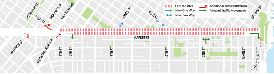
Map of Car Free Market traffic flow

6. Will I still be able to use Market Street to access Franklin and Gough?  

Yes. The Quick-Build phase-only restricts traffic east of 10th or Van Ness. The future capital project would extend the turn restrictions west to 12th Street, but will not affect access to Franklin or Gough.  

7. Will there be enforcement?  

San Francisco Police and SFMTA Parking Control Officers will be helping to call attention to the new restrictions and directing traffic.  Vehicles violating the restrictions could be cited for violating CVC 22101d (violating an official traffic control device) which carries a $238 fine and adds one point to a DMV record.  

8. What sort of outreach are you doing?  

Our teams have discussed various proposals with the community for years during the design phases for Better Market Street. We hosted 5 rounds of large public meetings, presented to dozens of groups and studied the corridor extensively. Outreach specific to the quick-build, car-free area included: social media, signs in parking garages, electronic signs on/above downtown streets, stakeholder meetings, multi-lingual flyers, door-to-door discussions, media stories, and messages on electronic NextBus signs in all Muni shelters. We also worked with all the app-based mapping companies to ensure they deliver accurate routes that avoid Market Street in the car-free area. 

9. How will Quick-Build improve accessibility? 

The private vehicle restrictions on Market Street and newly painted safety zones at select intersections will reduce pedestrian conflicts with vehicles.  We also have provided additional loading zones on cross streets – over 100 new loading zones, including 23 new white zones and 8 new blue zones. The vast majority of the loading zones on cross streets are for general commercial loading (unlike the ones on Market, which are restricted to six-wheel vehicle restrictions) and can be used for up to three minutes for passenger loading.  Maps of all the new and existing zones can be found here: SFMTA.com/BetterMarketStreet 

10. How much will it cost?  

The quick-build phase is estimated to cost approximately $3.5 million and is funded through local general funds.    

11. Which vehicles will be allowed after private vehicles are restricted? 

Transit, paratransit, taxis, commercial delivery vehicles and emergency vehicles (Transportation Network Companies such as Uber and Lyft are not permitted). All vehicles would continue to be allowed to access Franklin and Gough streets.  

12. Are there any exceptions for vehicles with disability placards? 

Vehicles with disability placards are not exempt from these restrictions unless they have commercial plates. It should be noted that there are not currently any blue zones or other legal parking available for vehicles with disability placards on Market Street, so Better Market Street does not add any new parking restrictions for people with disabilities.  

13. Will deliveries still be allowed on Market Street? 

Yes, as long as the delivery vehicles have commercial license plates. As is the case today, most of the loading zones on Market Street require vehicles to have at least six wheels (big trucks and buses). In addition, there will be new restrictions on deliveries during the peak-hours in the peak-direction to improve safety:  

  • Southside loading in the eastbound direction (towards the Ferry Building) would not be allowed on weekdays from 6:00 a.m. to 9:30 a.m. 

  • Northside loading in the westbound direction (towards Twin Peaks) would not be allowed between 3:00 p.m. and 7:30 p.m.  

14. How are you coordinating with Uber and Lyft and other Transportation Network Companies (TNCs)?   

TNCs are typically not commercial vehicles, and as such, they will not be allowed to drive on Market Street.  However, we have coordinated with Uber and Lyft to have the white zones added to their apps, so that passengers wishing to have a pick-up on Market Street will be redirected to the closest cross-street white zone for their pick-up.  

15. With cars no longer allowed to travel on Market Street, will traffic get worse on Mission Street and other parallel streets?   

We did extensive traffic modeling to understand the impacts of removing cars from Market Street. Currently, about 200 to 400 cars drive on Market Street during peak hours, depending on the block and direction.  Because streets north of Market and those in SoMa have grid layouts, people driving have extensive choices about which street to take, and will not all be diverted to the same street.  We anticipate about 100 cars per hour will be shifted to Mission Street, which will not significantly impact general traffic or transit on Mission Street. In addition, the turn restrictions will reduce congestion at intersections, as cars turning onto Market currently block traffic on cross streets as they wait for a gap in pedestrians crossing to complete their turn.  The turn restrictions will aim to improve traffic flow as well as pedestrian safety.  

16. When was the project approved?  

The Better Market Street project’s Environmental Impact Report was certified by the Planning Commission on October 10, 2019. The Public Works Hearing was held on October 11. The SFMTA Board approved the project on October 15, 2019.  

 17. Quick-Build is exciting, but when will the bigger construction project start?  

The capital project will be built in phases, with each of the five phases estimated to be $150-200M. Much of the costs are state of good repair work, including rail and trackway replacement, the overhead wire system, traffic signals, repaving, streetlights, sewer, and water.  Funding for Phase 1 has been secured through several existing local sources, including the voter-approved Prop A General Obligation Bond and Proposition K (formerly OBAG), as well as some federal funding through a BUILD transportation grant. The Better Market capital construction project is currently in design, with the first phase between 5th and 8th Streets anticipated to start construction in late 2020 or early 2021. We have more information on the full capital project construction and design available.


Published January 23, 2020 at 03:40PM
https://ift.tt/30OqbP4