Thursday, 30 September 2021

Late Night Metro and More J Church Service Starts October 2, 2021

Late Night Metro and More J Church Service Starts October 2, 2021
By Mariana Maguire

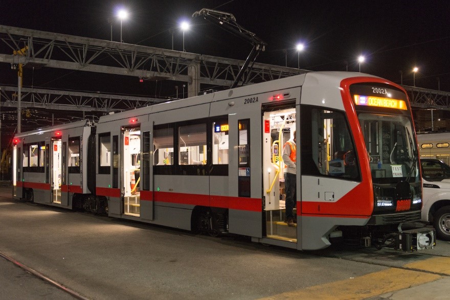
photo of train at night

Muni Metro train running a nightly route.

On Saturday October 2, Muni Metro service will be extended to run until midnight on weekdays and Saturdays due to an increase in evening demand, and to better align with BART late night service. Muni Metro will continue to operate until 10 p.m. on Sundays. The new Muni Metro hours will be:

  • Weekdays: 6 a.m. – 12 a.m.
  • Saturdays: 8 a.m. – 12 a.m.
  • Sundays: 8 a.m. – 10 p.m.

Last Metro trips on the KT Ingleside-Third, M Oceanview and N Judah will depart from their various neighborhood stops between approximately 11:30 p.m. and 11:50 p.m. in order to service the subway by midnight.

J Church Muni Metro service operating between San Jose and Geneva avenues and Church and Duboce streets will also be extended until midnight.

Please check schedules for last trip times for your Muni Metro line.

Frequency Improvements on J Church

In addition, the J Church will have frequency improvements to match the other metro routes frequencies as follow:

  • Weekday frequency improves from every 12 minutes to every 10 minutes
  • Weekend frequency improves from every 15 minutes to every12 minutes

Muni Metro Bus and Owl Service

Late night Muni Metro buses on the KT Ingleside-Third, M Oceanview and N Judah lines will continue to operate, in addition to train service, from 9 p.m. to 12 a.m. until further notice. Owl service on these routes will continue to run from midnight to 5 a.m.


Published September 30, 2021 at 01:26PM
https://ift.tt/3AXR1px

Wednesday, 29 September 2021

Last Chance - 2022 Muni Service Network Survey Closes October 1, 2021

Last Chance - 2022 Muni Service Network Survey Closes October 1, 2021
By Mariana Maguire

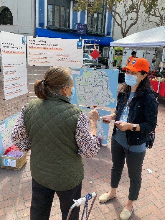
Photo of an SFMTA staffer talking to a customer

SFMTA staff talks with customer about 2022 Muni service options at farmer’s market pop-up event.

The SFMTA recently introduced three options for increasing Muni service in early 2022. We launched efforts to get community input on them, including a brief survey that closes Friday, October 1. If you haven’t taken the survey yet, there are still a few days left! You can find the survey link at SFMTA.com/2022Network.

We’ve received more than 4,000 survey responses so far and a few hundred calls to our hotline and feedback to our TellMuni@SFMTA.com email. You can also provide feedback on the shortened J Church route and changes to the 23 Monterey, 57 Parkmerced, 35 Eureka and 48 Quintara/24th Street by contacting TellMuni@SFMTA.com or 415.646.2005.

All three alternatives to increase Muni bus service in early 2022 have the same amount of total bus service – they’re just arranged differently. The “Familiar” alternative uses available resources to bring back the seven all-day Muni bus lines that have yet to restored since the pandemic began. The “Frequent” alternative instead uses the available resources to reduce wait times and crowding on Muni’s highest ridership lines (and does not restore those seven all-day bus lines). The “Hybrid” alternative aims to balance more routes and more frequency.

We’ve talked with over 30 stakeholder groups, a couple hundred attendees at our virtual meetings and several hundred more community members at tabling events and pop-ups in neighborhoods throughout the city.

Once our survey closes this Friday, our transit planners will use the input, paired with data that shows which lines are being used most and where ridership is highest, to develop a single proposal for increasing Muni service in early 2022. The proposal is expected to be ready in mid-October. We will also share details about how the survey results and other public feedback influenced the proposal.

After we release our proposal for early 2022 Muni service additions and changes, we will seek public feedback and refine the proposal in October and November. You will also have a chance to give input at upcoming open houses and office hours, by contacting TellMuni@SFMTA.com or 415.646.2005 and by taking our proposal survey in October.

The proposal for Muni service in early 2022 will be brought to the SFMTA Board for its consideration in December.


Published September 29, 2021 at 04:16PM
https://ift.tt/3uoUbzT

Friday, 24 September 2021

Residents Overwhelmingly Support Slow Streets

Residents Overwhelmingly Support Slow Streets
By Eillie Anzilotti
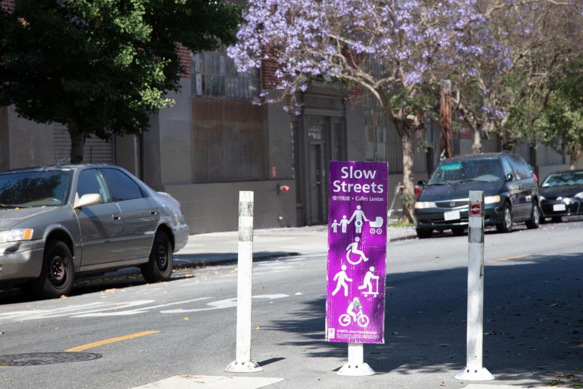
Photo of sign that indicates a slow street is in effect

After over a year of Slow Streets providing safe, low-volume corridors for people to walk, bike, play and travel during the pandemic, we’re excited to share our first comprehensive evaluation of the program. The key takeaway? San Franciscans are overwhelmingly in support of Slow Streets.

Slow Streets are designed to limit through traffic on certain residential streets and allow them to be used as a shared roadway for people traveling by foot and by bicycle. Since introducing Slow Streets in April 2020 in response to the Mayor’s Emergency Health Order, SFMTA has designated around 30 corridors covering 47 miles of roadway as Slow Streets. The program has evolved from a critical component of San Francisco’s pandemic response and recovery to a potential new avenue to further the city and SFMTA’s goals around climate action and sustainable transportation.

As the Slow Streets program has grown, we wanted to make sure we were understanding its impact on residents and city streets. Over the course of the program, we sent out a mail survey to anyone living within 0.25 mile of a Slow Street. We received over 15,000 responses on overall opinions of the program, how frequently residents use the streets, their experience when doing so and if they’d like to see the program continue. In tandem, we analyzed data on traffic volumes, vehicle speeds, collisions, bicycling and pedestrian volumes and spillover traffic impacts on adjacent streets to understand how the Slow Streets designation is changing conditions along the corridors.Through this initial evaluation, we were able to answer some of the main questions about Slow Streets that have come up over the past year and a half:

How do people feel about Slow Streets?

Residents who responded to the survey overwhelmingly supported the program. And, they noticed improvements in safety across the board: 71% agree that a street designated as a Slow Street became safer after the change.

Do Slow Streets impact traffic conditions on surrounding streets?

Our analysis of traffic data on adjacent streets shows that overall, Slow Streets do not cause an increase in traffic. We recognize, though, that COVID impacted traffic volumes throughout the city and we will continue to monitor for impacts as traffic conditions evolve.

Does a Slow Street designation make the road safer?

Of the Slow Streets in the network, 100% met the baseline conditions for a low-stress facility—fewer than 3,000 average daily vehicles and typical vehicle speeds of less than 25 mph. After a street is designated as a Slow Street, it sees, on average, a 35% decrease in daily traffic and a 14% decrease in vehicle speeds—along with a 36% decrease, on average, in collisions across the network.

Do Slow Streets encourage more people to walk or bike? In evaluating the Slow Streets program, we saw a virtuous cycle unfold: The less traffic on the street, the more likely people are to use it for biking and walking—and the more people use the street for safe and sustainable transport and play, the more likely others are to join in. Seeing young people learning to ride bikes on a number of Slow Streets was a sign that the roads were safe enough for all users. 

This Evaluation Summary shows data spanning from June 2020 through July 2021 for each of the corridors in the program, with a handful of exceptions that are outlined in the report. 

Next Steps

As San Francisco continues to move through the COVID-19 crisis, we are beginning the process of transitioning Slow Streets to from an emergency response measure to an ongoing program. We were able to use the data shown in this report to determine the first four corridors to remain in place after the pandemic: Sanchez Street, Shotwell Street, Golden Gate Avenue, and Lake Street. More information about the plans for these streets is available at Post-Pandemic Slow Streets.

We will continue to evaluate all existing Slow Streets to determine their post-pandemic future. To learn more about the overall program, visit Slow Streets.


Published September 24, 2021 at 02:44PM
https://ift.tt/3CHm8Gc
Thursday, 23 September 2021

Muni’s R-Howard 80 Years On

Muni’s R-Howard 80 Years On
By Jeremy Menzies

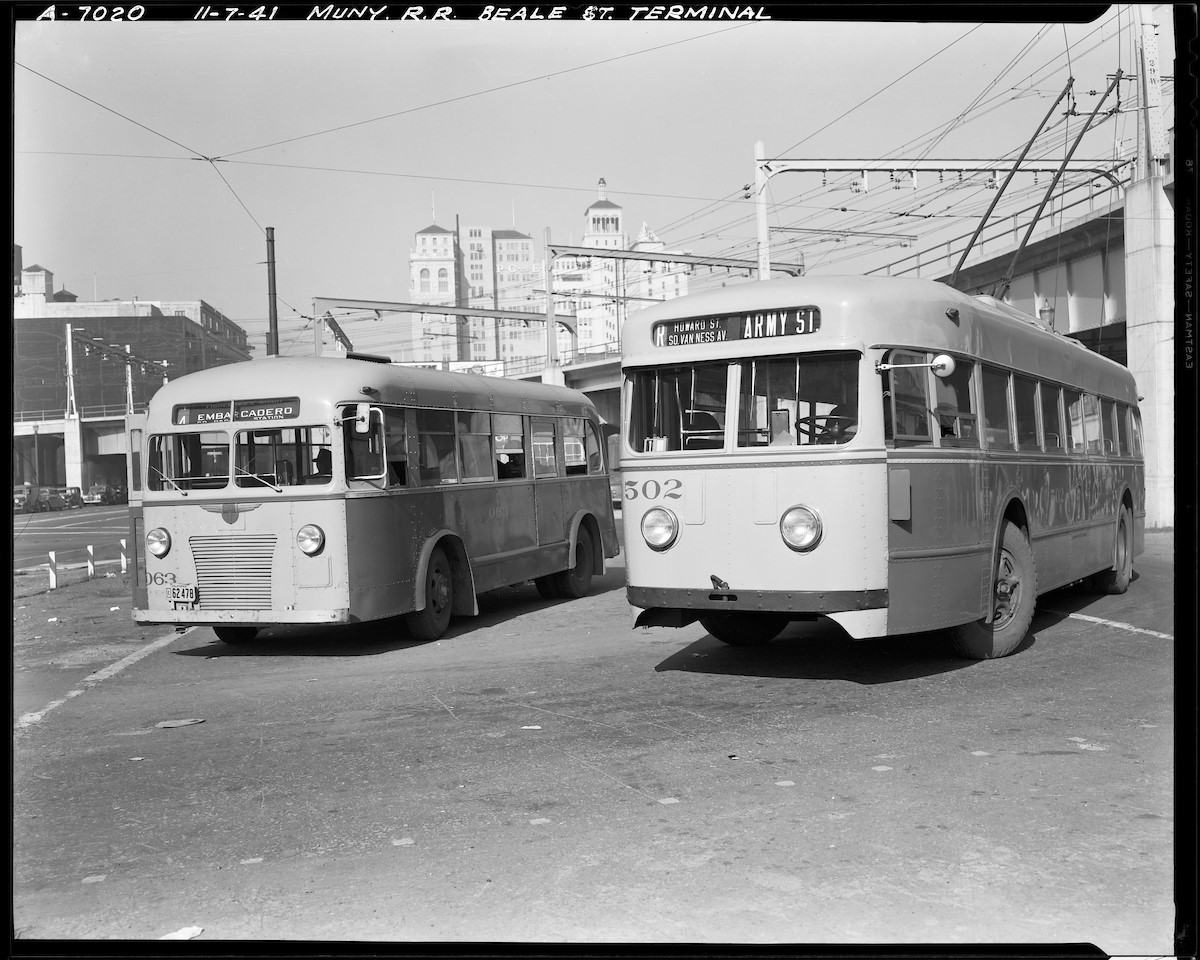
Eighty years ago on September 7, 1941, the San Francisco Municipal Railway launched its first all-electric bus route, the R Howard. Today the route no longer survives in its original form but the legacy of the R lives on in our electric trolley bus fleet and bus routes that serve the same area.

Two Muni buses lay over at the “Bridge Terminal” at Beale and Howard Streets in this November 1941 photograph. At left is the 4 Embarcadero, which ran along the waterfront and the recently established R Howard trolley bus at right.Two Muni buses lay over at the “Bridge Terminal” at Beale and Howard Streets in this November 1941 photograph. At left is the 4 Embarcadero, which ran along the waterfront and the recently established R Howard trolley bus at right.

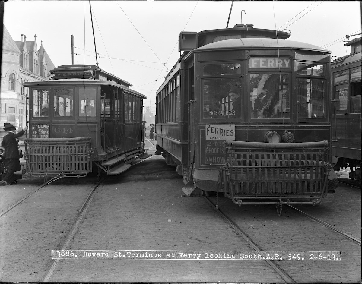
The R traces its lineage back to the 35 Howard streetcar line, operated by the Market Street Railway Company. This line ran from the Ferry Building to 24th and Rhode Island Streets on Howard and South Van Ness. In 1939, when the company’s agreement to run the 35 expired, the city decided to establish the R Howard in its place. Electric trolley buses were chosen for the new service for their low cost of operation and to test the viability of these uncommon vehicles.

While the privately-operated  33 Ashbury/18th was the very first trolley bus route in the city, the launch of Muni’s R line marked the beginning of a new era for electric buses in San Francisco. Just a few years after starting the R, Muni decided to build on its positive experience with the route by converting many streetcar lines to trolley bus operation. Electric trolley buses were a natural choice for San Francisco because they could handle the hills without problems and utilize (with modification) the existing overhead electrical system that powered the streetcars they replaced. Add to that a lower cost of operation and these buses became the highest earning mode in the Muni system during the early 1950s.

In this 1913 photo, streetcars await passengers at the terminal of the Howard Street Line just south of the Ferry Building.In this 1913 photo, streetcars await passengers at the terminal of the Howard Street Line just south of the Ferry Building.

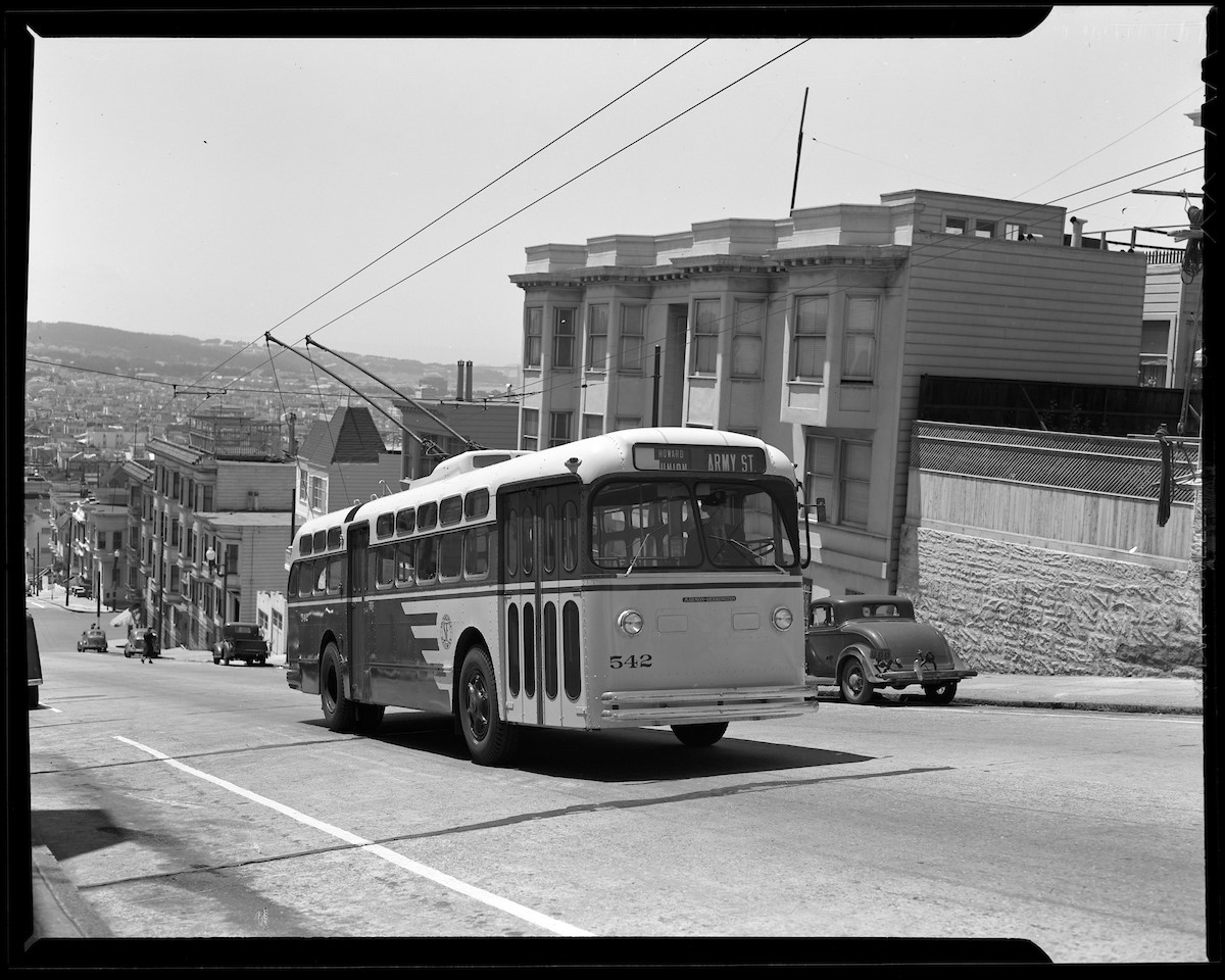
In 1947, the R was combined with the E Union streetcar line to form the 41 Union-Howard route. Connecting the Presidio to the Mission via Russian Hill and Downtown, the 41 covered nearly 7 miles one-way. Over 20 years later in 1970, the route was modified again when Howard Street was converted into a one-way street. The 41 was split in two with the portion north of Howard remaining the 41 and the southern portion becoming the 12.

The 41 Union-Howard climbs Russian Hill heading for its terminal in the Mission in this 1948 photo taken on Union Street.The 41 Union-Howard climbs Russian Hill heading for its terminal in the Mission in this 1948 photo taken on Union Street.

Today, the legacy of the R continues in the 12 Folsom-Pacific, which serves the original area of the R Howard, and in the numerous trolley buses that tirelessly climb hill after hill.


Published September 23, 2021 at 02:59PM
https://ift.tt/3u8p0J3

Wednesday, 22 September 2021

Improving Safety and Access to Golden Gate Park

Improving Safety and Access to Golden Gate Park
By Chava Kronenberg

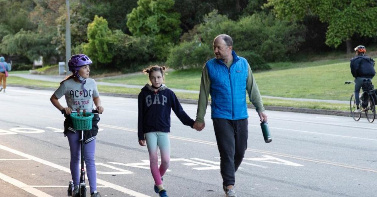
Photo of girl on scooter, man holding child's hand walking, and a person on a bicycle in Golden Gate ParkToday, the San Francisco Recreation and Park Department (RPD) and the SFMTA are jointly launching the Golden Gate Park Access and Safety Program, an effort to consider a post-pandemic set of closed or restricted access streets and mobility choices in San Francisco’s most iconic park.
During the first weeks of the pandemic, RPD closed JFK Drive on the east side of the park to drivers, following up with additional segments on the west side including Middle Drive and MLK. Closing these streets in 2020 was a step in decades of reducing the number of streets for cars in the park, and furthered a long conversation about opening JFK Drive to people walking, biking, scooting, rolling, dancing, and skating.

We’ve been monitoring and learning from the current car-free streets in the park. Since the closure, we’ve seen almost 7 million walking, biking, and rolling trips on JFK Drive, representing a 36% increase in people visiting the Park on the car-free route (compared to pre-pandemic visits).  With the elimination of cut-through traffic there have been no serious injury collisions on the car-free route (there were more than 50 such collisions over the 5 years prior). We have also seen faster transit service on the 44 O’Shaughnessy Muni line, which travels through the Music Concourse and serves the Bayview & Excelsior neighborhoods.

However, in addition to these successes, there have been access challenges for popular destinations and for park visitors in the disability community. The purpose of the Golden Gate Park Access and Safety Program is to bring a broad array of project proposals that can make access to the park even better than before the COVID closure while still retaining the traffic safety and park experience improvements we’ve experienced.

So now we’re ready to ask you:

  • Which streets should be closed to cars post-pandemic in Golden Gate Park?
  • What new or improved mobility options can be implemented to make these closures work for everyone?

Today, we’re launching our public outreach process through the GGP Access and Safety Online Open House, and with scheduled virtual information sessions and in-park tours. The proposals include potential street closures within Golden Gate Park, improved access to mobility services like the park shuttle, taxis, bikeshare, scootershare, pedicabs and more.

The upcoming public events include:

You can also contact us at GGPAccess@sfmta.com if you’d like a presentation for your organization, or to give us direct feedback. More information about how to engage in the program and the overall effort is on our webpage. We look forward to working with you to make Golden Gate Park safe and accessible for everyone.


Published September 22, 2021 at 07:19AM
https://ift.tt/39tQhfC

Friday, 17 September 2021

SFMTA Resumes Peak Hour Tow-Away Zone Enforcement

SFMTA Resumes Peak Hour Tow-Away Zone Enforcement
By Jessie Liang

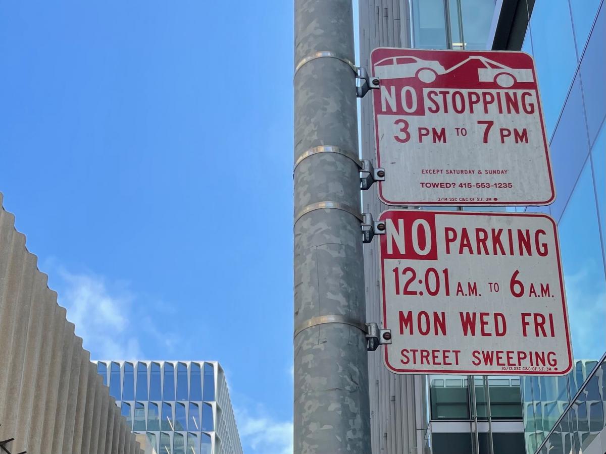
sign showing no stopping 3-7 pm

The SFMTA’s towing programs were temporarily suspended in March 2020 in response to the COVID-19 pandemic. As the city has reopened and traffic has returned, the SFMTA will resume enforcement of peak hour commuter tow-away zones starting September 20.

Vehicles parked at tow-away zones during restricted peak hours will be subject to citation and towing. 

We’re bringing back the enforcement of peak hour tow-away zones under the SFMTA Transportation Recovery Plan (TRP) as the economy reopens. Tows help the SFMTA facilitate the flow and safety of transit and traffic, support economic activity and maintain safe streets.

The reinstated tow-away enforcement will accommodate changing conditions on city streets. For example, enforcement will not apply to Shared Spaces that allow merchants to use sidewalks, full or partial streets and other nearby outdoor spaces under San Francisco’s Public Health Orders.

In addition to tows at peak hour tow-away zones, towing for all other violations will continue. These include but are not limited to, tows for violations of 72-hour overtime parking limits, vehicles with expired registrations over six months and vehicles with five or more delinquent parking citations.


For more information, please visit the Parking and Driving section of SFMTA’s COVID-19 Developments & Response.


Published September 17, 2021 at 05:34AM
https://ift.tt/39ft0Ow

Thursday, 16 September 2021

Long-awaited crosswalk on Geary helps rebuild community connections

Long-awaited crosswalk on Geary helps rebuild community connections
By Amy Fowler

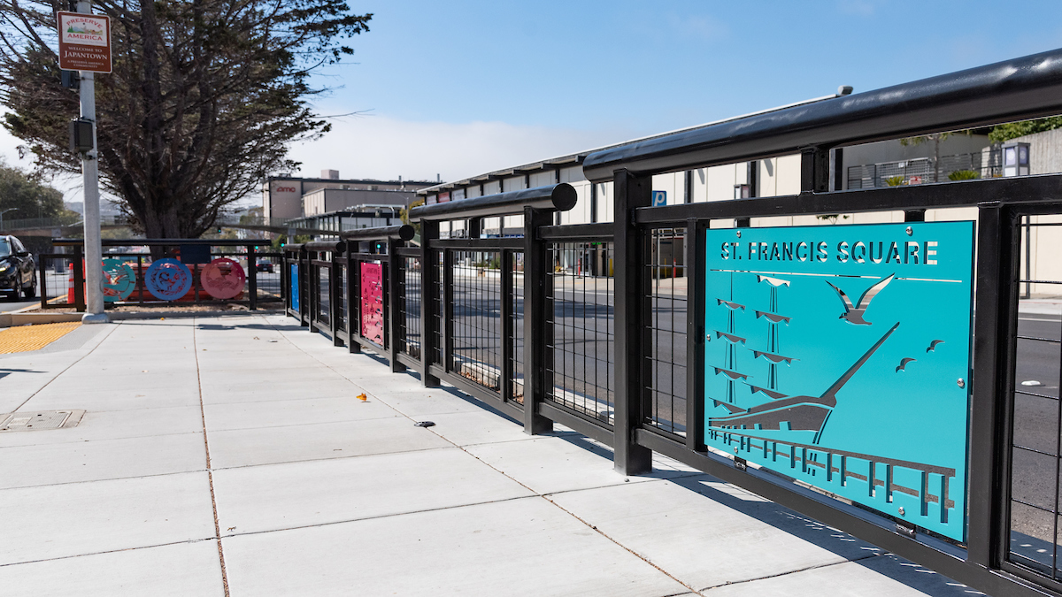
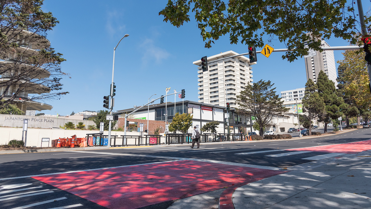
The Geary Rapid Project just met another major milestone with the completion of a long-awaited crosswalk connecting the Japantown Peace Plaza to the southside of Geary Boulevard. The new crossing at Geary and Buchanan Street serves as a physical reconnection to help bridge the gap between divided communities. But it’s also a symbolic one, exemplified by the decorative panels installed in the center median that were inspired and designed by the communities it now serves—the Fillmore, Japantown and St. Francis Square Cooperative.

Photo of man in new crosswalk on GearyA new crosswalk was installed at Geary and Buchanan, with decorative panels representing the surrounding communities.

The significance of the crosswalk is tied to the history of the neighborhood.

In the 1960s, the two neighborhoods were specifically targeted by urban planners, the vibrant Fillmore neighborhood --known as “the Harlem of the West” for its phenomenal jazz scene—and Japantown, still struggling after the forced relocation of Japanese-Americans into internment camps. San Francisco, like the rest of the country, had experienced a boom in private automobile ownership, leading many families to leave the urban core and move to more suburban settings. Under the name of "urban renewal," city planners proposed replacing homes in older neighborhoods with bigger, newer buildings, while promising to raise living standards.

In San Francisco, the result of this policy was to force people of color from their homes and shatter communities. In the Western Addition, Black and Japanese-American homes and businesses were torn down and the neighborhoods ripped apart with the construction of the Geary Expressway. This new eight-lane thoroughfare cut communities in half and encouraged motorists to speed past the Western Addition altogether on their way to the western half of the city. 

The effects were devastating and have echoed into the present, creating highway-like conditions along Geary that have led to vehicle-pedestrian collision rates eight times higher than the average San Francisco street. While we can never undo the harm that was created by urban renewal and the Geary Expressway, improvements like the new crosswalk at Buchanan, along with other transit and safety improvements, will help to make the neighborhood more safe, walkable and connected.

In addition to the new crossing at Buchanan, four other intersections at Webster, Steiner, Cook and Commonwealth/Beaumont streets have received new signalized crosswalks, along with improved median refuges and Accessible Pedestrian Signals (APS) as part of the Geary Rapid Project.

Another way we can “calm the Expressway” is through a road diet. The number of lanes on Geary was reduced from eight lanes to six, with two general-purpose and one bus lane in each direction. And traffic lanes have been restriped to be visually narrower, which encourages drivers to slow down.

These efforts weren’t created in vacuum. Many elements of the Geary Rapid Project design were developed in partnership with neighboring communities. For example, the 31 new cherry, London plane and Canary Island pine trees that were recently planted between Gough and Divisadero streets were chosen with community input for their cultural significance and suitability for a major thoroughfare. And some proposals, like removing the Webster pedestrian bridge, were abandoned after Japantown advocated to retain the bridge due to its importance both culturally and as a conduit to and from Peace Plaza.

image of new panels at crosswalk on Geary at BuchananCommunity input informed the dimensions of the Buchanan crosswalk, which needed to have a large enough median refuge to accommodate groups of Rosa Parks elementary school children.

The new crosswalk at Buchanan marks the completion of all Geary Rapid Project work West of Van Ness Avenue. The remaining work between Van Ness Avenue and Market Street is expected to be substantially completed within the next month.  


Published September 16, 2021 at 11:20AM
https://ift.tt/3CgJi64